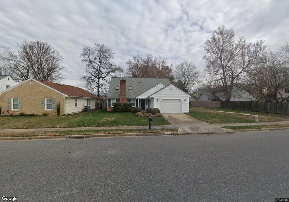
2130 Logans Mill Trail Chesapeake, VA 23320
Greenbrier East NeighborhoodEstimated Value: $416,030 - $425,000
4
Beds
3
Baths
1,852
Sq Ft
$227/Sq Ft
Est. Value
About This Home
This home is located at 2130 Logans Mill Trail, Chesapeake, VA 23320 and is currently estimated at $420,758, approximately $227 per square foot. 2130 Logans Mill Trail is a home located in Chesapeake City with nearby schools including Greenbrier Primary School, Greenbrier Intermediate School, and Greenbrier Middle.
Ownership History
Date
Name
Owned For
Owner Type
Purchase Details
Closed on
Apr 28, 2015
Sold by
Credir Demetria P
Bought by
Jones Andre K
Current Estimated Value
Home Financials for this Owner
Home Financials are based on the most recent Mortgage that was taken out on this home.
Original Mortgage
$239,000
Outstanding Balance
$184,650
Interest Rate
3.76%
Mortgage Type
VA
Estimated Equity
$236,108
Purchase Details
Closed on
Nov 27, 2001
Sold by
Sullivan Walter K
Bought by
Credit Gary L and Pressley,Demetria
Home Financials for this Owner
Home Financials are based on the most recent Mortgage that was taken out on this home.
Original Mortgage
$130,050
Interest Rate
6.67%
Create a Home Valuation Report for This Property
The Home Valuation Report is an in-depth analysis detailing your home's value as well as a comparison with similar homes in the area
Home Values in the Area
Average Home Value in this Area
Purchase History
| Date | Buyer | Sale Price | Title Company |
|---|---|---|---|
| Jones Andre K | $239,000,000 | -- | |
| Credit Gary L | $127,500 | -- |
Source: Public Records
Mortgage History
| Date | Status | Borrower | Loan Amount |
|---|---|---|---|
| Open | Jones Andre K | $239,000 | |
| Previous Owner | Credit Gary L | $130,050 |
Source: Public Records
Tax History
| Year | Tax Paid | Tax Assessment Tax Assessment Total Assessment is a certain percentage of the fair market value that is determined by local assessors to be the total taxable value of land and additions on the property. | Land | Improvement |
|---|---|---|---|---|
| 2025 | $3,502 | $378,700 | $160,000 | $218,700 |
| 2024 | $3,502 | $346,700 | $145,000 | $201,700 |
| 2023 | $3,078 | $329,000 | $125,000 | $204,000 |
| 2022 | $3,066 | $303,600 | $110,000 | $193,600 |
| 2021 | $2,858 | $272,200 | $95,000 | $177,200 |
| 2020 | $2,826 | $269,100 | $90,000 | $179,100 |
| 2019 | $2,745 | $261,400 | $90,000 | $171,400 |
| 2018 | $2,729 | $241,700 | $90,000 | $151,700 |
| 2017 | $2,613 | $248,900 | $90,000 | $158,900 |
| 2016 | $2,581 | $245,800 | $90,000 | $155,800 |
| 2015 | $2,538 | $241,700 | $90,000 | $151,700 |
| 2014 | $2,485 | $236,700 | $85,000 | $151,700 |
Source: Public Records
Map
Nearby Homes
- 1601 Stone Moss Reach Unit C
- 2200 Rock Cliff Reach Unit D
- 11 Penzance Cir
- 10 Warwick Cir
- 2104 Hollins Ct
- 912 Hastings Ct
- 1318 Mill Lake Quarter
- 1222 Cedar Mill Square
- 1217 Cedar Mill Square
- 1217 Welles Ct
- 1207 Brookside Landing
- 1233 Parkley Dr
- 2435 Fieldsway Dr
- 917 Sugar Tree Ct
- 6324 Chestnut Hill Rd
- 1439 Thistlewood Ln
- 6295 Drew Dr
- 923 Captains Ct
- 2123 Engle Ave
- 2209 Sparrow Rd
- 2128 Logans Mill Trail
- 2126 Logans Mill Trail
- 2002 Dawnee Brook Trail N
- 2000 Dawnee Brook Trail N
- 2004 Dawnee Brook Trail N
- 2124 Logans Mill Trail
- 2006 Dawnee Brook Trail N
- 1913 White Rock Bend
- 1914 White Rock Bend
- 1909 White Rock Bend
- 1912 Dawnee Brook Trail S
- 2200 Logans Mill Trail
- 1912 White Rock Bend
- 2008 Dawnee Brook Trail N
- 1917 Kelly Run
- 2120 Logans Mill Trail
- 1910 Dawnee Brook Trail S
- 1910 White Rock Bend
- 2202 Logans Mill Trail
- 2010 Dawnee Brook Trail N
Your Personal Tour Guide
Ask me questions while you tour the home.