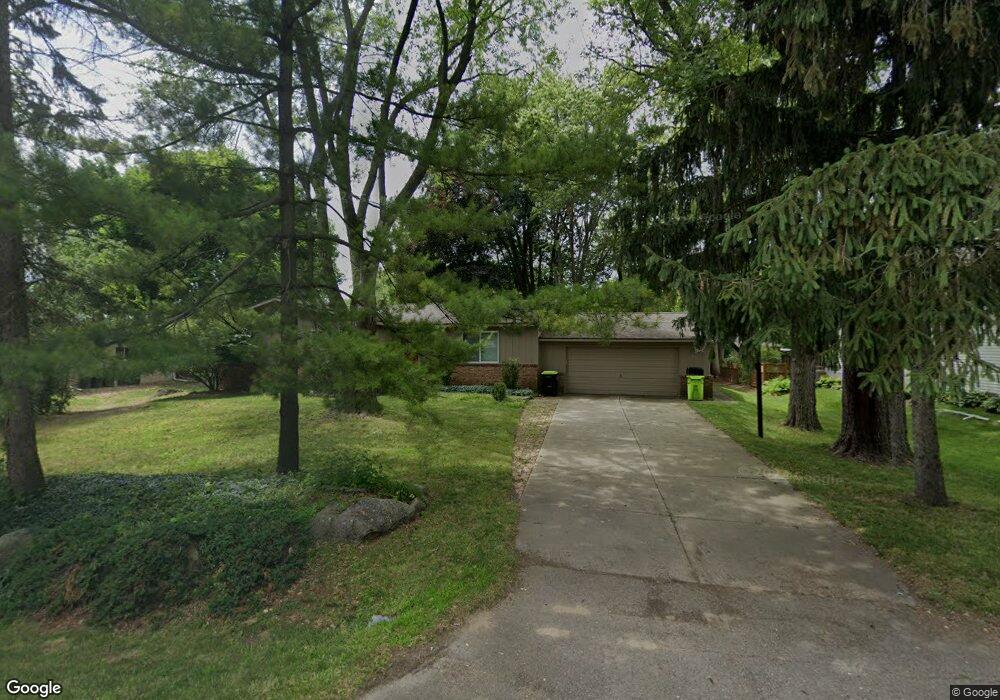
2130 Moorgate Dr West Bloomfield, MI 48324
Estimated Value: $332,445 - $413,000
3
Beds
2
Baths
1,402
Sq Ft
$259/Sq Ft
Est. Value
About This Home
This home is located at 2130 Moorgate Dr, West Bloomfield, MI 48324 and is currently estimated at $362,861, approximately $258 per square foot. 2130 Moorgate Dr is a home located in Oakland County with nearby schools including Waterford Montessori Academy, Our Lady Of Refuge School, and Lakecrest Baptist School.
Ownership History
Date
Name
Owned For
Owner Type
Purchase Details
Closed on
Oct 13, 2006
Sold by
Finsilver Ronald and Finsilver Stanley H
Bought by
Seleske Brian
Current Estimated Value
Home Financials for this Owner
Home Financials are based on the most recent Mortgage that was taken out on this home.
Original Mortgage
$148,700
Outstanding Balance
$87,546
Interest Rate
6.5%
Mortgage Type
Purchase Money Mortgage
Estimated Equity
$275,315
Purchase Details
Closed on
Aug 4, 2000
Sold by
Landis Patricia M
Bought by
Finsilver Ronald
Home Financials for this Owner
Home Financials are based on the most recent Mortgage that was taken out on this home.
Original Mortgage
$82,000
Interest Rate
8.16%
Create a Home Valuation Report for This Property
The Home Valuation Report is an in-depth analysis detailing your home's value as well as a comparison with similar homes in the area
Home Values in the Area
Average Home Value in this Area
Purchase History
| Date | Buyer | Sale Price | Title Company |
|---|---|---|---|
| Seleske Brian | $186,000 | Philip R Seaver Title Co Inc | |
| Finsilver Ronald | $179,000 | -- |
Source: Public Records
Mortgage History
| Date | Status | Borrower | Loan Amount |
|---|---|---|---|
| Open | Seleske Brian | $148,700 | |
| Previous Owner | Finsilver Ronald | $82,000 |
Source: Public Records
Tax History
| Year | Tax Paid | Tax Assessment Tax Assessment Total Assessment is a certain percentage of the fair market value that is determined by local assessors to be the total taxable value of land and additions on the property. | Land | Improvement |
|---|---|---|---|---|
| 2025 | $4,551 | $151,000 | $53,920 | $97,080 |
| 2024 | $3,357 | $147,260 | $0 | $0 |
| 2022 | $3,200 | $119,950 | $37,500 | $82,450 |
| 2021 | $2,870 | $112,870 | $0 | $0 |
| 2020 | $1,851 | $111,040 | $37,500 | $73,540 |
| 2018 | $2,768 | $102,850 | $37,510 | $65,340 |
| 2015 | -- | $78,050 | $0 | $0 |
| 2014 | -- | $69,860 | $0 | $0 |
| 2011 | -- | $63,720 | $0 | $0 |
Source: Public Records
Map
Nearby Homes
- 1883 Poppleton Dr
- 2110 Peachtree Ct
- 1844 Poppleton Dr
- 5920 Greer Rd
- 5699 Applegrove Dr
- 2501 Doleman Dr
- 4796 Dow Ridge Rd
- Lot 94 Hiller Rd
- VAC Daron Ln
- 1522 Oregon Ct
- 1860 Hiller Rd
- 2833 Hiller Rd
- 3102 Rose Ln
- 2780 Orchard Place
- 2797 Orchard Place
- 1985 Christopher Ct
- 00000 Muskingum
- 5617 Millpointe Dr
- 0000 Hiller Rd
- 6313 Kiev St
- 2150 Moorgate Dr
- 2110 Moorgate Dr
- 2159 Mapesbury Dr
- 2145 Mapesbury Dr
- 2169 Mapesbury Dr
- 5235 Greer Rd
- 2125 Moorgate Dr
- 2145 Moorgate Dr
- 2105 Mapesbury Dr
- 2181 Mapesbury Dr Unit Bldg-Unit
- 2181 Mapesbury Dr
- 2105 Moorgate Dr
- 2175 Moorgate Dr
- 5200 Latimer St
- 5208 Latimer St
- 5194 Latimer St
- 2150 Mapesbury Dr Unit Bldg-Unit
- 2150 Mapesbury Dr
- 2150 Mapesbury Dr
- 2146 Greydale
Your Personal Tour Guide
Ask me questions while you tour the home.