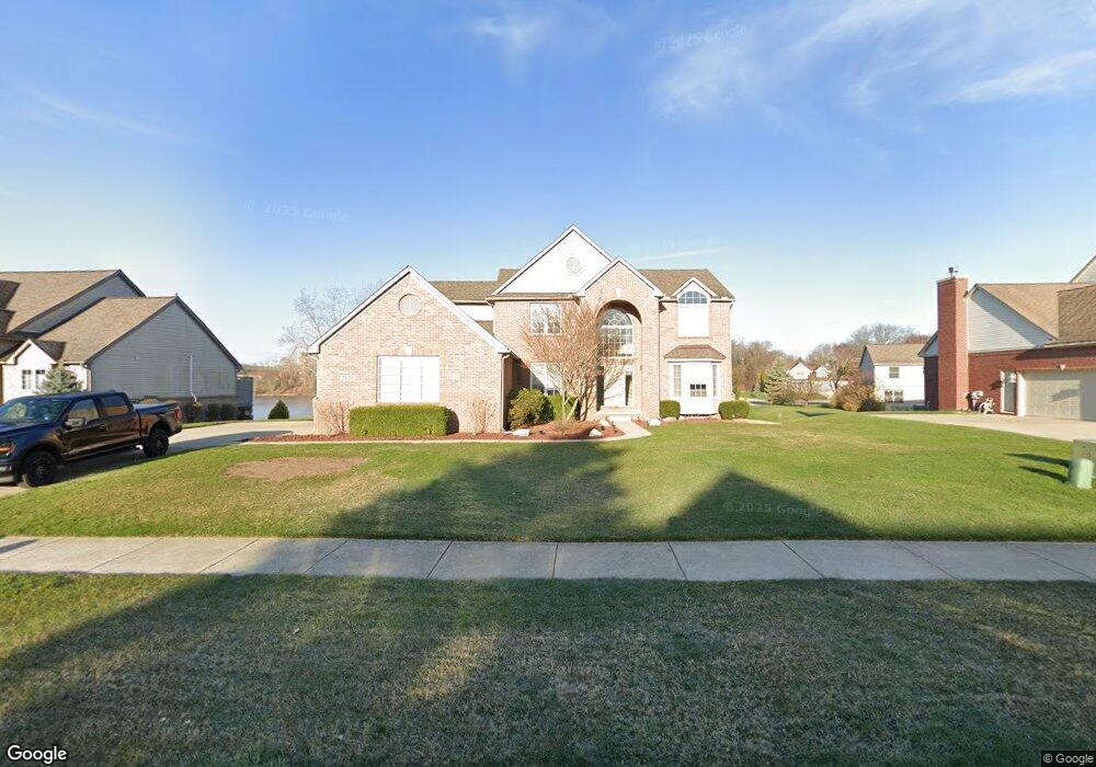
2130 Rolling Rock Dr Brighton, MI 48114
Estimated Value: $508,000 - $607,000
4
Beds
3
Baths
2,661
Sq Ft
$209/Sq Ft
Est. Value
About This Home
This home is located at 2130 Rolling Rock Dr, Brighton, MI 48114 and is currently estimated at $554,879, approximately $208 per square foot. 2130 Rolling Rock Dr is a home located in Livingston County with nearby schools including Three Fires Elementary, Parker Middle School, and Howell High School.
Ownership History
Date
Name
Owned For
Owner Type
Purchase Details
Closed on
Feb 3, 2021
Sold by
Uhl Jeffrey A and Uhl Christine M
Bought by
Uhl Jeffrey A and Uhl Christine M
Current Estimated Value
Purchase Details
Closed on
Apr 19, 2002
Sold by
Multi Building Co Inc
Bought by
Uhl Jeffrey A and Uhl Christine M
Home Financials for this Owner
Home Financials are based on the most recent Mortgage that was taken out on this home.
Original Mortgage
$190,000
Outstanding Balance
$80,560
Interest Rate
7.13%
Estimated Equity
$474,319
Create a Home Valuation Report for This Property
The Home Valuation Report is an in-depth analysis detailing your home's value as well as a comparison with similar homes in the area
Home Values in the Area
Average Home Value in this Area
Purchase History
| Date | Buyer | Sale Price | Title Company |
|---|---|---|---|
| Uhl Jeffrey A | -- | None Available | |
| Uhl Jeffrey A | -- | -- |
Source: Public Records
Mortgage History
| Date | Status | Borrower | Loan Amount |
|---|---|---|---|
| Open | Uhl Jeffrey A | $190,000 |
Source: Public Records
Tax History Compared to Growth
Tax History
| Year | Tax Paid | Tax Assessment Tax Assessment Total Assessment is a certain percentage of the fair market value that is determined by local assessors to be the total taxable value of land and additions on the property. | Land | Improvement |
|---|---|---|---|---|
| 2025 | $4,028 | $261,700 | $0 | $0 |
| 2024 | $2,655 | $252,100 | $0 | $0 |
| 2023 | $2,536 | $206,900 | $0 | $0 |
| 2022 | $3,536 | $166,700 | $0 | $0 |
| 2021 | $3,536 | $187,300 | $0 | $0 |
| 2020 | $3,536 | $185,200 | $0 | $0 |
| 2019 | $3,467 | $166,700 | $0 | $0 |
| 2018 | $3,292 | $161,700 | $0 | $0 |
| 2017 | $3,240 | $161,700 | $0 | $0 |
| 2016 | $3,218 | $152,300 | $0 | $0 |
| 2014 | $3,002 | $140,100 | $0 | $0 |
| 2012 | $3,002 | $125,000 | $0 | $0 |
Source: Public Records
Map
Nearby Homes
- 1756 Skyview Dr
- 0000 Clark Lake Rd
- 2755 Monte Vista Ave Unit 39
- 2181 Ore Creek Ln
- 2806 Breckenridge Dr Unit 24
- 2830 Breckenridge Dr
- 7662 Hidden Ponds Blvd Unit 2
- 8039 Cortez Dr
- 7566 Radcliffe Unit 60
- Woodland Plan at Woodland Shores
- 1500 Clark Lake Rd
- 8184 Woodland Shore Dr
- 1339 Pond Bluff Way Unit 31
- 1847 Brandy Ln
- 7401 Herbst Rd
- 8270 McClements Rd
- 8120 Allor Landing
- Lot #8 Deadwood Ln
- LOT #2 & #4 Deadwood Ln
- 8437 Woodland Shore Dr
- 2152 Rolling Rock Dr
- 2100 Rolling Rock Dr
- 2121 Claiborne Ct
- 2174 Rolling Rock Dr
- 2099 Claiborne Ct
- 7842 Claiborne Dr
- 2105 Rolling Rock Dr
- 7864 Claiborne Dr
- 2133 Rolling Rock Dr
- 2196 Rolling Rock Dr
- 7818 Claiborne Dr
- 2140 Claiborne Ct
- 2161 Rolling Rock Dr
- 7880 Claiborne Dr
- 2189 Rolling Rock Dr
- 7802 Claiborne Dr
- 2218 Rolling Rock Dr
- 0 S Claiborne Ct
- 2118 Claiborne Ct
- 2223 Rolling Rock Dr