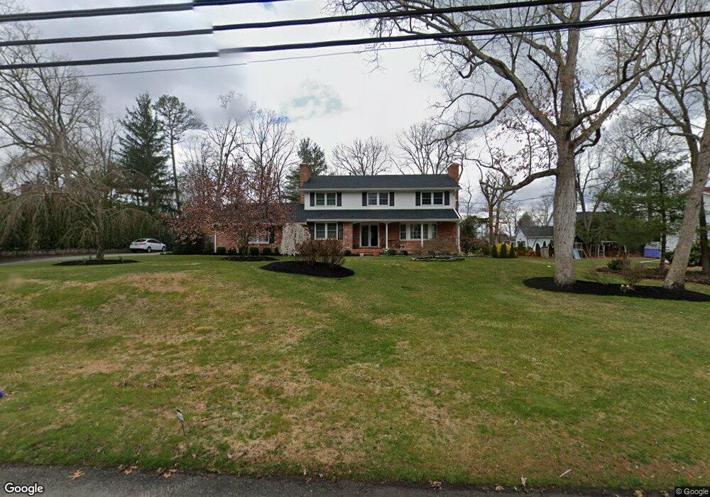
2130 S Brookfield St Vineland, NJ 08361
Estimated Value: $434,119 - $519,000
--
Bed
--
Bath
3,201
Sq Ft
$152/Sq Ft
Est. Value
About This Home
This home is located at 2130 S Brookfield St, Vineland, NJ 08361 and is currently estimated at $487,040, approximately $152 per square foot. 2130 S Brookfield St is a home located in Cumberland County with nearby schools including Anthony Rossi Elementary School, John H. Winslow Elementary School, and Vineland Senior High School.
Ownership History
Date
Name
Owned For
Owner Type
Purchase Details
Closed on
Sep 29, 2017
Sold by
Schwed Dale J and Schwed Candice L
Bought by
Pepe Richard T
Current Estimated Value
Purchase Details
Closed on
Dec 28, 1995
Sold by
Feld Sanford I
Bought by
Schwed Dale J and Schwed Candace L
Home Financials for this Owner
Home Financials are based on the most recent Mortgage that was taken out on this home.
Original Mortgage
$132,000
Interest Rate
7.13%
Create a Home Valuation Report for This Property
The Home Valuation Report is an in-depth analysis detailing your home's value as well as a comparison with similar homes in the area
Home Values in the Area
Average Home Value in this Area
Purchase History
| Date | Buyer | Sale Price | Title Company |
|---|---|---|---|
| Pepe Richard T | $32,000 | None Available | |
| Schwed Dale J | $166,000 | Landis Title Corporation |
Source: Public Records
Mortgage History
| Date | Status | Borrower | Loan Amount |
|---|---|---|---|
| Previous Owner | Schwed Dale J | $132,000 |
Source: Public Records
Tax History Compared to Growth
Tax History
| Year | Tax Paid | Tax Assessment Tax Assessment Total Assessment is a certain percentage of the fair market value that is determined by local assessors to be the total taxable value of land and additions on the property. | Land | Improvement |
|---|---|---|---|---|
| 2025 | $8,199 | $257,500 | $42,300 | $215,200 |
| 2024 | $8,199 | $257,500 | $42,300 | $215,200 |
| 2023 | $8,145 | $257,500 | $42,300 | $215,200 |
| 2022 | $7,903 | $257,500 | $42,300 | $215,200 |
| 2021 | $7,758 | $257,500 | $42,300 | $215,200 |
| 2020 | $7,537 | $257,500 | $42,300 | $215,200 |
| 2019 | $7,434 | $257,500 | $42,300 | $215,200 |
| 2018 | $7,238 | $257,500 | $42,300 | $215,200 |
| 2017 | $6,875 | $257,500 | $42,300 | $215,200 |
| 2016 | $6,633 | $257,500 | $42,300 | $215,200 |
| 2015 | $6,389 | $257,500 | $42,300 | $215,200 |
| 2014 | $6,041 | $257,500 | $42,300 | $215,200 |
Source: Public Records
Map
Nearby Homes
- 2151 S Brookfield St
- 1880 S Brookfield St
- 2851 Crane St
- 2769 Dante Ave
- 3391 Venturi Ln
- 1535 Bear Branch Ct
- 2551 Edna Dr
- 2564 Edna Dr
- 2603 Valhalla Rd
- 1730 Junior Dr
- 2354 Dante Ave
- 2676 Medina St
- 3176 Hance Bridge Rd
- 3773 Brookhaven Dr
- 1197 S Lincoln Ave
- 2270 Gettysburg Dr
- 1319 Paterson Dr
- 1550 S Lincoln Ave
- 2319 S Lincoln Ave
- 1154 Mcclain Dr
- 2108 S Brookfield St
- 2156 S Brookfield St
- 2133 Quail St
- 2155 Quail St
- 2113 Quail St
- 2086 S Brookfield St
- 2177 Quail St
- 2135 Brookfield St
- 2176 S Brookfield St
- 2115 S Brookfield St
- 2089 Quail St
- 2197 Quail St
- 2169 S Brookfield St
- 2142 Quail St
- 2089 S Brookfield St
- 2128 Quail St
- 2158 Quail St
- 2110 Quail St
- 2194 S Brookfield St
- 2176 Quail St