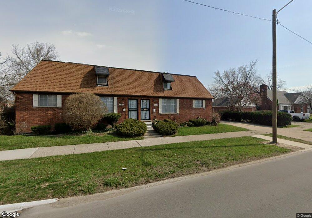
21305 Moross Rd Grosse Pointe, MI 48236
Cornerstone Village NeighborhoodEstimated Value: $80,000 - $175,000
2
Beds
1
Bath
1,312
Sq Ft
$91/Sq Ft
Est. Value
About This Home
This home is located at 21305 Moross Rd, Grosse Pointe, MI 48236 and is currently estimated at $118,916, approximately $90 per square foot. 21305 Moross Rd is a home located in Wayne County with nearby schools including Marquette Elementary-Middle School, Edward 'Duke' Ellington Conservatory of Music and Art, and Charles L. Spain Elementary-Middle School.
Ownership History
Date
Name
Owned For
Owner Type
Purchase Details
Closed on
Nov 18, 2008
Sold by
Wojtowicz Raymond J
Bought by
Harden Sir William R
Current Estimated Value
Purchase Details
Closed on
Mar 25, 2004
Sold by
Safadi Robert H
Bought by
Robertson Ola J
Create a Home Valuation Report for This Property
The Home Valuation Report is an in-depth analysis detailing your home's value as well as a comparison with similar homes in the area
Home Values in the Area
Average Home Value in this Area
Purchase History
| Date | Buyer | Sale Price | Title Company |
|---|---|---|---|
| Harden Sir William R | $8,000 | None Available | |
| Robertson Ola J | $135,000 | Metropolitan Title Company |
Source: Public Records
Tax History Compared to Growth
Tax History
| Year | Tax Paid | Tax Assessment Tax Assessment Total Assessment is a certain percentage of the fair market value that is determined by local assessors to be the total taxable value of land and additions on the property. | Land | Improvement |
|---|---|---|---|---|
| 2025 | $1,269 | $46,700 | $0 | $0 |
| 2024 | $1,250 | $40,600 | $0 | $0 |
| 2023 | $1,214 | $30,100 | $0 | $0 |
| 2022 | $1,293 | $28,400 | $0 | $0 |
| 2021 | $1,258 | $22,200 | $0 | $0 |
| 2020 | $1,309 | $19,800 | $0 | $0 |
| 2019 | $1,239 | $17,100 | $0 | $0 |
| 2018 | $1,089 | $14,000 | $0 | $0 |
| 2017 | $205 | $14,300 | $0 | $0 |
| 2016 | $1,192 | $12,600 | $0 | $0 |
| 2015 | $1,260 | $12,600 | $0 | $0 |
| 2013 | $3,409 | $34,085 | $0 | $0 |
| 2010 | -- | $49,973 | $918 | $49,055 |
Source: Public Records
Map
Nearby Homes
- 21111 Moross Rd
- 6300 Radnor St
- 18959 Rockcastle St
- 6306 Farmbrook St
- 20920 Moross Rd
- 6144 Radnor St
- 21718 Moross Rd
- 21248 Newcastle Rd
- 21228 Newcastle Rd
- 6166 Farmbrook St
- 21553 Bournemouth St
- 6137 Radnor St
- 17817 Chester St
- 21756 Moross Rd
- 6301 Lodewyck St
- 21602 Newcastle Rd
- 8850 Farmbrook St
- 21800 Moross Rd
- 21806 Moross Rd
- 21315 Prestwick Ave
- 21301 Moross Rd
- 19116 Cheshire St
- 21335 Moross Rd
- 19122 Cheshire St
- 19123 Chester St
- 19128 Cheshire St
- 19128 Cheshire St
- 19132 Cheshire St
- 19117 Cheshire St
- 19107 Cheshire Unit 1 St
- 19135 Chester St
- 19121 Cheshire St
- 19140 Cheshire St
- 19129 Cheshire St
- 19141 Chester St
- 19107 Cheshire St
- 19107 Cheshire St Unit 1 St
- 19144 Cheshire St
- 19135 Cheshire St
- 21215 Moross Rd