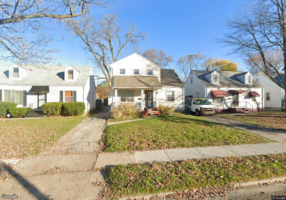
21309 Watson Rd Maple Heights, OH 44137
Estimated Value: $114,000 - $138,000
3
Beds
1
Bath
1,800
Sq Ft
$70/Sq Ft
Est. Value
About This Home
This home is located at 21309 Watson Rd, Maple Heights, OH 44137 and is currently estimated at $126,173, approximately $70 per square foot. 21309 Watson Rd is a home located in Cuyahoga County with nearby schools including Abraham Lincoln Elementary School, Rockside/ J.F. Kennedy School, and Barack Obama School.
Ownership History
Date
Name
Owned For
Owner Type
Purchase Details
Closed on
Mar 10, 2021
Sold by
Cuyahoga Development Group
Bought by
L & L Flynn Properties Llc
Current Estimated Value
Home Financials for this Owner
Home Financials are based on the most recent Mortgage that was taken out on this home.
Original Mortgage
$1,102,020
Interest Rate
3.69%
Mortgage Type
New Conventional
Purchase Details
Closed on
Jul 14, 2017
Sold by
Corlew Arika E and Third Federal Savings And Loan
Bought by
Cuyahoga Development Group Llc
Purchase Details
Closed on
Oct 31, 2007
Sold by
Cleveland Housing Network Inc
Bought by
Corlew Arika E
Home Financials for this Owner
Home Financials are based on the most recent Mortgage that was taken out on this home.
Original Mortgage
$35,000
Interest Rate
6.45%
Mortgage Type
Stand Alone Second
Purchase Details
Closed on
Nov 4, 2005
Sold by
Household Realty Corp
Bought by
Cleveland Housing Network Inc
Purchase Details
Closed on
Oct 6, 2005
Sold by
White Harold and Scroggins Mary K Hendrix
Bought by
Household Realty Corp
Purchase Details
Closed on
Mar 3, 2001
Sold by
White Harold
Bought by
Perry Lynette and Rivers Terrell
Home Financials for this Owner
Home Financials are based on the most recent Mortgage that was taken out on this home.
Original Mortgage
$3,000
Interest Rate
7.13%
Mortgage Type
Seller Take Back
Purchase Details
Closed on
Sep 9, 1999
Sold by
Hendrix Seroggins Mary K
Bought by
White Harold
Home Financials for this Owner
Home Financials are based on the most recent Mortgage that was taken out on this home.
Original Mortgage
$76,500
Interest Rate
11.25%
Purchase Details
Closed on
Feb 12, 1999
Sold by
Collins Laura F
Bought by
Hendrix Scroggins Mary K
Home Financials for this Owner
Home Financials are based on the most recent Mortgage that was taken out on this home.
Original Mortgage
$44,800
Interest Rate
10.55%
Purchase Details
Closed on
Oct 15, 1991
Sold by
Craig William Alan
Bought by
Craig Julia Marie
Purchase Details
Closed on
Jul 23, 1986
Sold by
Ziemak Raymond R
Bought by
Craig William Alan
Purchase Details
Closed on
Apr 5, 1978
Sold by
Flynn Paul T and Flynn Lena
Bought by
Ziemak Raymond R
Purchase Details
Closed on
Jan 1, 1975
Bought by
Flynn Paul T and Flynn Lena
Create a Home Valuation Report for This Property
The Home Valuation Report is an in-depth analysis detailing your home's value as well as a comparison with similar homes in the area
Home Values in the Area
Average Home Value in this Area
Purchase History
| Date | Buyer | Sale Price | Title Company |
|---|---|---|---|
| L & L Flynn Properties Llc | $1,515,890 | Chicago Title | |
| Cuyahoga Development Group Llc | $30,000 | None Available | |
| Corlew Arika E | $129,900 | Equity Title Agency Inc | |
| Cleveland Housing Network Inc | $58,000 | Foundation Title Agen | |
| Household Realty Corp | $60,000 | Attorney | |
| Perry Lynette | $3,000 | -- | |
| White Harold | $90,000 | First Service Title Agency I | |
| Hendrix Scroggins Mary K | $56,000 | -- | |
| Craig Julia Marie | -- | -- | |
| Craig William Alan | $48,000 | -- | |
| Ziemak Raymond R | $32,500 | -- | |
| Flynn Paul T | -- | -- |
Source: Public Records
Mortgage History
| Date | Status | Borrower | Loan Amount |
|---|---|---|---|
| Previous Owner | L & L Flynn Properties Llc | $1,102,020 | |
| Previous Owner | Corlew Arika E | $35,000 | |
| Previous Owner | Corlew Arika E | $93,900 | |
| Previous Owner | Perry Lynette | $3,000 | |
| Previous Owner | White Harold | $76,500 | |
| Previous Owner | Hendrix Scroggins Mary K | $44,800 | |
| Closed | White Harold | $9,000 |
Source: Public Records
Tax History
| Year | Tax Paid | Tax Assessment Tax Assessment Total Assessment is a certain percentage of the fair market value that is determined by local assessors to be the total taxable value of land and additions on the property. | Land | Improvement |
|---|---|---|---|---|
| 2025 | $2,784 | $33,250 | $6,720 | $26,530 |
| 2024 | $3,092 | $33,250 | $6,720 | $26,530 |
| 2023 | $2,343 | $21,350 | $4,060 | $17,290 |
| 2022 | $2,335 | $21,350 | $4,060 | $17,290 |
| 2021 | $2,490 | $21,350 | $4,060 | $17,290 |
| 2020 | $2,127 | $16,170 | $3,080 | $13,090 |
| 2019 | $2,117 | $46,200 | $8,800 | $37,400 |
| 2018 | $1,992 | $16,170 | $3,080 | $13,090 |
| 2017 | $2,227 | $15,540 | $2,870 | $12,670 |
| 2016 | $1,965 | $15,540 | $2,870 | $12,670 |
| 2015 | $1,965 | $15,540 | $2,870 | $12,670 |
| 2014 | $1,965 | $17,080 | $3,150 | $13,930 |
Source: Public Records
Map
Nearby Homes
- 21207 Franklin Rd
- 21202 Hillgrove Ave
- 20715 Watson Rd
- 20705 Hansen Rd
- 20905 Clare Ave
- 21860 Louis Rd
- 20600 Watson Rd
- 20814 Clare Ave
- 21601 Gardenview Dr
- 21202 Gardenview Dr
- 5147 Warrensville Center Rd
- 0 Miles Rd Unit 5188561
- 21607 Libby Rd
- 19931 Raymond St
- 5285 Mardale Ave
- 5301 Mardale Ave
- 19910 Mountville Dr
- 22711 Vera St
- 22504 Felch St
- 19520 Maple Heights Blvd
- 21305 Watson Rd
- 21313 Watson Rd
- 21301 Watson Rd
- 21317 Watson Rd
- 21217 Watson Rd
- 21401 Watson Rd
- 21312 Hansen Rd
- 21304 Hansen Rd
- 21316 Hansen Rd
- 21300 Hansen Rd
- 21213 Watson Rd
- 21405 Watson Rd
- 21402 Hansen Rd
- 21308 Watson Rd
- 21312 Watson Rd
- 21212 Hansen Rd
- 21300 Watson Rd
- 21209 Watson Rd
- 21409 Watson Rd
- 21400 Watson Rd
Your Personal Tour Guide
Ask me questions while you tour the home.