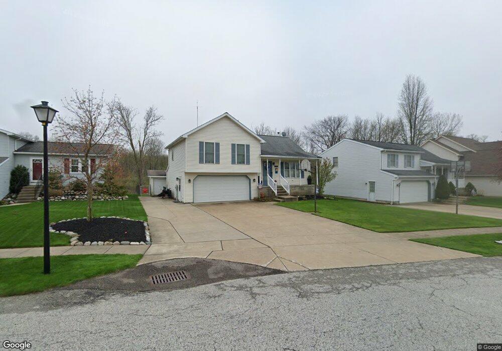
2131 Brooksboro Dr Erie, PA 16510
Millcreek NeighborhoodEstimated Value: $258,000 - $307,000
3
Beds
1
Bath
1,281
Sq Ft
$217/Sq Ft
Est. Value
About This Home
This home is located at 2131 Brooksboro Dr, Erie, PA 16510 and is currently estimated at $278,368, approximately $217 per square foot. 2131 Brooksboro Dr is a home located in Erie County with nearby schools including Belle Valley Elementary School, McDowell High School, and James S. Wilson Middle School.
Ownership History
Date
Name
Owned For
Owner Type
Purchase Details
Closed on
Nov 14, 2014
Sold by
Haulik Michael J
Bought by
Haulik Michael J and Haulik Mary C
Current Estimated Value
Home Financials for this Owner
Home Financials are based on the most recent Mortgage that was taken out on this home.
Original Mortgage
$136,000
Interest Rate
3.29%
Mortgage Type
New Conventional
Purchase Details
Closed on
Apr 16, 2002
Sold by
Haulik Michael J and Bujnowski Colleen T
Bought by
Haulik Michael J
Create a Home Valuation Report for This Property
The Home Valuation Report is an in-depth analysis detailing your home's value as well as a comparison with similar homes in the area
Home Values in the Area
Average Home Value in this Area
Purchase History
| Date | Buyer | Sale Price | Title Company |
|---|---|---|---|
| Haulik Michael J | -- | None Available | |
| Haulik Michael J | -- | -- |
Source: Public Records
Mortgage History
| Date | Status | Borrower | Loan Amount |
|---|---|---|---|
| Closed | Haulik Michael J | $136,000 |
Source: Public Records
Tax History Compared to Growth
Tax History
| Year | Tax Paid | Tax Assessment Tax Assessment Total Assessment is a certain percentage of the fair market value that is determined by local assessors to be the total taxable value of land and additions on the property. | Land | Improvement |
|---|---|---|---|---|
| 2025 | $4,553 | $165,680 | $36,800 | $128,880 |
| 2024 | $4,434 | $165,680 | $36,800 | $128,880 |
| 2023 | $4,186 | $165,680 | $36,800 | $128,880 |
| 2022 | $4,022 | $165,680 | $36,800 | $128,880 |
| 2021 | $3,979 | $165,680 | $36,800 | $128,880 |
| 2020 | $3,937 | $165,680 | $36,800 | $128,880 |
| 2019 | $3,872 | $165,680 | $36,800 | $128,880 |
| 2018 | $3,776 | $165,680 | $36,800 | $128,880 |
| 2017 | $3,768 | $165,680 | $36,800 | $128,880 |
| 2016 | $4,502 | $165,680 | $36,800 | $128,880 |
| 2015 | $4,460 | $165,680 | $36,800 | $128,880 |
| 2014 | $1,406 | $165,680 | $36,800 | $128,880 |
Source: Public Records
Map
Nearby Homes
- 2034 E Gore Rd
- 0 Conrad Rd
- 4315 Fargo St
- 2554 Pepper Tree Dr
- 4206 Stanton St
- 4030 Mcclelland Ave
- 4816 Avellino Dr
- 3950 Rice Ave
- 4309 Koehler Rd
- 2738 E 44th St
- 2227 E 38th St
- 2021 E 38th St
- 2259 E 38th St
- 5149 Henderson Rd Unit 139
- 5149 Henderson Rd Unit 110
- 0 Old French Rd Unit 181790
- 4813 Grouse Hollow Dr
- 4801 Grouse Hollow Dr
- 3816 Stanton St
- 4102 Davison Ave
- 2137 Brooksboro Dr
- 2127 Brooksboro Dr
- 2141 Brooksboro Dr
- 2117 Brooksboro Dr
- 2145 Brooksboro Dr
- 2134 Brooksboro Dr
- 2138 Brooksboro Dr
- 2130 Brooksboro Dr
- 5001 Goldsboro Dr
- 2142 Brooksboro Dr
- 2122 Brooksboro Dr
- 2205 Brooksboro Dr
- 4929 Goldsboro Dr
- 2202 Brooksboro Dr
- 2209 Brooksboro Dr
- 2139 Gatesmill Dr
- 4923 Goldsboro Dr
- 2135 Gatesmill Dr
- 2145 Gatesmill Dr
- 2206 Brooksboro Dr