
Seller's Agent in 2012
Ron Ross
Compass Commercial Real Estate
(541) 480-8884
22 Total Sales

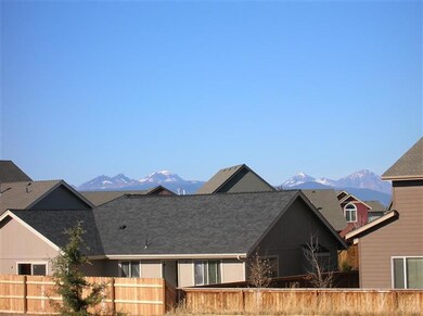
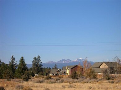
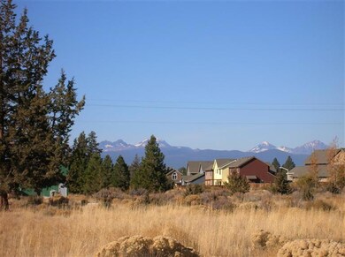
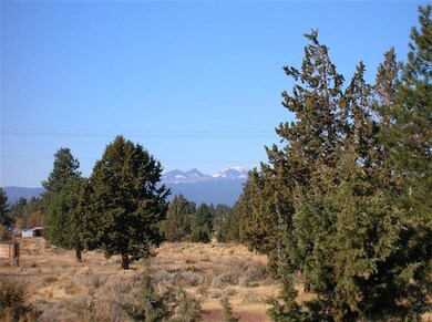

Bank owned nearly 5 acre parcel abutting UGB. Likely to be included in UGB expansion, with potential for commercial zoning. This is subject to Buyers own due diligence and verification. COI main canal runs through the NW corner of the property. Outstanding mountain views. This is a fabulous opportunity to buy a great piece of land in the path of progress at a great price. Last list price was $595,000.
Last Agent to Sell the Property
Compass Commercial Real Estate License #810304204 Listed on: 04/13/2012
Last Buyer's Agent
Nick Vaughn
Fratzke Commercial R.E. Advisors License #901000133
| Date | Buyer | Sale Price | Title Company |
|---|---|---|---|
| Larsen Family Trust | -- | None Listed On Document | |
| Larsen Michael | $135,000 | Deschutes County Title Co | |
| Columbia State Bank | -- | Deschutes County Title Co | |
| Stevens Road Properties Llc | -- | None Available | |
| Desertscape Properties Llc | -- | Western Title & Escrow Co | |
| Glazier Craig J | $525,000 | Western Title & Escrow Co |
| Date | Event | Price | List to Sale | Price per Sq Ft |
|---|---|---|---|---|
| 05/18/2012 05/18/12 | Sold | $135,000 | -9.4% | -- |
| 04/19/2012 04/19/12 | Pending | -- | -- | -- |
| 11/01/2011 11/01/11 | For Sale | $149,000 | -- | -- |
| Year | Tax Paid | Tax Assessment Tax Assessment Total Assessment is a certain percentage of the fair market value that is determined by local assessors to be the total taxable value of land and additions on the property. | Land | Improvement |
|---|---|---|---|---|
| 2025 | $1,696 | $113,200 | $113,200 | -- |
| 2024 | $1,622 | $109,910 | $109,910 | -- |
| 2023 | $1,527 | $106,710 | $106,710 | $0 |
| 2022 | $1,408 | $100,600 | $0 | $0 |
| 2021 | $1,417 | $97,670 | $0 | $0 |
| 2020 | $1,338 | $97,670 | $0 | $0 |
| 2019 | $1,300 | $94,830 | $0 | $0 |
| 2018 | $1,262 | $92,070 | $0 | $0 |
| 2017 | $1,229 | $89,390 | $0 | $0 |
| 2016 | $1,167 | $86,790 | $0 | $0 |
| 2015 | $1,135 | $84,270 | $0 | $0 |
| 2014 | $1,098 | $81,820 | $0 | $0 |
Seller's Agent in 2012
Ron Ross
Compass Commercial Real Estate
(541) 480-8884
22 Total Sales
N
Buyer's Agent in 2012
Nick Vaughn
Fratzke Commercial R.E. Advisors
Source: Oregon Datashare
MLS Number: 201108709
APN: 111999
Disclaimer: Certain information contained herein is derived from information provided by parties other than Homes.com. All information provided is deemed reliable, but is not guaranteed to be accurate and should be independently verified.
![]() © 2026 Oregon Datashare (KCAR | MLSCO | SOMLS). All rights reserved. The data relating to real estate for sale on this web site comes in part from the Internet Data Exchange Program of the Oregon Datashare. Real estate listings held by IDX Brokerage firms other than Ten-X are marked with the Internet Data Exchange logo or the Internet Data Exchange thumbnail logo and detailed information about them includes the name of the listing Brokers. Information provided is for consumers' personal, non-commercial use and may not be used for any purpose other than to identify prospective properties the viewer may be interested in purchasing. The consumer will not copy, retransmit nor redistribute any of the content from this website. Information provided is deemed reliable, but not guaranteed.
© 2026 Oregon Datashare (KCAR | MLSCO | SOMLS). All rights reserved. The data relating to real estate for sale on this web site comes in part from the Internet Data Exchange Program of the Oregon Datashare. Real estate listings held by IDX Brokerage firms other than Ten-X are marked with the Internet Data Exchange logo or the Internet Data Exchange thumbnail logo and detailed information about them includes the name of the listing Brokers. Information provided is for consumers' personal, non-commercial use and may not be used for any purpose other than to identify prospective properties the viewer may be interested in purchasing. The consumer will not copy, retransmit nor redistribute any of the content from this website. Information provided is deemed reliable, but not guaranteed.
Ask me questions while you tour the home.