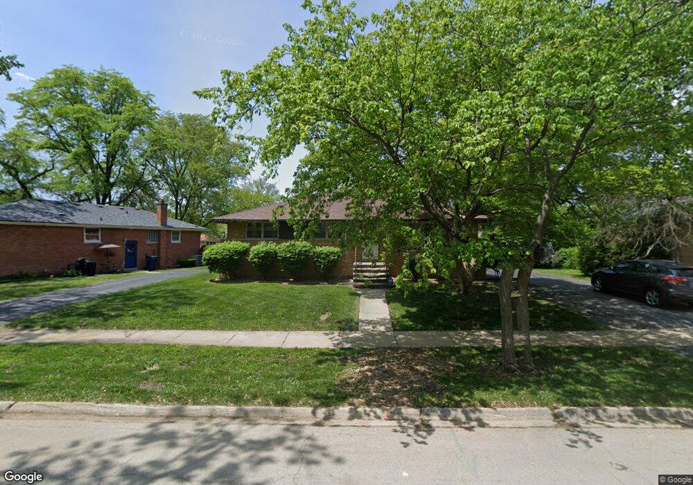
21318 Tower Ave Matteson, IL 60443
Old Matteson NeighborhoodEstimated Value: $181,000 - $203,000
About This Home
This home is located at 21318 Tower Ave, Matteson, IL 60443 and is currently estimated at $194,893, approximately $187 per square foot. 21318 Tower Ave is a home located in Cook County with nearby schools including Illinois School, Matteson Elementary School, and Sauk Elementary School.
Ownership History
We collect this data history from publicly available records. To have your information removed, we recommend requesting removal directly through your county’s website.
Purchase Details
Home Financials for this Owner
Home Financials are based on the most recent Mortgage that was taken out on this home.Home Values in the Area
Average Home Value in this Area
Purchase History
We collect this data history from publicly available records. To have your information removed, we recommend requesting removal directly through your county’s website.
| Date | Buyer | Sale Price | Title Company |
|---|---|---|---|
| -- | First American Title |
Mortgage History
We collect this data history from publicly available records. To have your information removed, we recommend requesting removal directly through your county’s website.
| Date | Status | Borrower | Loan Amount |
|---|---|---|---|
| Open | $117,943 |
Tax History
We collect this data history from publicly available records. To have your information removed, we recommend requesting removal directly through your county’s website.
| Year | Tax Paid | Tax Assessment Tax Assessment Total Assessment is a certain percentage of the fair market value that is determined by local assessors to be the total taxable value of land and additions on the property. | Land | Improvement |
|---|---|---|---|---|
| 2025 | $6,069 | $18,000 | $3,067 | $14,933 |
| 2024 | $6,069 | $18,000 | $3,067 | $14,933 |
| 2023 | $2,676 | $18,000 | $3,067 | $14,933 |
| 2022 | $2,676 | $8,353 | $2,684 | $5,669 |
| 2021 | $2,762 | $8,352 | $2,683 | $5,669 |
| 2020 | $2,674 | $8,352 | $2,683 | $5,669 |
| 2019 | $3,084 | $9,388 | $2,491 | $6,897 |
| 2018 | $3,080 | $9,388 | $2,491 | $6,897 |
| 2017 | $2,987 | $9,388 | $2,491 | $6,897 |
| 2016 | $3,687 | $9,995 | $2,300 | $7,695 |
| 2015 | $3,593 | $9,995 | $2,300 | $7,695 |
| 2014 | $3,507 | $9,995 | $2,300 | $7,695 |
| 2013 | $3,060 | $9,718 | $2,300 | $7,418 |
Map
- 3732 214th St
- 21406 S Jean Ave
- 3704 214th Place
- 3615 214th St
- 21142 Locust St
- 3862 216th St
- 1034 Pine Ave
- 4042 Charleston Rd
- 3817 216th Place
- 3865 216th Place
- 3846 217th St
- 4035 216th St
- 3857 217th St
- 21616 Richmond Rd
- 4101 216th St
- 21607 Main St
- 547 Homan Ave
- 303 Jackson St
- 831 Violet Ln
- 21606 Dogwood Rd Unit 1182
- 3810 213th Place
- 21312 Tower Ave
- 3818 213th Place
- 3822 213th Place
- 21315 Tower Ave
- 21319 Tower Ave
- 3815 213th St
- 21309 Tower Ave
- 3826 213th Place
- 3809 213th St
- 3809 213th Place
- 21305 Tower Ave
- 3819 213th Place
- 3815 213th Place
- 3823 213th Place
- 3819 213th St
- 3760 213th Place
- 3827 213th Place
- 3830 213th Place
- 3761 213th St
Ask me questions while you tour the home.