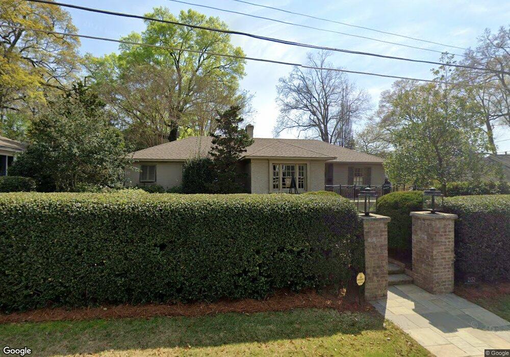
2132 21st St Columbus, GA 31906
Garrard Woods NeighborhoodEstimated Value: $376,000 - $543,000
2
Beds
3
Baths
1,731
Sq Ft
$258/Sq Ft
Est. Value
About This Home
This home is located at 2132 21st St, Columbus, GA 31906 and is currently estimated at $447,043, approximately $258 per square foot. 2132 21st St is a home located in Muscogee County with nearby schools including Richards Middle School, Hardaway High School, and Wynnton Elementary School.
Ownership History
Date
Name
Owned For
Owner Type
Purchase Details
Closed on
Mar 18, 2022
Sold by
Avant Marie J
Bought by
Green William
Current Estimated Value
Home Financials for this Owner
Home Financials are based on the most recent Mortgage that was taken out on this home.
Original Mortgage
$385,521
Outstanding Balance
$361,161
Interest Rate
4.16%
Estimated Equity
$85,882
Create a Home Valuation Report for This Property
The Home Valuation Report is an in-depth analysis detailing your home's value as well as a comparison with similar homes in the area
Home Values in the Area
Average Home Value in this Area
Purchase History
| Date | Buyer | Sale Price | Title Company |
|---|---|---|---|
| Green William | $390,000 | None Listed On Document |
Source: Public Records
Mortgage History
| Date | Status | Borrower | Loan Amount |
|---|---|---|---|
| Open | Green William | $385,521 |
Source: Public Records
Tax History Compared to Growth
Tax History
| Year | Tax Paid | Tax Assessment Tax Assessment Total Assessment is a certain percentage of the fair market value that is determined by local assessors to be the total taxable value of land and additions on the property. | Land | Improvement |
|---|---|---|---|---|
| 2025 | $5,227 | $155,032 | $17,192 | $137,840 |
| 2024 | $5,227 | $155,032 | $17,192 | $137,840 |
| 2023 | $6,107 | $155,032 | $17,192 | $137,840 |
| 2022 | $2,786 | $81,056 | $17,192 | $63,864 |
| 2021 | $2,779 | $75,608 | $17,192 | $58,416 |
| 2020 | $2,780 | $75,608 | $17,192 | $58,416 |
| 2019 | $2,790 | $75,608 | $17,192 | $58,416 |
| 2018 | $2,790 | $75,608 | $17,192 | $58,416 |
| 2017 | $2,801 | $75,608 | $17,192 | $58,416 |
| 2016 | $2,812 | $81,450 | $7,077 | $74,373 |
| 2015 | $1,127 | $81,450 | $7,077 | $74,373 |
| 2014 | $2,820 | $81,450 | $7,077 | $74,373 |
| 2013 | $2,826 | $81,450 | $7,077 | $74,373 |
Source: Public Records
Map
Nearby Homes
- 2104 Cherokee Ave
- 1809 Carter Ave
- 2230 Cherokee Ave Unit 10
- 1806 Stark Ave
- 1717 Stark Ave
- 1706 Stark Ave
- 1700 Stark Ave
- 2512 19th Ave
- 2220 Country Club Rd
- 2609 Hilton Ave
- 1525 19th St
- 2416 16th Ave
- 2424 16th Ave
- 2420 16th Ave
- 1531 Wildwood Ave
- 1447 21st St
- 1450 23rd St
- 2016 Poplar Dr
- 1557 18th Ave
- 2010 Wells Dr