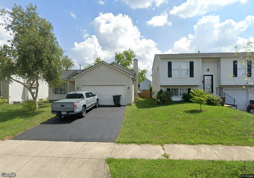
2132 Brookbank Dr Grove City, OH 43123
Estimated Value: $277,000 - $301,148
3
Beds
3
Baths
1,712
Sq Ft
$171/Sq Ft
Est. Value
About This Home
This home is located at 2132 Brookbank Dr, Grove City, OH 43123 and is currently estimated at $293,037, approximately $171 per square foot. 2132 Brookbank Dr is a home located in Franklin County with nearby schools including Georgian Heights Alt Elementary School, Wedgewood Middle School, and Briggs High School.
Ownership History
Date
Name
Owned For
Owner Type
Purchase Details
Closed on
Apr 4, 2023
Sold by
Brenning Tina M
Bought by
Opendoor Property Trust
Current Estimated Value
Purchase Details
Closed on
May 12, 2017
Sold by
Corrado John F and Corrado Tammy M
Bought by
Brenning Tina
Home Financials for this Owner
Home Financials are based on the most recent Mortgage that was taken out on this home.
Original Mortgage
$137,750
Interest Rate
4.08%
Mortgage Type
New Conventional
Purchase Details
Closed on
Apr 13, 2007
Sold by
Weinhold That A and 2132 Brookbank Land Trust
Bought by
Corrado John F and Corrado Tammy M
Home Financials for this Owner
Home Financials are based on the most recent Mortgage that was taken out on this home.
Original Mortgage
$92,650
Interest Rate
6.18%
Mortgage Type
Purchase Money Mortgage
Purchase Details
Closed on
Aug 2, 2003
Sold by
Brown Kara L and Miller Tamara J
Bought by
Baranowski C and 2132 Brookbank Land Trust
Create a Home Valuation Report for This Property
The Home Valuation Report is an in-depth analysis detailing your home's value as well as a comparison with similar homes in the area
Home Values in the Area
Average Home Value in this Area
Purchase History
| Date | Buyer | Sale Price | Title Company |
|---|---|---|---|
| Opendoor Property Trust | $255,800 | Os National | |
| Brenning Tina | $145,000 | Title Source Inc | |
| Corrado John F | $109,000 | Resourcetit | |
| Baranowski C | -- | Peterson Title Agency Inc |
Source: Public Records
Mortgage History
| Date | Status | Borrower | Loan Amount |
|---|---|---|---|
| Previous Owner | Brenning Tina | $137,750 | |
| Previous Owner | Corrado John F | $92,650 |
Source: Public Records
Tax History Compared to Growth
Tax History
| Year | Tax Paid | Tax Assessment Tax Assessment Total Assessment is a certain percentage of the fair market value that is determined by local assessors to be the total taxable value of land and additions on the property. | Land | Improvement |
|---|---|---|---|---|
| 2024 | $3,447 | $76,800 | $18,240 | $58,560 |
| 2023 | $3,403 | $76,800 | $18,240 | $58,560 |
| 2022 | $2,957 | $57,020 | $8,400 | $48,620 |
| 2021 | $2,963 | $57,020 | $8,400 | $48,620 |
| 2020 | $2,966 | $57,020 | $8,400 | $48,620 |
| 2019 | $2,890 | $47,640 | $7,000 | $40,640 |
| 2018 | $2,694 | $47,640 | $7,000 | $40,640 |
| 2017 | $2,853 | $47,640 | $7,000 | $40,640 |
| 2016 | $2,744 | $39,660 | $6,970 | $32,690 |
| 2015 | $2,503 | $39,660 | $6,970 | $32,690 |
| 2014 | $2,459 | $39,660 | $6,970 | $32,690 |
| 2013 | $1,398 | $44,065 | $7,735 | $36,330 |
Source: Public Records
Map
Nearby Homes
- 2236 Maribeth Place
- 0 Glencreek Rd
- 2195 Big Run Ave
- 3124 Musket Ridge Dr
- 2930 Alkire Rd
- 1761 Arrowhead Dr
- 2117 Drumlin Dr
- 2154 Drumlin Dr
- 3339 Joes Way
- 2364 Nedra St
- 3434 Royal Hill Dr
- 3246 Bluhm Ct
- 3491 Cove Lake Ln
- 1657 Ripplebrook Rd
- 1520 Fall Brook Rd
- 2188 Dry Ridge Ct
- 2408 Warfield Dr
- 3567 Alkire Rd
- 3816 Miltonsburg Dr
- 2711-2713 Charles Dr
- 2140 Brookbank Dr
- 2124 Brookbank Dr
- 2148 Brookbank Dr
- 2116 Brookbank Dr
- 2135 Tonda Ln
- 2141 Tonda Ln
- 2129 Tonda Ln
- 2147 Tonda Ln
- 2147 Tonda Ln Unit 88
- 2108 Brookbank Dr
- 2156 Brookbank Dr
- 2123 Tonda Ln
- 2133 Brookbank Dr
- 2125 Brookbank Dr
- 2141 Brookbank Dr
- 2153 Tonda Ln
- 2117 Brookbank Dr
- 2149 Brookbank Dr
- 2117 Tonda Ln
- 2100 Brookbank Dr