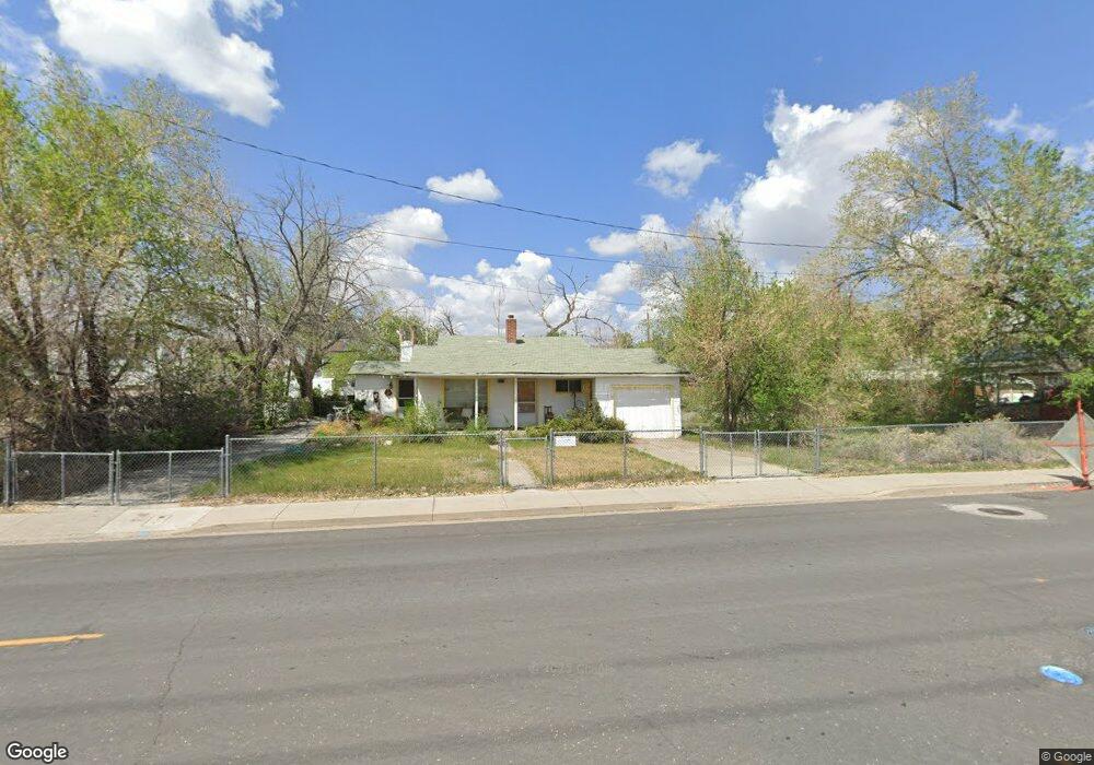
2132 Cannonball Rd Unit 29 Sparks, NV 89431
Downtown Sparks NeighborhoodEstimated Value: $256,000 - $270,000
2
Beds
2
Baths
1,080
Sq Ft
$245/Sq Ft
Est. Value
About This Home
This home is located at 2132 Cannonball Rd Unit 29, Sparks, NV 89431 and is currently estimated at $264,459, approximately $244 per square foot. 2132 Cannonball Rd Unit 29 is a home located in Washoe County with nearby schools including Kate M Smith Elementary School, Sparks Middle School, and Sparks High School.
Ownership History
Date
Name
Owned For
Owner Type
Purchase Details
Closed on
May 18, 1999
Sold by
Glazier Robert H and Glazier Patricia Michele
Bought by
Segura Leticia
Current Estimated Value
Home Financials for this Owner
Home Financials are based on the most recent Mortgage that was taken out on this home.
Original Mortgage
$76,900
Outstanding Balance
$19,672
Interest Rate
6.92%
Estimated Equity
$244,787
Create a Home Valuation Report for This Property
The Home Valuation Report is an in-depth analysis detailing your home's value as well as a comparison with similar homes in the area
Home Values in the Area
Average Home Value in this Area
Purchase History
| Date | Buyer | Sale Price | Title Company |
|---|---|---|---|
| Segura Leticia | $77,000 | First Centennial Title Co |
Source: Public Records
Mortgage History
| Date | Status | Borrower | Loan Amount |
|---|---|---|---|
| Open | Segura Leticia | $76,900 |
Source: Public Records
Tax History Compared to Growth
Tax History
| Year | Tax Paid | Tax Assessment Tax Assessment Total Assessment is a certain percentage of the fair market value that is determined by local assessors to be the total taxable value of land and additions on the property. | Land | Improvement |
|---|---|---|---|---|
| 2025 | $574 | $40,156 | $24,108 | $16,048 |
| 2024 | $574 | $39,737 | $22,712 | $17,025 |
| 2023 | $413 | $36,717 | $21,205 | $15,512 |
| 2022 | $543 | $29,287 | $15,766 | $13,521 |
| 2021 | $528 | $24,732 | $10,841 | $13,891 |
| 2020 | $511 | $26,081 | $11,797 | $14,284 |
| 2019 | $496 | $25,125 | $10,988 | $14,137 |
| 2018 | $484 | $21,467 | $7,424 | $14,043 |
| 2017 | $471 | $21,246 | $7,203 | $14,043 |
| 2016 | $459 | $19,150 | $4,484 | $14,666 |
| 2015 | $459 | $18,847 | $3,859 | $14,988 |
| 2014 | $445 | $13,861 | $2,315 | $11,546 |
| 2013 | -- | $13,872 | $2,168 | $11,704 |
Source: Public Records
Map
Nearby Homes
- 2168 Cannonball Rd
- 972 Flatcar Ln
- 2011 H St
- 1940 Brunetti Way
- 2100 G St Unit 2
- 2385 Pauline Ave
- 1150 El Rancho Dr
- 2002 F St
- 1841 Merchant St
- 1811 H St
- 1837 Merchant St
- 2380 Roundhouse Rd
- 1855 Verano Dr
- 1720 G St
- 1560 Steven Ct Unit 2
- 1830 C St
- 1536 Irene Way
- 1527 Steven Ct
- 987 Damon Ln
- 1799 Vance Way
- 2134 Cannonball Rd
- 2136 Cannonball Rd Unit G31
- 2138 Cannonball Rd
- 2140 Cannonball Rd
- 2145 Jessie Ave
- 2142 Cannonball Rd Unit 34
- 2165 Jessie Ave
- 2144 Cannonball Rd
- 2125 Jessie Ave
- 992 Buffalo Way
- 984 Buffalo Way
- 984 Buffalo Way Unit 21
- 995 Sullivan Ln
- 2146 Cannonball Rd
- 976 Buffalo Way
- 2185 Jessie Ave
- 968 Buffalo Way
- 991 Buffalo Way Unit 28
- 2105 Jessie Ave
- 985 Buffalo Way