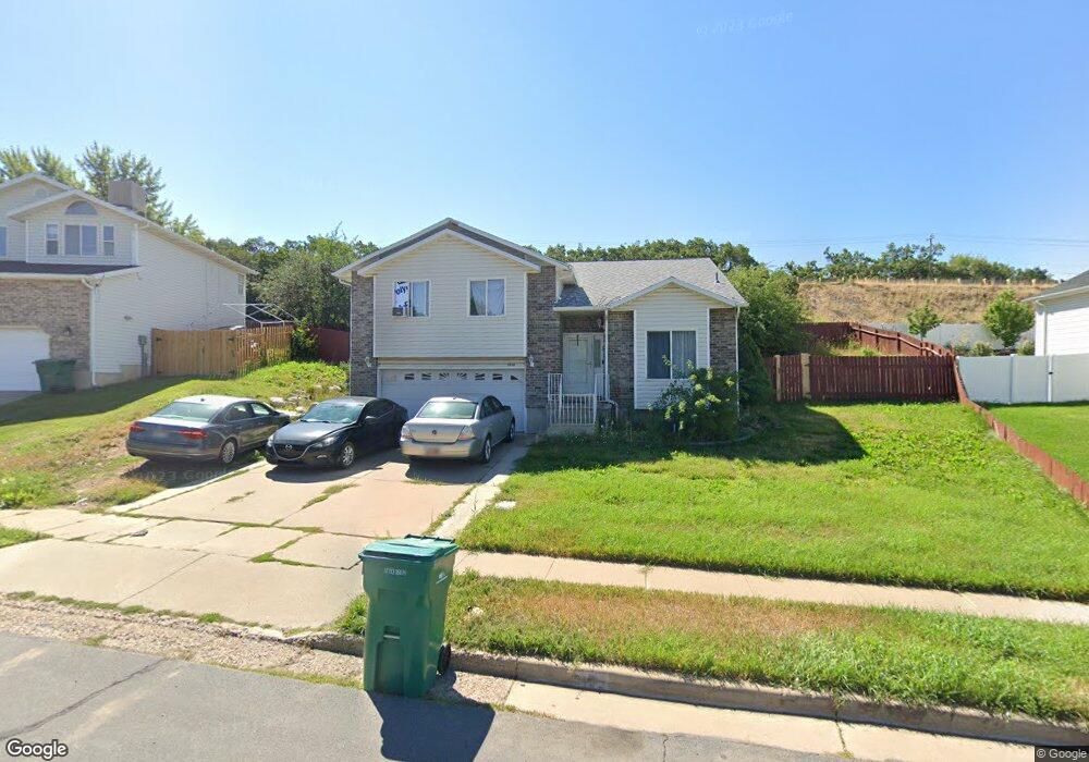
2132 E 3100 N Layton, UT 84040
Estimated Value: $488,000 - $564,000
5
Beds
3
Baths
2,176
Sq Ft
$239/Sq Ft
Est. Value
About This Home
This home is located at 2132 E 3100 N, Layton, UT 84040 and is currently estimated at $519,180, approximately $238 per square foot. 2132 E 3100 N is a home located in Davis County with nearby schools including Mountain View Elementary School, North Layton Junior High School, and Northridge High School.
Ownership History
Date
Name
Owned For
Owner Type
Purchase Details
Closed on
Jun 8, 2020
Sold by
Creation Holdings Llc
Bought by
Propst Billy W and Propst William W
Current Estimated Value
Home Financials for this Owner
Home Financials are based on the most recent Mortgage that was taken out on this home.
Original Mortgage
$324,022
Outstanding Balance
$286,585
Interest Rate
3.2%
Mortgage Type
FHA
Estimated Equity
$232,595
Purchase Details
Closed on
Dec 27, 2019
Sold by
Aranda Richard and Aranda Sung P
Bought by
Creation Holdings Llc
Home Financials for this Owner
Home Financials are based on the most recent Mortgage that was taken out on this home.
Original Mortgage
$263,370
Interest Rate
3.7%
Mortgage Type
Unknown
Purchase Details
Closed on
Jan 4, 2007
Sold by
Aranda Richard
Bought by
Aranda Richard and Aranda Sung P
Home Financials for this Owner
Home Financials are based on the most recent Mortgage that was taken out on this home.
Original Mortgage
$57,800
Interest Rate
6.16%
Mortgage Type
New Conventional
Purchase Details
Closed on
May 29, 2003
Sold by
Aranda Richard
Bought by
Aranda Richard and Aranda Sung P
Home Financials for this Owner
Home Financials are based on the most recent Mortgage that was taken out on this home.
Original Mortgage
$154,368
Interest Rate
5.75%
Mortgage Type
VA
Purchase Details
Closed on
Aug 21, 2002
Sold by
Hess David B and Hess Deanna K
Bought by
Aranda Richard
Home Financials for this Owner
Home Financials are based on the most recent Mortgage that was taken out on this home.
Original Mortgage
$153,510
Interest Rate
6.52%
Mortgage Type
VA
Purchase Details
Closed on
Aug 1, 2002
Sold by
Aranda Richard
Bought by
Aranda Richard and Aranda Sung P
Home Financials for this Owner
Home Financials are based on the most recent Mortgage that was taken out on this home.
Original Mortgage
$153,510
Interest Rate
6.52%
Mortgage Type
VA
Purchase Details
Closed on
Oct 17, 1996
Sold by
Hansen Industries Inc
Bought by
Hess David B and Hess Deanna K
Home Financials for this Owner
Home Financials are based on the most recent Mortgage that was taken out on this home.
Original Mortgage
$127,205
Interest Rate
8.37%
Mortgage Type
VA
Create a Home Valuation Report for This Property
The Home Valuation Report is an in-depth analysis detailing your home's value as well as a comparison with similar homes in the area
Home Values in the Area
Average Home Value in this Area
Purchase History
| Date | Buyer | Sale Price | Title Company |
|---|---|---|---|
| Propst Billy W | -- | Advantage Title | |
| Creation Holdings Llc | -- | Real Advantage Title | |
| Aranda Richard | -- | First American Title | |
| Aranda Richard | -- | First American Title | |
| Aranda Richard | -- | First American | |
| Aranda Richard | -- | First American Title Co | |
| Aranda Richard | -- | Title West Title Company | |
| Aranda Richard | -- | Title West Title Company | |
| Hess David B | -- | Associated Title Company |
Source: Public Records
Mortgage History
| Date | Status | Borrower | Loan Amount |
|---|---|---|---|
| Open | Propst Billy W | $324,022 | |
| Previous Owner | Creation Holdings Llc | $263,370 | |
| Previous Owner | Aranda Richard | $57,800 | |
| Previous Owner | Aranda Richard | $154,368 | |
| Previous Owner | Aranda Richard | $153,510 | |
| Previous Owner | Hess David B | $127,205 |
Source: Public Records
Tax History
| Year | Tax Paid | Tax Assessment Tax Assessment Total Assessment is a certain percentage of the fair market value that is determined by local assessors to be the total taxable value of land and additions on the property. | Land | Improvement |
|---|---|---|---|---|
| 2025 | $2,353 | $246,950 | $126,524 | $120,426 |
| 2024 | $2,252 | $238,151 | $150,002 | $88,149 |
| 2023 | $2,221 | $414,000 | $148,034 | $265,966 |
| 2022 | $2,331 | $235,950 | $78,554 | $157,396 |
| 2021 | $2,186 | $330,000 | $127,711 | $202,289 |
| 2020 | $1,954 | $283,000 | $101,810 | $181,190 |
| 2019 | $405 | $273,000 | $104,616 | $168,384 |
| 2018 | $405 | $247,000 | $103,187 | $143,813 |
| 2016 | $192 | $115,445 | $47,914 | $67,531 |
| 2015 | $1,556 | $108,515 | $47,914 | $60,601 |
| 2014 | $134 | $108,800 | $41,664 | $67,136 |
| 2013 | -- | $101,405 | $31,020 | $70,385 |
Source: Public Records
Map
Nearby Homes
- 3302 N 2175 E
- 1935 Deere Valley Dr
- 1827 E Whitetail Dr
- 1731 E 2825 N
- 2597 N 2300 E
- 2798 N 1525 E
- 1505 E 3225 N
- 2330 E 2400 N
- 1447 E 2700 N
- 2273 N 1975 E
- 1292 E 2675 N
- 1266 E 3125 N
- 2202 N 2300 E
- 3297 N Layton Ridge Dr
- 2563 E 2250 N
- 1444 E 2400 N
- 1123 E 2500 N
- 2222 E Rolling Oaks Ln
- 2316 E 1975 N
- 935 E 3000 N Unit 175
- 2102 E 3100 N Unit 103
- 2142 E 3100 N
- 2080 E 3100 N Unit 102
- 2080 E 3100 N
- 1985 E 2900 N
- 2148 E 3100 N
- 2135 E 3100 N
- 3102 N Broadwing Dr Unit 1
- 2064 E 3100 N Unit 101
- 2064 E 3100 N
- 2131 E 3000 N
- 2139 E 3000 N
- 2168 E 3100 N
- 2127 E 3000 N
- 3095 N 2200 E
- 3116 N Broadwing Dr Unit 2
- 3116 N Broadwing Dr
- 2152 E 3025 N
- 2157 E 3100 N
- 3101 N Broadwing Dr Unit 4