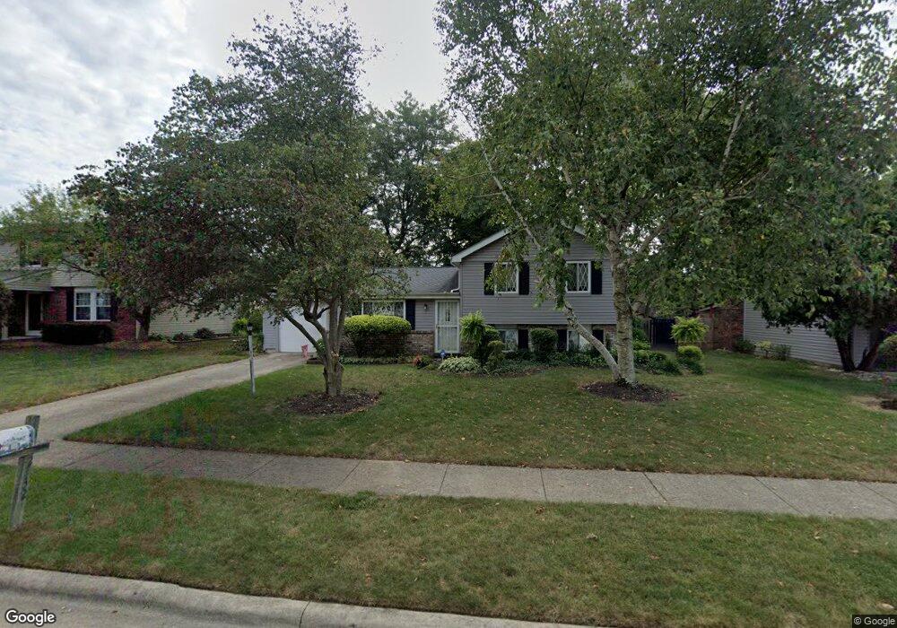
2132 Leah Ln Reynoldsburg, OH 43068
Estimated Value: $239,536 - $271,000
3
Beds
2
Baths
1,448
Sq Ft
$174/Sq Ft
Est. Value
About This Home
This home is located at 2132 Leah Ln, Reynoldsburg, OH 43068 and is currently estimated at $252,634, approximately $174 per square foot. 2132 Leah Ln is a home located in Franklin County with nearby schools including Slate Ridge Elementary School, Baldwin Road Junior High School, and Hannah J Ashton Middle School.
Ownership History
Date
Name
Owned For
Owner Type
Purchase Details
Closed on
Nov 14, 2005
Sold by
Beard Christopher A and Beard Eva L
Bought by
West Robert Lee
Current Estimated Value
Home Financials for this Owner
Home Financials are based on the most recent Mortgage that was taken out on this home.
Original Mortgage
$129,900
Outstanding Balance
$71,175
Interest Rate
6.04%
Mortgage Type
Purchase Money Mortgage
Estimated Equity
$181,460
Purchase Details
Closed on
Apr 3, 2004
Sold by
Rupert Eva L
Bought by
Beard Christopher and Beard Eva L
Home Financials for this Owner
Home Financials are based on the most recent Mortgage that was taken out on this home.
Original Mortgage
$73,700
Interest Rate
5.66%
Mortgage Type
New Conventional
Purchase Details
Closed on
Oct 4, 1995
Sold by
Simpson June
Bought by
Eva L Rupert
Home Financials for this Owner
Home Financials are based on the most recent Mortgage that was taken out on this home.
Original Mortgage
$82,450
Interest Rate
7.91%
Mortgage Type
New Conventional
Create a Home Valuation Report for This Property
The Home Valuation Report is an in-depth analysis detailing your home's value as well as a comparison with similar homes in the area
Home Values in the Area
Average Home Value in this Area
Purchase History
| Date | Buyer | Sale Price | Title Company |
|---|---|---|---|
| West Robert Lee | $129,900 | Lawyers Tit | |
| Beard Christopher | -- | Stewart Title Agency Of Colu | |
| Eva L Rupert | $86,800 | -- |
Source: Public Records
Mortgage History
| Date | Status | Borrower | Loan Amount |
|---|---|---|---|
| Open | West Robert Lee | $129,900 | |
| Previous Owner | Beard Christopher | $73,700 | |
| Previous Owner | Eva L Rupert | $82,450 |
Source: Public Records
Tax History Compared to Growth
Tax History
| Year | Tax Paid | Tax Assessment Tax Assessment Total Assessment is a certain percentage of the fair market value that is determined by local assessors to be the total taxable value of land and additions on the property. | Land | Improvement |
|---|---|---|---|---|
| 2024 | $3,455 | $67,480 | $20,020 | $47,460 |
| 2023 | $3,297 | $67,480 | $20,020 | $47,460 |
| 2022 | $2,779 | $43,020 | $7,950 | $35,070 |
| 2021 | $2,789 | $43,020 | $7,950 | $35,070 |
| 2020 | $2,846 | $43,020 | $7,950 | $35,070 |
| 2019 | $2,616 | $35,850 | $6,620 | $29,230 |
| 2018 | $2,460 | $35,850 | $6,620 | $29,230 |
| 2017 | $2,497 | $35,850 | $6,620 | $29,230 |
| 2016 | $2,377 | $29,130 | $6,270 | $22,860 |
| 2015 | $2,304 | $29,130 | $6,270 | $22,860 |
| 2014 | $2,314 | $29,130 | $6,270 | $22,860 |
| 2013 | $1,325 | $34,265 | $7,385 | $26,880 |
Source: Public Records
Map
Nearby Homes
- 6549 Santa Cruz Place
- 6682 Woodsedge Dr
- 6348 E Livingston Ave
- 0 Brice Rd
- 0 Radekin Rd Unit 225029852
- 6728 Greenbush Dr
- 6772 Gilette Dr
- 1550 Idlewild Dr
- 6584 Benjamin Dr
- 6658 Furth Dr
- 6775 Centennial Dr
- 1888 Birkdale Dr
- 1324 Idlewild Dr
- 6793 Laird Ave
- 1334 Manor Dr
- 1328 Manor Dr
- 2997 Hubbardton Place
- 6486 Ethan Dr
- 1603 Hallworth Ct Unit 16038
- 1474 Marty Dr