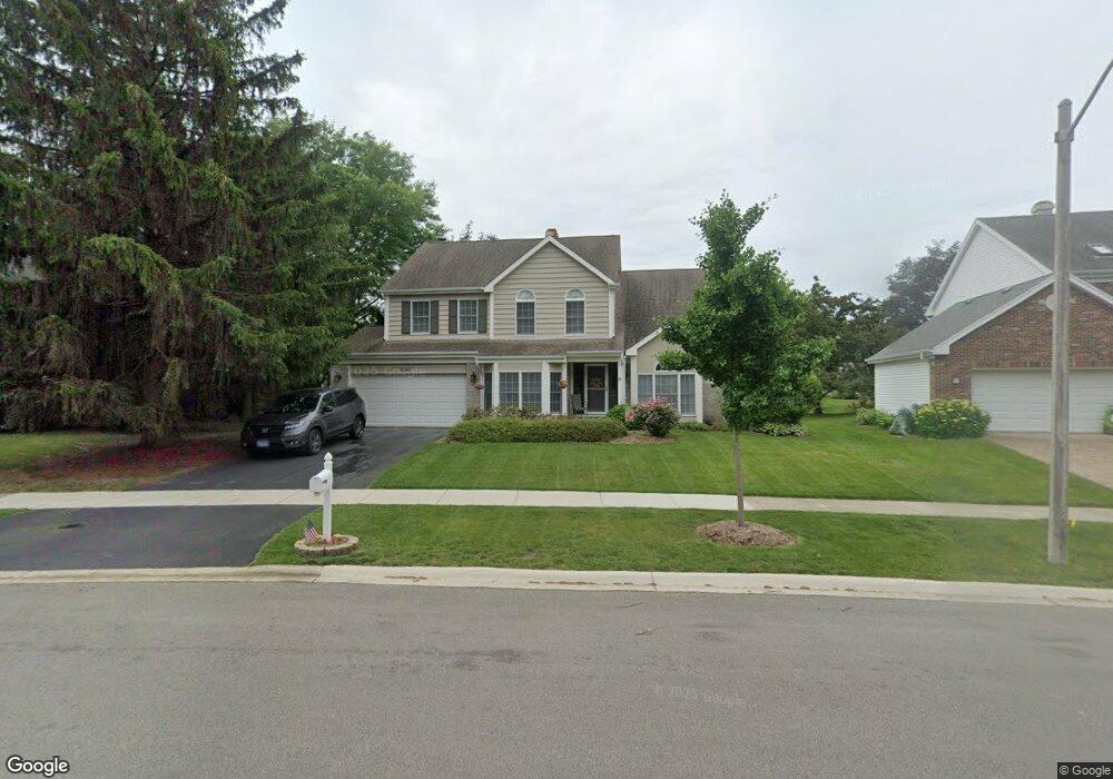
2132 N Charter Point Dr Arlington Heights, IL 60004
Ivy Hill NeighborhoodEstimated Value: $739,000 - $766,000
3
Beds
3
Baths
2,767
Sq Ft
$271/Sq Ft
Est. Value
About This Home
This home is located at 2132 N Charter Point Dr, Arlington Heights, IL 60004 and is currently estimated at $750,700, approximately $271 per square foot. 2132 N Charter Point Dr is a home located in Cook County with nearby schools including Dwight D Eisenhower Elementary School, Anne Sullivan Elementary School, and Betsy Ross Elementary School.
Ownership History
Date
Name
Owned For
Owner Type
Purchase Details
Closed on
Nov 16, 2010
Sold by
Bryan G Fred and Bryan Jean K
Bought by
Bryan G Fred and Bryan Jean K
Current Estimated Value
Home Financials for this Owner
Home Financials are based on the most recent Mortgage that was taken out on this home.
Original Mortgage
$277,000
Interest Rate
4.19%
Mortgage Type
New Conventional
Purchase Details
Closed on
Jul 1, 2005
Sold by
Cronkhite Fred O and Cronkhite Georgeann P
Bought by
Bryan G Fred and Freeman Jean K
Home Financials for this Owner
Home Financials are based on the most recent Mortgage that was taken out on this home.
Original Mortgage
$359,650
Interest Rate
5.75%
Mortgage Type
Fannie Mae Freddie Mac
Purchase Details
Closed on
Aug 8, 2002
Sold by
Cronkhite Fred Omer and Cronkhite Georgeann P
Bought by
Cronkhite Fred O and Cronkhite Georgeann P
Create a Home Valuation Report for This Property
The Home Valuation Report is an in-depth analysis detailing your home's value as well as a comparison with similar homes in the area
Home Values in the Area
Average Home Value in this Area
Purchase History
| Date | Buyer | Sale Price | Title Company |
|---|---|---|---|
| Bryan G Fred | -- | First American | |
| Bryan G Fred | $555,000 | Lawyers | |
| Cronkhite Fred O | -- | -- |
Source: Public Records
Mortgage History
| Date | Status | Borrower | Loan Amount |
|---|---|---|---|
| Closed | Bryan G Fred | $277,000 | |
| Closed | Bryan G Fred | $359,650 |
Source: Public Records
Tax History Compared to Growth
Tax History
| Year | Tax Paid | Tax Assessment Tax Assessment Total Assessment is a certain percentage of the fair market value that is determined by local assessors to be the total taxable value of land and additions on the property. | Land | Improvement |
|---|---|---|---|---|
| 2024 | $13,129 | $54,000 | $12,106 | $41,894 |
| 2023 | $12,487 | $54,000 | $12,106 | $41,894 |
| 2022 | $12,487 | $54,000 | $12,106 | $41,894 |
| 2021 | $10,985 | $42,135 | $8,322 | $33,813 |
| 2020 | $10,815 | $42,135 | $8,322 | $33,813 |
| 2019 | $11,531 | $49,772 | $8,322 | $41,450 |
| 2018 | $12,091 | $47,707 | $7,313 | $40,394 |
| 2017 | $11,995 | $47,707 | $7,313 | $40,394 |
| 2016 | $11,656 | $47,707 | $7,313 | $40,394 |
| 2015 | $11,263 | $42,395 | $6,305 | $36,090 |
| 2014 | $11,711 | $42,395 | $6,305 | $36,090 |
| 2013 | $11,431 | $42,395 | $6,305 | $36,090 |
Source: Public Records
Map
Nearby Homes
- 2060 N Charter Point Dr Unit 14
- 1964 N Coldspring Rd Unit 52
- 1949 N Charter Point Dr Unit 1949
- 1912 N Coldspring Rd Unit 96
- 1956 N Lake Arlington Dr
- 307 Anne Ct
- 1044 Creekside Ct Unit 2B
- 1500 Harbour Dr Unit 1D
- 1500 Harbour Dr Unit 2K
- 412 Cherry Creek Ln
- 2143 E Peachtree Ln
- 1054 Harbour Ct Unit 1A
- 1038 Harbour Ct Unit 2A
- 21 E Stonegate Dr
- 1925 E Waverly Ln
- 11 W Palatine Rd
- 2409 E Greshan Ct
- 10 N Wildwood Dr
- 2616 N Prindle Ave
- 2611 E Radford Ct
- 2146 N Lake Arlington Dr
- 2136 N Lake Arlington Dr
- 2152 N Charter Point Dr
- 2117 N Lake Shore Cir Unit 3
- 2115 N Lake Shore Cir
- 2151 N Charter Point Dr
- 2107 N Lake Shore Cir
- 2147 N Lake Shore Cir
- 2150 N Lake Arlington Dr
- 2157 N Lake Shore Cir
- 2162 N Charter Point Dr
- 2070 N Charter Point Dr Unit 15
- 2068 N Charter Point Dr Unit 14
- 2161 N Charter Point Dr
- 2167 N Lake Shore Cir
- 2072 N Charter Point Dr Unit 15
- 2066 N Charter Point Dr Unit 14
- 2074 N Charter Point Dr Unit 15
- 2116 N Charter Point Dr Unit 17
- 2112 N Charter Point Dr Unit 17