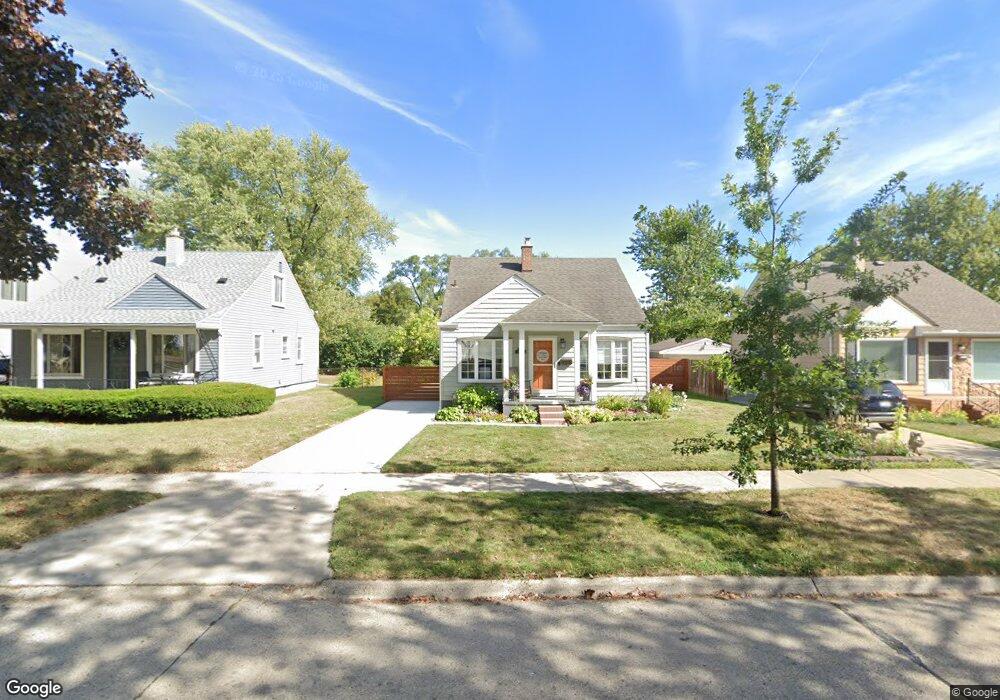
2132 Tyler Ave Berkley, MI 48072
Estimated Value: $285,453 - $374,000
3
Beds
1
Bath
978
Sq Ft
$334/Sq Ft
Est. Value
About This Home
This home is located at 2132 Tyler Ave, Berkley, MI 48072 and is currently estimated at $326,363, approximately $333 per square foot. 2132 Tyler Ave is a home located in Oakland County with nearby schools including Angell Elementary School, Anderson Middle School, and Berkley High School.
Ownership History
Date
Name
Owned For
Owner Type
Purchase Details
Closed on
Jul 24, 2006
Sold by
Radcliffe Scott C and Radcliffe Lura
Bought by
Forman Erica L
Current Estimated Value
Purchase Details
Closed on
May 11, 1999
Sold by
Misterovich Patrick
Bought by
Radcliffe Scott C
Purchase Details
Closed on
May 10, 1996
Sold by
Misterovich Patrick
Bought by
Misterovich Patrick
Home Financials for this Owner
Home Financials are based on the most recent Mortgage that was taken out on this home.
Original Mortgage
$97,700
Interest Rate
8.1%
Create a Home Valuation Report for This Property
The Home Valuation Report is an in-depth analysis detailing your home's value as well as a comparison with similar homes in the area
Home Values in the Area
Average Home Value in this Area
Purchase History
| Date | Buyer | Sale Price | Title Company |
|---|---|---|---|
| Forman Erica L | $178,000 | Homeland Title & Escrow Agen | |
| Radcliffe Scott C | $137,500 | -- | |
| Misterovich Patrick | -- | -- |
Source: Public Records
Mortgage History
| Date | Status | Borrower | Loan Amount |
|---|---|---|---|
| Previous Owner | Misterovich Patrick | $97,700 |
Source: Public Records
Tax History
| Year | Tax Paid | Tax Assessment Tax Assessment Total Assessment is a certain percentage of the fair market value that is determined by local assessors to be the total taxable value of land and additions on the property. | Land | Improvement |
|---|---|---|---|---|
| 2025 | $2,988 | $132,130 | $0 | $0 |
| 2024 | $2,834 | $123,950 | $0 | $0 |
| 2023 | $2,555 | $113,190 | $0 | $0 |
| 2022 | $2,553 | $103,980 | $0 | $0 |
| 2021 | $2,496 | $98,680 | $0 | $0 |
| 2020 | $2,388 | $94,230 | $0 | $0 |
| 2019 | $2,507 | $89,090 | $0 | $0 |
| 2018 | $2,397 | $84,390 | $0 | $0 |
| 2017 | $2,367 | $80,890 | $0 | $0 |
| 2016 | $2,390 | $76,100 | $0 | $0 |
| 2015 | -- | $69,770 | $0 | $0 |
| 2014 | -- | $63,010 | $0 | $0 |
| 2011 | -- | $59,070 | $0 | $0 |
Source: Public Records
Map
Nearby Homes
- 2260 Buckingham Ave
- 2330 Buckingham Ave
- 1888 Griffith Ave
- 1975 Kipling Ave
- 2863 Columbia Rd
- 3050 Catalpa Dr
- 2679 Oxford Rd
- 14611 Kingston St
- 14421 Labelle St
- 2795 Robina Ave
- 2828 Robina Ave
- 2076 Thomas Ave
- 2813 Kipling Ave
- 2616 Kenmore Rd
- 2427 Harvard Rd
- 2438 Columbia Rd
- 2435 Sunnyknoll Ave
- 14670 Talbot St
- 13680 Borgman St
- 14710 Loretta Place
- 2150 Tyler Ave
- 2118 Tyler Ave
- 2164 Tyler Ave
- 2098 Tyler Ave
- 2125 Gardner Ave
- 2149 Gardner Ave Unit Bldg-Unit
- 2149 Gardner Ave
- 2178 Tyler Ave
- 2086 Tyler Ave
- 2115 Gardner Ave
- 2163 Gardner Ave
- 2115 Tyler Ave
- 2194 Tyler Ave
- 2185 Gardner Ave
- 2125 Tyler Ave
- 2139 Tyler Ave
- 2072 Tyler Ave
- 2159 Tyler Ave
- 2097 Tyler Ave
- 2193 Gardner Ave
Your Personal Tour Guide
Ask me questions while you tour the home.