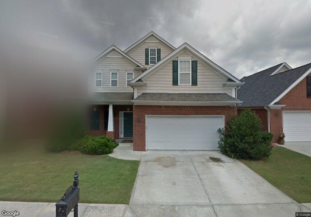
2133 Benchmark Dr Snellville, GA 30078
Estimated Value: $405,124 - $458,000
3
Beds
3
Baths
2,933
Sq Ft
$147/Sq Ft
Est. Value
About This Home
This home is located at 2133 Benchmark Dr, Snellville, GA 30078 and is currently estimated at $431,781, approximately $147 per square foot. 2133 Benchmark Dr is a home located in Gwinnett County with nearby schools including Britt Elementary School, Snellville Middle School, and South Gwinnett High School.
Ownership History
Date
Name
Owned For
Owner Type
Purchase Details
Closed on
Apr 14, 2005
Sold by
Salmon Leighton G
Bought by
Salmon Leighton G and Salmon Nerissa
Current Estimated Value
Home Financials for this Owner
Home Financials are based on the most recent Mortgage that was taken out on this home.
Original Mortgage
$35,650
Interest Rate
5.88%
Mortgage Type
New Conventional
Create a Home Valuation Report for This Property
The Home Valuation Report is an in-depth analysis detailing your home's value as well as a comparison with similar homes in the area
Home Values in the Area
Average Home Value in this Area
Purchase History
| Date | Buyer | Sale Price | Title Company |
|---|---|---|---|
| Salmon Leighton G | $209,900 | -- | |
| Salmon Leighton G | $209,900 | -- |
Source: Public Records
Mortgage History
| Date | Status | Borrower | Loan Amount |
|---|---|---|---|
| Previous Owner | Salmon Leighton G | $35,650 |
Source: Public Records
Tax History Compared to Growth
Tax History
| Year | Tax Paid | Tax Assessment Tax Assessment Total Assessment is a certain percentage of the fair market value that is determined by local assessors to be the total taxable value of land and additions on the property. | Land | Improvement |
|---|---|---|---|---|
| 2025 | $1,115 | $168,800 | $32,120 | $136,680 |
| 2024 | $1,115 | $165,400 | $32,120 | $133,280 |
| 2023 | $1,115 | $169,640 | $33,400 | $136,240 |
| 2022 | $1,115 | $145,720 | $22,000 | $123,720 |
| 2021 | $1,115 | $118,800 | $20,000 | $98,800 |
| 2020 | $1,663 | $111,800 | $20,000 | $91,800 |
| 2019 | $3,633 | $107,160 | $20,000 | $87,160 |
| 2018 | $3,528 | $102,560 | $16,000 | $86,560 |
| 2016 | $3,281 | $92,800 | $14,000 | $78,800 |
| 2015 | $3,075 | $85,080 | $14,000 | $71,080 |
| 2014 | $3,095 | $85,080 | $14,000 | $71,080 |
Source: Public Records
Map
Nearby Homes
- 2059 Wicker Wood Way
- 2055 Hickory Station Cir
- 2280 Hickory Station Cir
- 2455 Hickory Station Cir
- 2435 Hickory Station Cir
- 2676 Abington Dr
- 3391 Thurgood Ct Unit 1
- 2842 Ally Carol Place
- 3385 Thurgood Ct
- 3385 Thurgood Ct Unit 4
- 2841 Ally Carol Place
- 3387 Thurgood Ct Unit 3
- 3383 Thurgood Ct Unit 5
- 3391 Thurgood Ct
- 3383 Thurgood Ct
- 3387 Thurgood Ct
- 2348 Radbury Ln
- 2272 Kimberley Way Unit 1
- 2274 Amber Woods Dr
- 1601 Rockdale Cir
- 2143 Benchmark Dr
- 2153 Benchmark Dr
- 2112 Wicker Wood Way
- 2102 Wicker Wood Way
- 0 Benchmark Dr SW Unit 7059304
- 0 Benchmark Dr SW Unit 8185697
- 2092 Wicker Wood Way
- 2113 Benchmark Dr
- 2163 Benchmark Dr
- 2082 Wicker Wood Way
- 2136 Benchmark Dr
- 2122 Wicker Wood Way
- 2126 Benchmark Dr
- 2156 Benchmark Dr
- 2215 Hickory Station Cir
- 2103 Benchmark Dr
- 2173 Benchmark Dr
- 2225 Hickory Station Cir
- 2166 Benchmark Dr
- 2116 Benchmark Dr