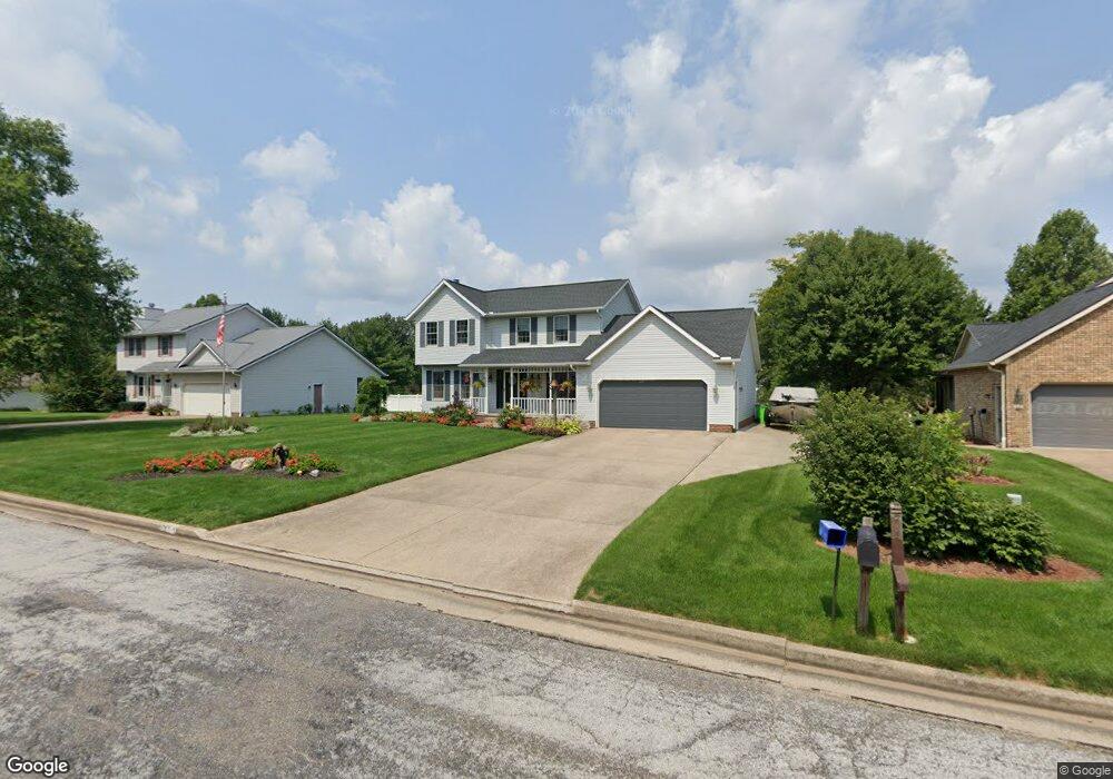
2133 Crestwood St Alliance, OH 44601
Estimated Value: $280,000 - $328,000
3
Beds
3
Baths
1,896
Sq Ft
$159/Sq Ft
Est. Value
About This Home
This home is located at 2133 Crestwood St, Alliance, OH 44601 and is currently estimated at $301,012, approximately $158 per square foot. 2133 Crestwood St is a home located in Stark County with nearby schools including Marlington High School and Regina Coeli/St Joseph School.
Ownership History
Date
Name
Owned For
Owner Type
Purchase Details
Closed on
Mar 31, 2010
Sold by
Copeland Alexis J
Bought by
Copeland Rex A
Current Estimated Value
Home Financials for this Owner
Home Financials are based on the most recent Mortgage that was taken out on this home.
Original Mortgage
$85,000
Interest Rate
5.03%
Mortgage Type
New Conventional
Purchase Details
Closed on
Oct 15, 1993
Purchase Details
Closed on
Nov 23, 1992
Create a Home Valuation Report for This Property
The Home Valuation Report is an in-depth analysis detailing your home's value as well as a comparison with similar homes in the area
Home Values in the Area
Average Home Value in this Area
Purchase History
| Date | Buyer | Sale Price | Title Company |
|---|---|---|---|
| Copeland Rex A | -- | Heritage Union Title Co Ltd | |
| -- | $17,000 | -- | |
| -- | -- | -- |
Source: Public Records
Mortgage History
| Date | Status | Borrower | Loan Amount |
|---|---|---|---|
| Closed | Copeland Rex A | $85,000 |
Source: Public Records
Tax History Compared to Growth
Tax History
| Year | Tax Paid | Tax Assessment Tax Assessment Total Assessment is a certain percentage of the fair market value that is determined by local assessors to be the total taxable value of land and additions on the property. | Land | Improvement |
|---|---|---|---|---|
| 2025 | -- | $84,290 | $23,280 | $61,010 |
| 2024 | -- | $84,290 | $23,280 | $61,010 |
| 2023 | $3,323 | $69,130 | $17,710 | $51,420 |
| 2022 | $2,147 | $69,130 | $17,710 | $51,420 |
| 2021 | $2,154 | $69,130 | $17,710 | $51,420 |
| 2020 | $2,103 | $60,310 | $15,400 | $44,910 |
| 2019 | $2,085 | $60,310 | $15,400 | $44,910 |
| 2018 | $2,087 | $60,310 | $15,400 | $44,910 |
| 2017 | $1,817 | $52,890 | $12,360 | $40,530 |
| 2016 | $1,746 | $50,790 | $12,360 | $38,430 |
| 2015 | $1,749 | $50,790 | $12,360 | $38,430 |
| 2014 | $1,830 | $48,650 | $11,830 | $36,820 |
| 2013 | $915 | $48,650 | $11,830 | $36,820 |
Source: Public Records
Map
Nearby Homes
- 1430 Westwood Ave
- 2081 Marwood Cir
- 0 S Sawburg Ave Unit 5113457
- 2371 Ansley St Unit 2371
- 2377 Ansley St Unit 2377
- 8630 Schubert Ave NE
- 0 W Main St Unit 5090123
- 1201 Overlook Dr
- 2050 Federal Ave
- 2220 Western Ave
- 2112 Blenheim Ave
- 2851 Patriots Path Unit 3D
- 0 Easton St NE
- 2435 Queensbury Rd
- 13061 Beeson St NE
- 970 Kingsway St
- 1321 Parkway Blvd
- 13334 Cindy St NE
- 884 W College Rd
- 896 Parkway Blvd
- 2117 Crestwood St
- 2149 Crestwood St
- 1440 Westwood Ave
- 2136 Overcrest St
- 2116 Overcrest St
- 2132 Crestwood St
- 2098 Overcrest St
- 2081 Crestwood St
- 2148 Crestwood St
- 2116 Crestwood St
- 2180 Overcrest St
- 2164 Crestwood St
- 2090 Crestwood St
- 2090 Overcrest St
- 2071 Crestwood St
- 2180 Crestwood St
- 2080 Crestwood St
- 2082 Overcrest St
- 2105 Marwood Cir
- 1445 Westwood Ave