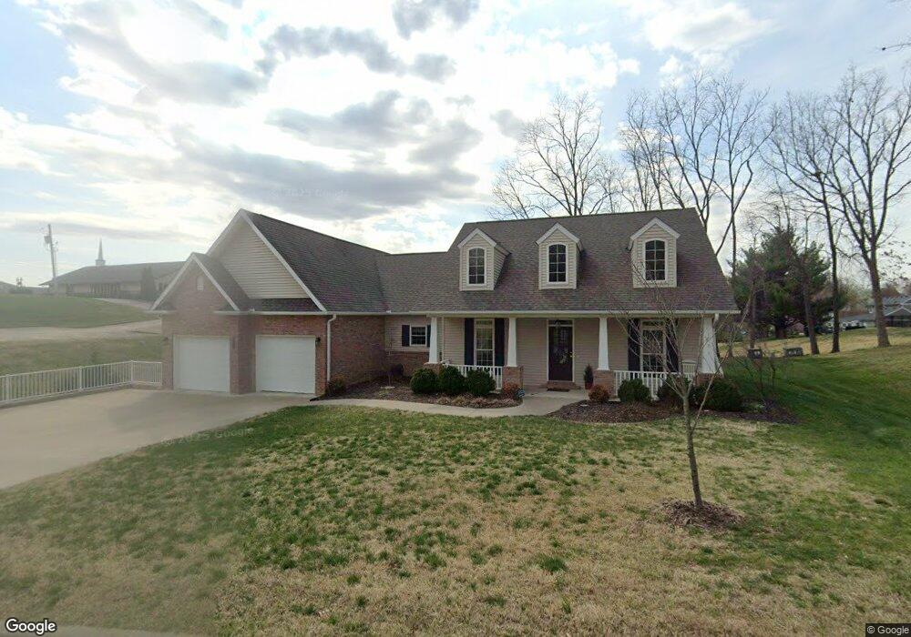
2133 Kent Dr Cape Girardeau, MO 63701
Estimated Value: $415,769 - $636,000
4
Beds
3
Baths
1,816
Sq Ft
$267/Sq Ft
Est. Value
About This Home
This home is located at 2133 Kent Dr, Cape Girardeau, MO 63701 and is currently estimated at $484,192, approximately $266 per square foot. 2133 Kent Dr is a home located in Cape Girardeau County with nearby schools including Clippard Elementary School, Central Middle School, and Central Junior High School.
Ownership History
Date
Name
Owned For
Owner Type
Purchase Details
Closed on
Sep 17, 2024
Sold by
Lisa B Letner Revocable Living Trust and Gerlach Elisabeth F
Bought by
Gerlach Elisabeth F and Gerlach Paul
Current Estimated Value
Home Financials for this Owner
Home Financials are based on the most recent Mortgage that was taken out on this home.
Original Mortgage
$50,000
Interest Rate
6.72%
Mortgage Type
Credit Line Revolving
Purchase Details
Closed on
Jun 4, 2020
Sold by
Gerlach Elisabeth F and Gerlach David P
Bought by
Gerlach Elisabeth F and Letner Revocable Living Trust
Purchase Details
Closed on
Mar 12, 2015
Sold by
Randol Farms Development Inc
Bought by
Gerlach Elisabeth F
Home Financials for this Owner
Home Financials are based on the most recent Mortgage that was taken out on this home.
Original Mortgage
$187,100
Interest Rate
3.68%
Mortgage Type
New Conventional
Create a Home Valuation Report for This Property
The Home Valuation Report is an in-depth analysis detailing your home's value as well as a comparison with similar homes in the area
Home Values in the Area
Average Home Value in this Area
Purchase History
| Date | Buyer | Sale Price | Title Company |
|---|---|---|---|
| Gerlach Elisabeth F | -- | None Listed On Document | |
| Gerlach Elisabeth F | -- | None Available | |
| Gerlach Elisabeth F | -- | Cape Girardeau County Abstra |
Source: Public Records
Mortgage History
| Date | Status | Borrower | Loan Amount |
|---|---|---|---|
| Previous Owner | Gerlach Elisabeth F | $50,000 | |
| Previous Owner | Gerlach Elisabeth F | $187,100 |
Source: Public Records
Tax History Compared to Growth
Tax History
| Year | Tax Paid | Tax Assessment Tax Assessment Total Assessment is a certain percentage of the fair market value that is determined by local assessors to be the total taxable value of land and additions on the property. | Land | Improvement |
|---|---|---|---|---|
| 2025 | $33 | $66,310 | $3,360 | $62,950 |
| 2024 | $33 | $63,150 | $3,200 | $59,950 |
| 2023 | $3,282 | $63,150 | $3,200 | $59,950 |
| 2022 | $3,026 | $58,200 | $2,950 | $55,250 |
| 2021 | $3,026 | $58,200 | $2,950 | $55,250 |
| 2020 | $3,035 | $58,200 | $2,950 | $55,250 |
| 2019 | $3,030 | $58,200 | $0 | $0 |
| 2018 | $2,536 | $58,200 | $0 | $0 |
| 2017 | $2,543 | $58,200 | $0 | $0 |
| 2016 | $114 | $2,200 | $0 | $0 |
| 2015 | $114 | $2,200 | $0 | $0 |
| 2014 | $121 | $2,200 | $0 | $0 |
Source: Public Records
Map
Nearby Homes
- 2520 Horseshoe Ridge
- 2519 Horseshoe Ridge
- 2137 Wood Hollow Ct
- 2528 Palomino Dr
- 2206 Derbyshire Ln
- 2085 Derbyshire Ln
- 1705 Paul Revere Dr
- 2415 Perryville Rd
- 1966 Randol Ave
- 2153 Esker Trail
- 2640 Walden Blvd
- 2161 Esker Trail
- 1960 Briarwood Dr
- 2224 Heywood Meadows
- 1938 Westwood Dr
- 2253 Heywood Meadows
- 2062 Concord Place
- 2550 Marvin St
- 2990 Pine Hill Spur
- 1623 Lexington Ave
- 2120 Kent (Lot 4)
- 2128 Kent (Lot 2)
- 2128 Kent Dr
- 2120 Kent Dr Unit 4
- 2120 Kent Dr
- 2132 Kent Dr
- 2137 Kent Dr
- 2305 Earleen St
- 2136 Kent Dr
- 2124 2128 Kent (Lots 2 & 3)
- 2124 Kent Dr
- 2124 Kent (Lot 3)
- 2309 Earleen St
- 2206 Earleen St
- 2313 Earleen St
- 2201 Kent Dr
- 2306 Earleen St
- 2202 Kent Dr
- 2310 Earleen St
- 2317 Earleen St