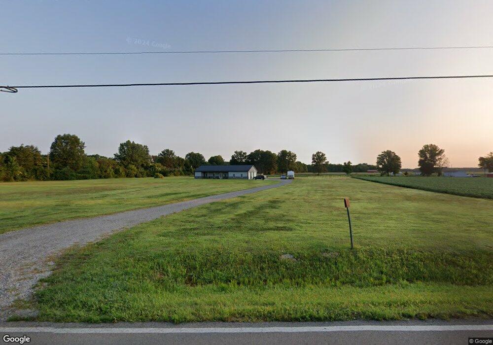
2133 New Harmony Shiloh Rd Mount Orab, OH 45154
Estimated Value: $205,000 - $506,114
3
Beds
2
Baths
1,720
Sq Ft
$191/Sq Ft
Est. Value
About This Home
This home is located at 2133 New Harmony Shiloh Rd, Mount Orab, OH 45154 and is currently estimated at $329,279, approximately $191 per square foot. 2133 New Harmony Shiloh Rd is a home with nearby schools including Western Brown High School.
Ownership History
Date
Name
Owned For
Owner Type
Purchase Details
Closed on
Jan 21, 2025
Sold by
Ballein Brian C and Ballein Kelly J
Bought by
Adams Colten and Adams Brittany
Current Estimated Value
Purchase Details
Closed on
Nov 9, 2021
Sold by
Page Charles David and Page Thomas Richard
Bought by
Ballein Brian C and Ballein Kelly J
Home Financials for this Owner
Home Financials are based on the most recent Mortgage that was taken out on this home.
Original Mortgage
$59,500
Interest Rate
3.05%
Mortgage Type
Commercial
Create a Home Valuation Report for This Property
The Home Valuation Report is an in-depth analysis detailing your home's value as well as a comparison with similar homes in the area
Home Values in the Area
Average Home Value in this Area
Purchase History
| Date | Buyer | Sale Price | Title Company |
|---|---|---|---|
| Adams Colten | -- | None Listed On Document | |
| Ballein Brian C | $75,000 | Ivy Pointee Title Llc |
Source: Public Records
Mortgage History
| Date | Status | Borrower | Loan Amount |
|---|---|---|---|
| Previous Owner | Ballein Brian C | $59,500 |
Source: Public Records
Tax History Compared to Growth
Tax History
| Year | Tax Paid | Tax Assessment Tax Assessment Total Assessment is a certain percentage of the fair market value that is determined by local assessors to be the total taxable value of land and additions on the property. | Land | Improvement |
|---|---|---|---|---|
| 2024 | $3,630 | $125,340 | $35,780 | $89,560 |
| 2023 | $3,630 | $60,410 | $25,410 | $35,000 |
| 2022 | $434 | $14,540 | $14,540 | $0 |
| 2021 | $110 | $14,540 | $14,540 | $0 |
| 2020 | $166 | $12,120 | $12,120 | $0 |
| 2019 | $179 | $12,120 | $12,120 | $0 |
| 2018 | $177 | $5,440 | $5,440 | $0 |
| 2017 | $245 | $7,440 | $7,440 | $0 |
| 2016 | $245 | $7,440 | $7,440 | $0 |
| 2015 | -- | $7,440 | $7,440 | $0 |
| 2014 | -- | $3,810 | $3,810 | $0 |
| 2013 | $126 | $3,810 | $3,810 | $0 |
Source: Public Records
Map
Nearby Homes
- 1993 Old State Rd
- 2437 Tri County Hwy
- 153 Willow Run Rd
- 115 Sweet Bay Trail
- 100 Longwood Blvd
- 12570 Liming van Thompson Rd
- 3305 Pleasant Hill Rd
- 3722 Coon Ave
- 108 Boulder Dr
- 3614 Bootjack Corner Rd
- 3524 Pleasant Hill Rd
- 3644 Deer Trace
- 15070 Bodman Rd
- 0 Deer Trace Rd
- 101 Julian Ln
- 133 Kelly Dr
- 0 Karampas Unit 1850784
- 3690 Todds Run Foster Rd
- 2756 Bardwell Rd W
- 110 Copper Sun Ct
- 2128 New Harmony Shiloh Rd
- 13718 Upper Cumberland Rd
- 13728 Upper Cumberland Rd
- 2130 New Harmony Shiloh Rd
- 13738 Upper Cumberland Rd
- 12990 Upper Cumberland Rd
- 2017 Maple Grove Rd
- 13682 Lower Cumberland Rd
- 13677 Lower Cumberland Rd
- 2180 New Harmony Shiloh Rd
- 2180 New Harmony Shiloh Rd
- 2056 New Harmony Shiloh Rd
- 1981 Maple Grove Rd
- 2048 New Harmony Shiloh Rd
- 2229 New Harmony Shiloh Rd
- 1966 Maple Grove Rd
- 13632 Lower Cumberland Rd
- 1946 Maple Grove Rd
- 2015 New Harmony Shiloh Rd
- 1945 Maple Grove Rd