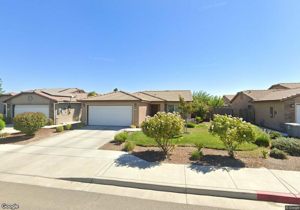
2133 Tatum Ave Dos Palos, CA 93620
Estimated Value: $334,000 - $379,000
4
Beds
2
Baths
1,277
Sq Ft
$280/Sq Ft
Est. Value
About This Home
This home is located at 2133 Tatum Ave, Dos Palos, CA 93620 and is currently estimated at $357,647, approximately $280 per square foot. 2133 Tatum Ave is a home with nearby schools including Dos Palos Elementary School, Bernhard Marks Elementary School, and Bryant Middle School.
Ownership History
Date
Name
Owned For
Owner Type
Purchase Details
Closed on
May 16, 2017
Sold by
Gateway Housing Llc
Bought by
Cardoza Victor Manuel
Current Estimated Value
Home Financials for this Owner
Home Financials are based on the most recent Mortgage that was taken out on this home.
Original Mortgage
$195,463
Outstanding Balance
$163,741
Interest Rate
4.37%
Mortgage Type
FHA
Estimated Equity
$193,906
Purchase Details
Closed on
Dec 21, 2007
Sold by
Tatum Ranch Llc
Bought by
Taliaferro and Scagliotti
Home Financials for this Owner
Home Financials are based on the most recent Mortgage that was taken out on this home.
Original Mortgage
$769,500
Interest Rate
6.15%
Mortgage Type
Purchase Money Mortgage
Create a Home Valuation Report for This Property
The Home Valuation Report is an in-depth analysis detailing your home's value as well as a comparison with similar homes in the area
Home Values in the Area
Average Home Value in this Area
Purchase History
We collect this data history from publicly available records. To have your information removed, we recommend requesting removal directly through your county’s website.
| Date | Buyer | Sale Price | Title Company |
|---|---|---|---|
| Cardoza Victor Manuel | $199,500 | Fidelity National Title | |
| Taliaferro | $1,026,000 | Transcounty Title Company |
Source: Public Records
Mortgage History
We collect this data history from publicly available records. To have your information removed, we recommend requesting removal directly through your county’s website.
| Date | Status | Borrower | Loan Amount |
|---|---|---|---|
| Open | Cardoza Victor Manuel | $195,463 | |
| Previous Owner | Taliaferro | $769,500 |
Source: Public Records
Tax History
| Year | Tax Paid | Tax Assessment Tax Assessment Total Assessment is a certain percentage of the fair market value that is determined by local assessors to be the total taxable value of land and additions on the property. | Land | Improvement |
|---|---|---|---|---|
| 2025 | $2,287 | $231,066 | $58,026 | $173,040 |
| 2024 | $2,287 | $226,537 | $56,889 | $169,648 |
| 2023 | $2,209 | $222,096 | $55,774 | $166,322 |
| 2022 | $2,112 | $217,742 | $54,681 | $163,061 |
| 2021 | $2,114 | $213,473 | $53,609 | $159,864 |
| 2020 | $2,091 | $211,285 | $53,060 | $158,225 |
| 2019 | $2,053 | $207,143 | $52,020 | $155,123 |
| 2018 | $2,074 | $203,082 | $51,000 | $152,082 |
| 2017 | $433 | $40,800 | $40,800 | $0 |
| 2016 | $234 | $21,080 | $21,080 | $0 |
| 2015 | $231 | $20,764 | $20,764 | $0 |
| 2014 | $227 | $20,358 | $20,358 | $0 |
Source: Public Records
Map
Nearby Homes
- 2166 Mccurdy St
- 0 Christian Ave Unit MC25192705
- 37 Christian Ave
- 0 Christian Ave Unit MC25192693
- 0 Christian Ave Unit MC25192664
- 0 Christian Ave Unit MC25192654
- 21627 State Highway 33
- 1725 California Ave
- 1609 Kathy Ave
- 2109 Marguerite St
- 1333 Frank Ave
- 1340 Bennett Ave
- 0 W Almond St Unit MC25192737
- 1718 Oliver St
- 0 Shirley Ct
- 1109 Center Ave
- 1041 Golden Gate Ave
- 45777 Valeria Ave
- 22022 6th St
- 8795 Blossom Ave
- 2137 Tatum Ave
- 2134 Norris Ave
- 2134 Morris Ave
- 2129 Tatum Ave
- 2125 Tatum Ave
- 2138 Norris Ave
- 2130 Norris Ave
- 2126 Norris Ave
- 2134 Tatum Ave
- 2130 Tatum Ave
- 2138 Tatum Ave
- 2121 Tatum Ave
- 2149 Tatum Ave
- 2122 Norris Ave
- 2150 Fugate Landing
- 2150 Tatum Ave
- 2153 Tatum Ave
- 2133 Miles Ave
- 2129 Miles Ave
- 2137 Miles Ave
Your Personal Tour Guide
Ask me questions while you tour the home.