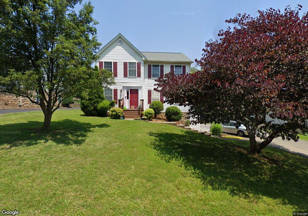
2134 Bloomfield Ave Roanoke, VA 24012
Estimated Value: $386,000 - $389,093
3
Beds
3
Baths
2,159
Sq Ft
$180/Sq Ft
Est. Value
About This Home
This home is located at 2134 Bloomfield Ave, Roanoke, VA 24012 and is currently estimated at $388,023, approximately $179 per square foot. 2134 Bloomfield Ave is a home located in Roanoke County with nearby schools including Bonsack Elementary School, William Byrd Middle School, and William Byrd High School.
Ownership History
Date
Name
Owned For
Owner Type
Purchase Details
Closed on
May 10, 2010
Sold by
Williams Linwood N and Williams Elizabeth G
Bought by
Onwi Michael E and Onwi Juliette M
Current Estimated Value
Home Financials for this Owner
Home Financials are based on the most recent Mortgage that was taken out on this home.
Original Mortgage
$207,209
Outstanding Balance
$139,291
Interest Rate
5.11%
Mortgage Type
FHA
Estimated Equity
$248,732
Purchase Details
Closed on
Nov 7, 2007
Sold by
Phillips Edward Mathew and Barrera Phillips Lisa M
Bought by
Williams Linwood N and Williams Elizabeth G
Home Financials for this Owner
Home Financials are based on the most recent Mortgage that was taken out on this home.
Original Mortgage
$207,100
Interest Rate
6.21%
Mortgage Type
New Conventional
Create a Home Valuation Report for This Property
The Home Valuation Report is an in-depth analysis detailing your home's value as well as a comparison with similar homes in the area
Home Values in the Area
Average Home Value in this Area
Purchase History
| Date | Buyer | Sale Price | Title Company |
|---|---|---|---|
| Onwi Michael E | $210,000 | None Available | |
| Williams Linwood N | $219,950 | First American Title Ins Co |
Source: Public Records
Mortgage History
| Date | Status | Borrower | Loan Amount |
|---|---|---|---|
| Open | Onwi Michael E | $207,209 | |
| Previous Owner | Williams Linwood N | $207,100 |
Source: Public Records
Tax History Compared to Growth
Tax History
| Year | Tax Paid | Tax Assessment Tax Assessment Total Assessment is a certain percentage of the fair market value that is determined by local assessors to be the total taxable value of land and additions on the property. | Land | Improvement |
|---|---|---|---|---|
| 2025 | $3,265 | $317,000 | $59,000 | $258,000 |
| 2024 | $3,134 | $301,300 | $54,000 | $247,300 |
| 2023 | $3,091 | $291,600 | $54,000 | $237,600 |
| 2022 | $2,652 | $243,300 | $49,000 | $194,300 |
| 2021 | $2,455 | $225,200 | $45,000 | $180,200 |
| 2020 | $2,305 | $211,500 | $40,000 | $171,500 |
| 2019 | $2,235 | $205,000 | $39,000 | $166,000 |
| 2018 | $2,133 | $201,300 | $39,000 | $162,300 |
| 2017 | $2,133 | $195,700 | $39,000 | $156,700 |
| 2016 | $2,074 | $190,300 | $38,000 | $152,300 |
| 2015 | $2,045 | $187,600 | $38,000 | $149,600 |
| 2014 | $2,021 | $185,400 | $36,000 | $149,400 |
Source: Public Records
Map
Nearby Homes
- 2414 Carlsbad Cir
- 1802 W Ruritan Rd
- 1713 Ashbury Ct
- 1525 W Ruritan Rd
- 1944 W Ruritan Rd
- 4127 Mockingbird Hill Rd
- 0 E Ruritan Rd
- 1971 W Ruritan Rd
- 2020 Ruritan Rd
- 2054 Ruritan Rd
- 2910 Mystique Ct
- 2206 Coachman Dr
- 2637 Coachman Cir
- 5018 Carter Grove Ln
- 5114 Huntridge Rd
- 2441 Coachman Dr
- 2826 Greggin Dr
- 3516 Springtree Cir NE
- 6119 Wisteria Place Ct
- 6110 Wisteria Place Ct
- 2122 Bloomfield Ave
- 2140 Bloomfield Ave
- 2033 Bridgeport Ln
- 2110 Bloomfield Ave
- 2150 Bloomfield Ave
- 2133 Bloomfield Ave
- 2039 Bridgeport Ln
- 2141 Bloomfield Ave
- 2125 Bloomfield Ave
- 2029 Bridgeport Ln
- 2149 Bloomfield Ave
- 2030 Bloomfield Ave
- 2117 Bloomfield Ave
- 2146 Bloomfield Ave
- 2109 Bloomfield Ave
- 1935 Summerfield Dr
- 2157 Bloomfield Ave
- 2021 Bridgeport Ln
- 2020 Bloomfield Ave
- 2038 Bridgeport Ln