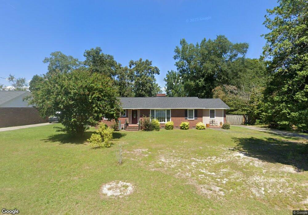
2134 Leaphart Rd West Columbia, SC 29169
Estimated Value: $196,499 - $220,000
2
Beds
2
Baths
1,340
Sq Ft
$155/Sq Ft
Est. Value
About This Home
This home is located at 2134 Leaphart Rd, West Columbia, SC 29169 and is currently estimated at $207,625, approximately $154 per square foot. 2134 Leaphart Rd is a home located in Lexington County with nearby schools including Riverbank Elementary, Northside Middle, and Brookland-Cayce High School.
Ownership History
Date
Name
Owned For
Owner Type
Purchase Details
Closed on
Jan 8, 2016
Sold by
Laval Harry L and Laval Judy C
Bought by
Laval Harry L and Laval Judy C
Current Estimated Value
Purchase Details
Closed on
Dec 4, 2015
Sold by
Reed Gwendlia D
Bought by
Laval Harry L and Laval Judy C
Purchase Details
Closed on
Feb 10, 2010
Sold by
Federal Home Loan Mortgage Corporation
Bought by
Reed Gwendlia D
Purchase Details
Closed on
Oct 13, 2009
Sold by
Owens Veronica L and Regions Bank
Bought by
Federal Home Loan Mortgage Corporation
Purchase Details
Closed on
Dec 17, 1999
Sold by
James Reginald H
Bought by
Owens Veronica Lynn
Create a Home Valuation Report for This Property
The Home Valuation Report is an in-depth analysis detailing your home's value as well as a comparison with similar homes in the area
Home Values in the Area
Average Home Value in this Area
Purchase History
| Date | Buyer | Sale Price | Title Company |
|---|---|---|---|
| Laval Harry L | -- | None Available | |
| Laval Harry L | $102,000 | None Available | |
| Reed Gwendlia D | $64,000 | -- | |
| Federal Home Loan Mortgage Corporation | $60,000 | -- | |
| Owens Veronica Lynn | $75,000 | -- |
Source: Public Records
Tax History Compared to Growth
Tax History
| Year | Tax Paid | Tax Assessment Tax Assessment Total Assessment is a certain percentage of the fair market value that is determined by local assessors to be the total taxable value of land and additions on the property. | Land | Improvement |
|---|---|---|---|---|
| 2024 | $995 | $4,692 | $1,489 | $3,203 |
| 2023 | $896 | $4,692 | $1,489 | $3,203 |
| 2022 | $905 | $4,692 | $1,489 | $3,203 |
| 2020 | $869 | $4,692 | $1,489 | $3,203 |
| 2019 | $771 | $4,080 | $1,540 | $2,540 |
| 2018 | $779 | $4,080 | $1,540 | $2,540 |
| 2017 | $748 | $4,080 | $1,540 | $2,540 |
| 2016 | $769 | $4,080 | $1,540 | $2,540 |
| 2015 | $1,957 | $5,518 | $1,810 | $3,708 |
| 2014 | $1,470 | $4,799 | $1,800 | $2,999 |
| 2013 | -- | $4,800 | $1,800 | $3,000 |
Source: Public Records
Map
Nearby Homes
- 215 Sandel Ln
- 207 Woodhaven Dr
- 339 Gum Swamp Trail
- 2004 Dew Ave
- 349 Gum Swamp Trail
- 0 Platt Springs Rd Unit 606355
- 116 Silver Run Place
- 135 Silver Run Place
- 623 Hook Ave
- 212 Alexandria St
- 165 Cavendish Dr
- 529 Finnegan Ln
- 309 Hammond Ave
- 913 Harper Rose Ct
- 500 Finnegan Ln
- 1802 D Ave
- 615 Dawn Dr
- 179 War Admiral Dr
- 1734 C Ave
- 108 Harvest Glen Ln
- 2140 Leaphart Rd
- 205 Sandel Ln
- 2150 Leaphart Rd
- 2160 Leaphart Rd
- 121 Menscer Dr
- 2132 Leaphart Rd
- 209 Sandel Ln
- 0 Dreher Rd
- 0 Dreher Rd
- 107 Woodhaven Dr
- 204 Sandel Ln
- 105 Woodhaven Dr
- 2230 Leaphart Rd
- 2128 Leaphart Rd
- 213 Sandel Ln
- 115 Woodhaven Dr
- 206 Sandel Ln
- 109 Menscer Dr
- 116 Menscer Dr
- 2124 Leaphart Rd