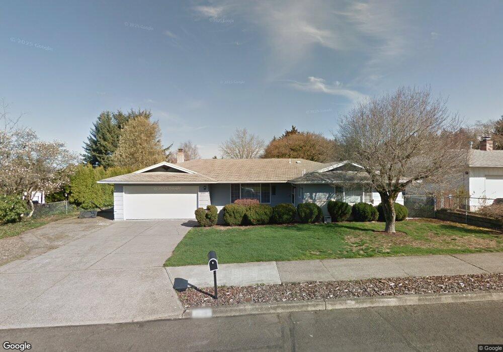
21347 SE Main St Gresham, OR 97030
North Central NeighborhoodEstimated Value: $443,000 - $482,000
3
Beds
2
Baths
1,600
Sq Ft
$286/Sq Ft
Est. Value
About This Home
This home is located at 21347 SE Main St, Gresham, OR 97030 and is currently estimated at $457,592, approximately $285 per square foot. 21347 SE Main St is a home located in Multnomah County with nearby schools including North Gresham Elementary School, Clear Creek Middle School, and Gresham High School.
Ownership History
Date
Name
Owned For
Owner Type
Purchase Details
Closed on
Aug 18, 2005
Sold by
Johnson Jay A
Bought by
Weldon George T and Weldon Carlene A
Current Estimated Value
Home Financials for this Owner
Home Financials are based on the most recent Mortgage that was taken out on this home.
Original Mortgage
$166,400
Outstanding Balance
$86,301
Interest Rate
5.56%
Mortgage Type
Fannie Mae Freddie Mac
Estimated Equity
$371,291
Purchase Details
Closed on
Apr 1, 2004
Sold by
Leaird Hiram Kenneth
Bought by
Johnson Jay A and Johnson Juliette E
Home Financials for this Owner
Home Financials are based on the most recent Mortgage that was taken out on this home.
Original Mortgage
$135,200
Interest Rate
5.56%
Mortgage Type
Purchase Money Mortgage
Create a Home Valuation Report for This Property
The Home Valuation Report is an in-depth analysis detailing your home's value as well as a comparison with similar homes in the area
Home Values in the Area
Average Home Value in this Area
Purchase History
| Date | Buyer | Sale Price | Title Company |
|---|---|---|---|
| Weldon George T | $220,000 | Lawyers Title Ins | |
| Johnson Jay A | $169,000 | Fidelity Natl Title Co Of Or |
Source: Public Records
Mortgage History
| Date | Status | Borrower | Loan Amount |
|---|---|---|---|
| Open | Weldon George T | $166,400 | |
| Previous Owner | Johnson Jay A | $135,200 | |
| Closed | Johnson Jay A | $16,900 |
Source: Public Records
Tax History
| Year | Tax Paid | Tax Assessment Tax Assessment Total Assessment is a certain percentage of the fair market value that is determined by local assessors to be the total taxable value of land and additions on the property. | Land | Improvement |
|---|---|---|---|---|
| 2025 | $4,891 | $240,340 | -- | -- |
| 2024 | $4,682 | $233,340 | -- | -- |
| 2023 | $4,265 | $226,550 | $0 | $0 |
| 2022 | $4,146 | $219,960 | $0 | $0 |
| 2021 | $4,042 | $213,560 | $0 | $0 |
| 2020 | $3,803 | $207,340 | $0 | $0 |
| 2019 | $3,704 | $201,310 | $0 | $0 |
| 2018 | $3,531 | $195,450 | $0 | $0 |
| 2017 | $3,388 | $189,760 | $0 | $0 |
| 2016 | $2,987 | $184,240 | $0 | $0 |
Source: Public Records
Map
Nearby Homes
- 21033 SE Clay Ct
- 21532 SE Alder St
- 2013 NW Bella Vista Dr
- 1811 NW 19th St
- 21400 SE Stark St Unit 2
- 21260 SE Stark St
- 21016 SE Stark St Unit 71
- 21016 SE Stark St Unit 69
- 1861 NW Wonderview Ave
- 21525 SE Oak St
- 1596 NW Riverview Ave
- 209 SE 214th Ave
- 1035 SE 225th Ave
- 132 SE 214th Ave
- 21553 SE Ankeny Terrace
- 210 SE 218th Ave
- 1325 NW 9th St
- 1387 NW Riverview Ave Unit 14B
- 54 NW 13th St
- 70 NW Birdsdale Ave
- 1250 SE 214th Ave
- 21415 SE Main St
- 21423 SE Salmon St
- 1244 SE 214th Ave
- 21346 SE Main St
- 21427 SE Salmon St
- 21420 SE Main St
- 1230 SE 214th Ave
- 21334 SE Main St
- 1249 SE 214th Ave
- 21432 SE Main St
- 21414 SE Salmon St
- 1239 SE 213th Ave
- 21328 SE Main St
- 21422 SE Salmon St
- 21431 SE Salmon St
- 21322 SE Main St
- 1218 SE 214th Ave
- 21444 SE Main St
- 21430 SE Salmon St
Your Personal Tour Guide
Ask me questions while you tour the home.