Estimated Value: $228,000 - $281,000
2
Beds
2
Baths
1,286
Sq Ft
$195/Sq Ft
Est. Value
About This Home
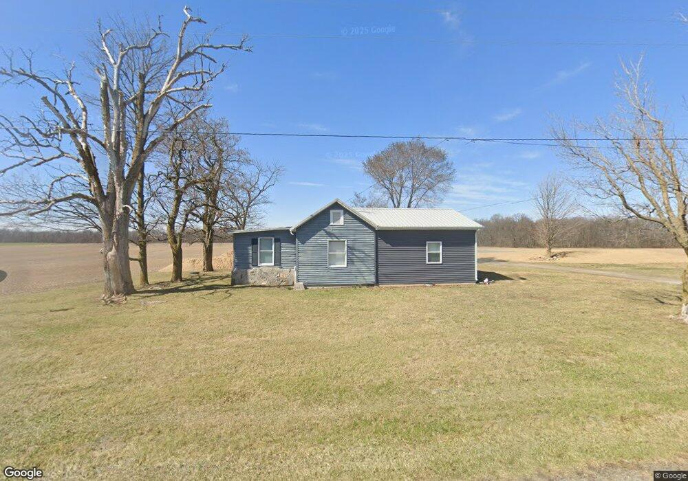
This home is located at 21348 State Route 235, Ada, OH 45810 and is currently estimated at $250,214, approximately $194 per square foot. 21348 State Route 235 is a home located in Hancock County with nearby schools including Cory-Rawson Elementary School and Cory-Rawson High School.
Ownership History
Date
Name
Owned For
Owner Type
Purchase Details
Closed on
Sep 21, 2023
Sold by
Klopfenstein Evanne M
Bought by
Miller Nathan and Oberlitner Jessica
Current Estimated Value
Home Financials for this Owner
Home Financials are based on the most recent Mortgage that was taken out on this home.
Original Mortgage
$216,015
Outstanding Balance
$211,544
Interest Rate
7.09%
Mortgage Type
FHA
Estimated Equity
$38,670
Purchase Details
Closed on
Aug 2, 2016
Sold by
Bert Wade A and Bert Linda I
Bought by
Klopfenstein Evanne M
Home Financials for this Owner
Home Financials are based on the most recent Mortgage that was taken out on this home.
Original Mortgage
$7,800
Interest Rate
3.48%
Mortgage Type
New Conventional
Purchase Details
Closed on
Nov 13, 1989
Bought by
Bert Wade A and Bert Linda I
Create a Home Valuation Report for This Property
The Home Valuation Report is an in-depth analysis detailing your home's value as well as a comparison with similar homes in the area
Home Values in the Area
Average Home Value in this Area
Purchase History
| Date | Buyer | Sale Price | Title Company |
|---|---|---|---|
| Miller Nathan | $220,000 | Golden Key Title | |
| Klopfenstein Evanne M | -- | None Available | |
| Bert Wade A | $46,500 | -- |
Source: Public Records
Mortgage History
| Date | Status | Borrower | Loan Amount |
|---|---|---|---|
| Open | Miller Nathan | $216,015 | |
| Previous Owner | Klopfenstein Evanne M | $7,800 |
Source: Public Records
Tax History Compared to Growth
Tax History
| Year | Tax Paid | Tax Assessment Tax Assessment Total Assessment is a certain percentage of the fair market value that is determined by local assessors to be the total taxable value of land and additions on the property. | Land | Improvement |
|---|---|---|---|---|
| 2024 | $1,849 | $59,770 | $8,490 | $51,280 |
| 2023 | $1,842 | $59,770 | $8,490 | $51,280 |
| 2022 | $1,851 | $59,770 | $8,490 | $51,280 |
| 2021 | $1,282 | $37,490 | $8,470 | $29,020 |
| 2020 | $1,284 | $37,490 | $8,470 | $29,020 |
| 2019 | $1,253 | $37,490 | $8,470 | $29,020 |
| 2018 | $1,099 | $34,290 | $7,370 | $26,920 |
| 2017 | $550 | $34,290 | $7,370 | $26,920 |
| 2016 | $1,111 | $34,290 | $7,370 | $26,920 |
| 2015 | $876 | $28,390 | $7,370 | $21,020 |
| 2014 | $883 | $28,390 | $7,370 | $21,020 |
| 2012 | $934 | $27,390 | $7,370 | $20,020 |
Source: Public Records
Map
Nearby Homes
- 3600 Township Road 27
- 3769 County Road 304
- 22694 County Road 12
- 20515 County Road 15
- 00 Lincoln Hwy
- 18101 County Road 12
- 0 Ohio 103
- 106 Riley St
- 210 N Jackson St
- 409 S Main St
- 222 N Lawn Ave
- 212 S Lawn Ave
- 301 Parkview Dr
- 656 S Main St
- 513 S Jackson St
- 303 Parkview Dr
- 217 Grove St
- 305 Parkview Dr
- 307 Parkview Dr
- 313 Parkview Dr
- 21348 Ohio 235
- 21348 State Route
- 2842 Township Road 28
- 21876 State Route 235
- 3146 Township Road 27
- 27 Township Road 27
- 3523 Township Road 28
- 3179 Township Road 28
- 3306 Township Road 27
- 3306 Orange Township Road 27
- 2677 Township Road 27
- 3520 Township Road 27
- 3520 Orange Township Road 27
- 3747 Township Road 28
- 3423 Township Road 27
- 3423 Township Road 27
- 3672 Township Road 28
- 3363 Trail 27
- 3520 Trail 27