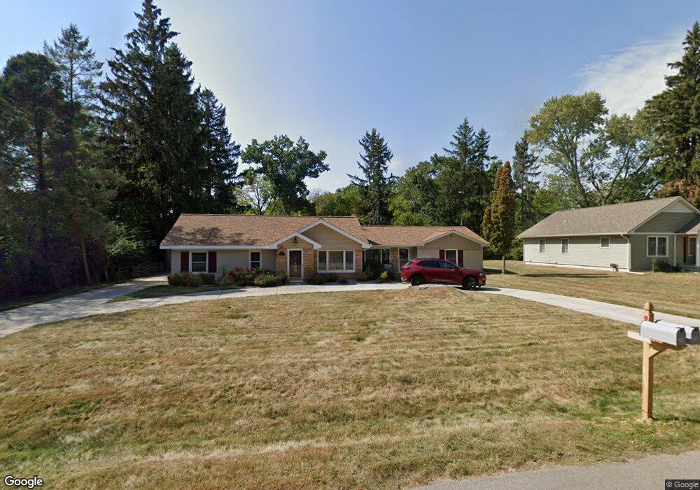
21349 Stahelin Rd Southfield, MI 48075
Estimated Value: $210,000 - $280,000
--
Bed
1
Bath
2,070
Sq Ft
$118/Sq Ft
Est. Value
About This Home
This home is located at 21349 Stahelin Rd, Southfield, MI 48075 and is currently estimated at $243,641, approximately $117 per square foot. 21349 Stahelin Rd is a home located in Oakland County with nearby schools including Agbu Alex-Marie Manoogian School, Pembroke Academy, and Dr. Joseph F. Pollack Academic Center Of Excellence.
Ownership History
Date
Name
Owned For
Owner Type
Purchase Details
Closed on
Apr 10, 2017
Sold by
Carter George A
Bought by
Carter George A and George Carter Revocable Trust
Current Estimated Value
Purchase Details
Closed on
Aug 31, 2012
Sold by
Bennett Janine V
Bought by
Carter George A
Purchase Details
Closed on
Oct 24, 2006
Sold by
Bennett Janine
Bought by
Bennett Janine Y and Janine Bennett Revocable Trust
Purchase Details
Closed on
Dec 17, 2004
Sold by
London Leslie
Bought by
Bennett Janine
Home Financials for this Owner
Home Financials are based on the most recent Mortgage that was taken out on this home.
Original Mortgage
$141,878
Interest Rate
5.82%
Mortgage Type
FHA
Purchase Details
Closed on
Jan 15, 2002
Sold by
Ward James E
Bought by
Mattrix Residential Funding C
Create a Home Valuation Report for This Property
The Home Valuation Report is an in-depth analysis detailing your home's value as well as a comparison with similar homes in the area
Home Values in the Area
Average Home Value in this Area
Purchase History
| Date | Buyer | Sale Price | Title Company |
|---|---|---|---|
| Carter George A | -- | None Available | |
| Carter George A | -- | None Available | |
| Bennett Janine Y | -- | None Available | |
| Bennett Janine | $143,000 | Philip R Seaver Title Co Inc | |
| Mattrix Residential Funding C | $98,495 | -- |
Source: Public Records
Mortgage History
| Date | Status | Borrower | Loan Amount |
|---|---|---|---|
| Previous Owner | Bennett Janine | $141,878 |
Source: Public Records
Tax History Compared to Growth
Tax History
| Year | Tax Paid | Tax Assessment Tax Assessment Total Assessment is a certain percentage of the fair market value that is determined by local assessors to be the total taxable value of land and additions on the property. | Land | Improvement |
|---|---|---|---|---|
| 2022 | $2,544 | $88,250 | $13,800 | $74,450 |
| 2021 | $2,641 | $78,770 | $14,140 | $64,630 |
| 2020 | $2,129 | $67,820 | $10,180 | $57,640 |
| 2018 | $2,484 | $41,470 | $10,180 | $31,290 |
| 2015 | -- | $34,260 | $0 | $0 |
| 2014 | -- | $35,450 | $0 | $0 |
| 2011 | -- | $40,760 | $0 | $0 |
Source: Public Records
Map
Nearby Homes
- 19100 Dorset St
- 18656 Midway Ave
- 19368 Midway Rd
- 18252 Westland Ave
- 20534 Grandville Ave
- 18249 Westover Ave
- 20980 Evergreen Rd
- 21450 Evergreen Rd
- 18155 Westhaven Ave
- 20285 Glastonbury Rd
- 20510 Rosemont Ave
- 20542 Ashton Ave
- 20092 Avon Ave
- 20210 Westhampton Ave
- 20569 Evergreen Rd
- 20093 Faust Ave
- 19880 Hazelhurst St
- 20052 Avon Ave
- 17581 Roxbury Ave
- 20044 Avon Ave
- 19050 Melrose Ave
- 19026 Melrose Ave
- 21325 Stahelin Rd
- 21373 Stahelin Rd
- 19101 Magnolia Pkwy
- 21397 Stahelin Rd
- 19125 Magnolia Pkwy
- 19070 Melrose Ave
- 19098 Melrose Ave
- 21173 Stahelin Rd
- 19151 Magnolia Pkwy
- 19049 Melrose Ave
- 19075 Magnolia Pkwy
- 19175 Magnolia Pkwy
- 19073 Melrose Ave
- 21421 Stahelin Rd
- 21350 Stahelin Rd
- 21149 Stahelin Rd
- 21374 Stahelin Rd
- 21174 Stahelin Rd