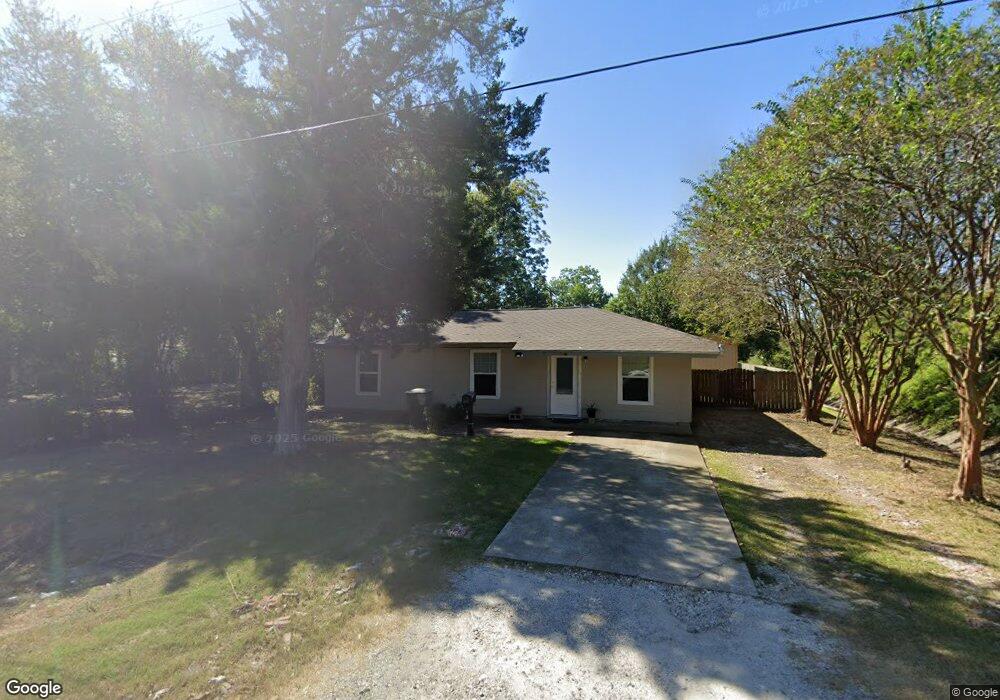
2135 10th Ave Port Arthur, TX 77642
Estimated Value: $61,000 - $92,000
--
Bed
--
Bath
1,032
Sq Ft
$77/Sq Ft
Est. Value
About This Home
This home is located at 2135 10th Ave, Port Arthur, TX 77642 and is currently estimated at $79,750, approximately $77 per square foot. 2135 10th Ave is a home located in Jefferson County with nearby schools including Tyrrell Elementary School, Jefferson Middle School, and Memorial High School.
Ownership History
Date
Name
Owned For
Owner Type
Purchase Details
Closed on
Jun 20, 2023
Sold by
Cardenas Juan Martin and Aide Gabriela
Bought by
Valencia Gonzalo and Valencia Yesenia Belen
Current Estimated Value
Purchase Details
Closed on
Jan 25, 2017
Sold by
Ceja Juan
Bought by
Cardenas Juan Martin and Cardenas Aide Gabriela
Purchase Details
Closed on
Mar 26, 2013
Sold by
Cerda Wanda Rae
Bought by
Matthews Cecil
Create a Home Valuation Report for This Property
The Home Valuation Report is an in-depth analysis detailing your home's value as well as a comparison with similar homes in the area
Home Values in the Area
Average Home Value in this Area
Purchase History
| Date | Buyer | Sale Price | Title Company |
|---|---|---|---|
| Valencia Gonzalo | -- | Capital Title | |
| Cardenas Juan Martin | -- | None Available | |
| Matthews Cecil | -- | None Available | |
| Cerda Wanda Rae | -- | None Available |
Source: Public Records
Tax History Compared to Growth
Tax History
| Year | Tax Paid | Tax Assessment Tax Assessment Total Assessment is a certain percentage of the fair market value that is determined by local assessors to be the total taxable value of land and additions on the property. | Land | Improvement |
|---|---|---|---|---|
| 2025 | $2,177 | $80,234 | $10,500 | $69,734 |
| 2024 | $2,177 | $75,992 | $3,675 | $72,317 |
| 2023 | $2,177 | $42,169 | $0 | $0 |
| 2022 | $1,218 | $38,335 | $0 | $0 |
| 2021 | $1,155 | $42,640 | $2,940 | $39,700 |
| 2020 | $544 | $31,682 | $2,940 | $28,742 |
| 2019 | $959 | $30,090 | $2,940 | $27,150 |
| 2018 | $506 | $30,810 | $2,940 | $27,870 |
| 2017 | $955 | $30,810 | $2,940 | $27,870 |
| 2016 | $903 | $30,810 | $2,940 | $27,870 |
| 2015 | -- | $30,810 | $2,940 | $27,870 |
| 2014 | -- | $30,810 | $2,940 | $27,870 |
Source: Public Records
Map
Nearby Homes
- 2325 Oaklawn Ave
- 2301 Glenwood Dr
- 2323 7th Ave
- 2515 Glenwood Dr
- 4100 Dryden Rd
- LOT 55 Royal Meadows Estate
- 2621 Evergreen Dr
- 2129 Neches Ave
- 3812 30th St
- 3945 12th St
- 3137 18th St
- 3132 18th St
- 3208 29th St
- 4034 32nd St
- 4501 Springdale St
- 3500 32nd St
- 3124 30th St
- 3015 25th St
- 3118 14th St
- 3200 4th Ave
- 2125 10th Ave
- 2121 10th Ave
- 2146 Evergreen Dr
- 2130 Evergreen Dr
- 2115 10th Ave
- 2136 10th Ave
- 2120 Evergreen Dr
- 2126 10th Ave
- 2113 10th Ave
- 2200 Oaklawn Ave
- 2124 10th Ave
- 2230 Oaklawn Ave
- 2100 Evergreen Dr
- 2116 10th Ave
- 2105 10th Ave
- 2240 Oaklawn Ave
- 2049 10th Ave
- 2104 10th Ave
- 2047 10th Ave
- 2100 10th Ave