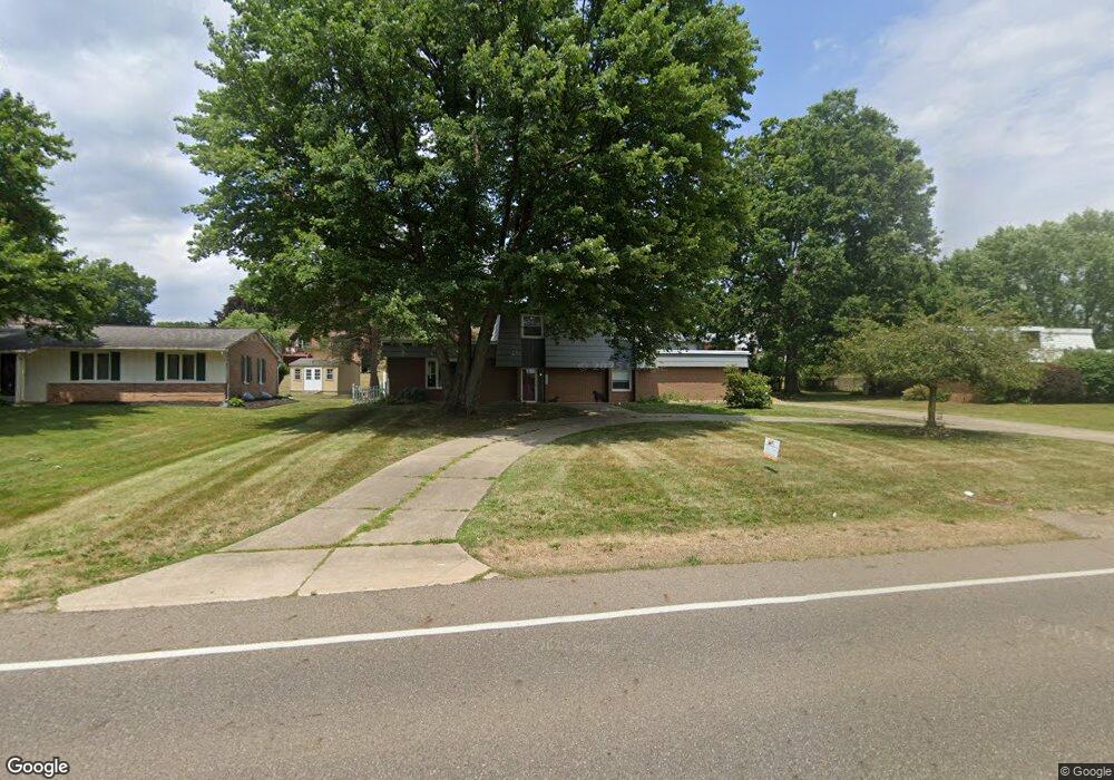
2135 55th St NE Canton, OH 44721
Estimated Value: $274,245 - $308,000
3
Beds
3
Baths
1,872
Sq Ft
$156/Sq Ft
Est. Value
About This Home
This home is located at 2135 55th St NE, Canton, OH 44721 and is currently estimated at $292,311, approximately $156 per square foot. 2135 55th St NE is a home located in Stark County with nearby schools including Ransom H. Barr Elementary School, Glenwood Intermediate School, and GlenOak High School.
Ownership History
Date
Name
Owned For
Owner Type
Purchase Details
Closed on
Sep 30, 2019
Sold by
Boyd Maxine Lea
Bought by
Boyd Daniel B
Current Estimated Value
Purchase Details
Closed on
Jul 26, 2005
Sold by
Boyd Maxine L
Bought by
Boyd Maxine Lea and The Maxine Lea Boyd Revocable Living Tr
Purchase Details
Closed on
Jun 14, 2005
Sold by
Boyd Keith B
Bought by
Boyd Maxine L
Purchase Details
Closed on
Apr 9, 1990
Create a Home Valuation Report for This Property
The Home Valuation Report is an in-depth analysis detailing your home's value as well as a comparison with similar homes in the area
Home Values in the Area
Average Home Value in this Area
Purchase History
| Date | Buyer | Sale Price | Title Company |
|---|---|---|---|
| Boyd Daniel B | -- | None Available | |
| Boyd Maxine Lea | -- | -- | |
| Boyd Maxine L | -- | -- | |
| -- | $90,000 | -- |
Source: Public Records
Tax History Compared to Growth
Tax History
| Year | Tax Paid | Tax Assessment Tax Assessment Total Assessment is a certain percentage of the fair market value that is determined by local assessors to be the total taxable value of land and additions on the property. | Land | Improvement |
|---|---|---|---|---|
| 2025 | $5,934 | $89,640 | $17,360 | $72,280 |
| 2024 | $1,530 | $89,640 | $17,360 | $72,280 |
| 2023 | $9,817 | $56,880 | $12,290 | $44,590 |
| 2022 | $2,956 | $56,880 | $12,290 | $44,590 |
| 2021 | $2,735 | $56,880 | $12,290 | $44,590 |
| 2020 | $2,630 | $49,710 | $10,610 | $39,100 |
| 2019 | $2,547 | $49,710 | $10,610 | $39,100 |
| 2018 | $2,516 | $49,710 | $10,610 | $39,100 |
| 2017 | $2,469 | $44,810 | $10,330 | $34,480 |
| 2016 | $2,476 | $44,810 | $10,330 | $34,480 |
| 2015 | $2,393 | $44,810 | $10,330 | $34,480 |
| 2014 | $232 | $40,880 | $9,450 | $31,430 |
| 2013 | $1,089 | $40,880 | $9,450 | $31,430 |
Source: Public Records
Map
Nearby Homes
- 1920 Birk Cir NE
- 2317 Raintree St NE
- 2533 57th St NE
- 5111 Johnnycake Ridge NE
- 2419 Bur Oak St NE
- 5300 Aster Ave NE
- 2216 49th St NE
- 2690 Crompton St NE
- 5315 Loma Linda Ln NE
- 5225 Loma Linda Ln NE
- 1023 55th St NE
- 5845 Royal Hill Cir NE
- 6090 Wiclif St NE
- 2955 Chaucer Dr NE
- 5700 Birmingham Rd NE
- 1614 Bellview St NE
- 6473 Saint Leger Ave NE
- 4402 Dalbury Ave NE Unit 9E
- 2538 Ironstone St NE
- 6402 Blossomwood Cir NE
- 2205 55th St NE
- 2125 55th St NE
- 2200 Tamarack Cir NE
- 2124 Tamarack Cir NE
- 2215 55th St NE
- 2130 55th St NE
- 2200 55th St NE
- 2220 Tamarack Cir NE
- 2210 55th St NE
- 5515 Lindford Ave NE
- 5507 Lindford Ave NE
- 5420 Lindford Ave NE
- 5507 Aspen Valley Ave NE
- 5521 Aspen Valley Ave NE
- 2205 Tamarack Cir NE
- 2218 55th St NE
- 5525 Lindford Ave NE
- 2125 Tamarack Cir NE
- 2108 55th St NE
- 2230 Tamarack Cir NE