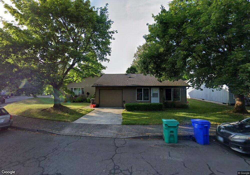
2135 SE 10th St Gresham, OR 97080
Mount Hood NeighborhoodEstimated Value: $469,376 - $585,000
5
Beds
2
Baths
1,982
Sq Ft
$272/Sq Ft
Est. Value
About This Home
This home is located at 2135 SE 10th St, Gresham, OR 97080 and is currently estimated at $538,594, approximately $271 per square foot. 2135 SE 10th St is a home located in Multnomah County with nearby schools including Hogan Cedars Elementary School, Dexter McCarty Middle School, and Gresham High School.
Ownership History
Date
Name
Owned For
Owner Type
Purchase Details
Closed on
Jun 21, 1996
Sold by
Erickson Kirk W
Bought by
Lozzi Steven Tony and Lozzi Denise E
Current Estimated Value
Home Financials for this Owner
Home Financials are based on the most recent Mortgage that was taken out on this home.
Original Mortgage
$99,750
Outstanding Balance
$5,730
Interest Rate
8.09%
Mortgage Type
Purchase Money Mortgage
Estimated Equity
$532,864
Create a Home Valuation Report for This Property
The Home Valuation Report is an in-depth analysis detailing your home's value as well as a comparison with similar homes in the area
Home Values in the Area
Average Home Value in this Area
Purchase History
| Date | Buyer | Sale Price | Title Company |
|---|---|---|---|
| Lozzi Steven Tony | $133,000 | Ticor Title Insurance |
Source: Public Records
Mortgage History
| Date | Status | Borrower | Loan Amount |
|---|---|---|---|
| Open | Lozzi Steven Tony | $99,750 |
Source: Public Records
Tax History
| Year | Tax Paid | Tax Assessment Tax Assessment Total Assessment is a certain percentage of the fair market value that is determined by local assessors to be the total taxable value of land and additions on the property. | Land | Improvement |
|---|---|---|---|---|
| 2025 | $5,184 | $254,770 | -- | -- |
| 2024 | $4,963 | $247,350 | -- | -- |
| 2023 | $4,521 | $240,150 | $0 | $0 |
| 2022 | $4,395 | $233,160 | $0 | $0 |
| 2021 | $4,284 | $226,370 | $0 | $0 |
| 2020 | $4,031 | $219,780 | $0 | $0 |
| 2019 | $3,926 | $213,380 | $0 | $0 |
| 2018 | $3,743 | $207,170 | $0 | $0 |
| 2017 | $3,591 | $201,140 | $0 | $0 |
| 2016 | $3,166 | $195,290 | $0 | $0 |
Source: Public Records
Map
Nearby Homes
- 732 SE Rene Ave
- 1949 SE Palmquist Rd Unit 51
- 1949 SE Palmquist Rd Unit 91
- 1949 SE Palmquist Rd Unit 121
- 2358 SE Palmquist Rd
- 2137 SE 15th Aly
- 450 SE Hogan Rd
- 2240 SE 16th St
- 1715 SE 5th St Unit 1725
- 2696 SE Palmquist Rd
- 2392 SE 16th Aly
- 1700 SE 4th St
- 2125 SE 18th Aly
- 3105 SE Powell Valley Rd
- 2243 SE 19th St
- 389 SE Palmblad Dr
- 2846 SE 18th Cir
- 4740 SE 2nd St
- 4764 SE 2nd St
- 4667 SE 2nd St
- 920 SE Francis Ave Unit 922
- 2167 SE 10th St
- 933 SE Rene Ave Unit 935
- 900 SE Francis Ave Unit 44
- 2146 SE 10th St Unit 2148
- 941 SE Francis Ave Unit 943
- 2096 SE 9th St
- 2120 SE 10th St Unit 2122
- 2160 SE 10th St Unit 2162
- 983 SE Francis Ave Unit 985
- 890 SE Francis Ave
- 2186 SE 10th St Unit 2188
- 2214 SE 9th Ct
- 2205 SE 10th St
- 887 SE Francis Ave
- 877 SE Francis Ave Unit 887
- 880 SE Francis Ave
- 2210 SE 10th St Unit 2212
- 855 SE Rene Ave Unit 865
- 867 SE Francis Ave
Your Personal Tour Guide
Ask me questions while you tour the home.