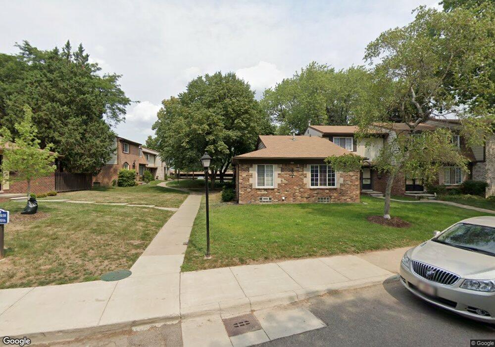
2136 Wickham St Unit 1, 1 Royal Oak, MI 48073
Estimated Value: $229,000 - $241,000
3
Beds
2
Baths
1,458
Sq Ft
$161/Sq Ft
Est. Value
About This Home
This home is located at 2136 Wickham St Unit 1, 1, Royal Oak, MI 48073 and is currently estimated at $235,414, approximately $161 per square foot. 2136 Wickham St Unit 1, 1 is a home located in Oakland County with nearby schools including Alfred E. Upton Elementary School, Royal Oak Middle School, and Royal Oak High School.
Ownership History
Date
Name
Owned For
Owner Type
Purchase Details
Closed on
May 13, 2016
Sold by
Elizabeth K Ammann Revocable Trust
Bought by
Arnold Jacqueline A
Current Estimated Value
Home Financials for this Owner
Home Financials are based on the most recent Mortgage that was taken out on this home.
Original Mortgage
$111,120
Outstanding Balance
$88,228
Interest Rate
3.58%
Mortgage Type
New Conventional
Estimated Equity
$147,186
Purchase Details
Closed on
Aug 10, 1998
Sold by
Ammann Elizabeth K
Bought by
Elizabeth K Ammann Tr
Create a Home Valuation Report for This Property
The Home Valuation Report is an in-depth analysis detailing your home's value as well as a comparison with similar homes in the area
Home Values in the Area
Average Home Value in this Area
Purchase History
| Date | Buyer | Sale Price | Title Company |
|---|---|---|---|
| Arnold Jacqueline A | $138,900 | Partners Title Agency Llc | |
| Elizabeth K Ammann Tr | -- | -- |
Source: Public Records
Mortgage History
| Date | Status | Borrower | Loan Amount |
|---|---|---|---|
| Open | Arnold Jacqueline A | $111,120 |
Source: Public Records
Tax History Compared to Growth
Tax History
| Year | Tax Paid | Tax Assessment Tax Assessment Total Assessment is a certain percentage of the fair market value that is determined by local assessors to be the total taxable value of land and additions on the property. | Land | Improvement |
|---|---|---|---|---|
| 2024 | $1,953 | $94,620 | $0 | $0 |
| 2022 | $2,308 | $84,270 | $0 | $0 |
| 2020 | $1,898 | $64,510 | $0 | $0 |
| 2018 | $2,308 | $54,050 | $0 | $0 |
| 2017 | $2,219 | $54,050 | $0 | $0 |
| 2015 | -- | $43,290 | $0 | $0 |
| 2014 | -- | $35,520 | $0 | $0 |
| 2011 | -- | $34,110 | $0 | $0 |
Source: Public Records
Map
Nearby Homes
- 4921 Crooks Rd Unit M-10
- 4909 Crooks Rd Unit E8
- 4909 Crooks Rd Unit 4
- 4921 N Crooks Rd Unit N-10
- 5025 Crooks Rd Unit 42
- 1823 Torquay Ave
- 4702 Thorncroft Ave
- 1807 Samoset Rd
- 1936 Torquay Ave Unit 205
- 2306 W 14 Mile Rd Unit 14
- 4830 Briarwood Ave Unit 2
- 4859 Mansfield Ave Unit H5
- 2356 W 14 Mile Rd Unit 1
- 2420 Parmenter Blvd Unit 101
- 2440 Parmenter Blvd Unit 112
- 2425 Torquay Ave Unit 101A
- 2405 Torquay Ave Unit 104
- 851 N Webik Ave
- 531 N Manitou Ave
- 4363 Crooks Rd
- 2136 Wickham St
- 2136 Wickham St Unit 1
- 4902 Cara Ct Unit 350
- 0 Cara Ct
- 4901 Cara Ct Unit 54
- 4901 Cara Ct Unit 327
- 4912 Cara Ct Unit 346
- 4921 Crooks Rd Unit 8
- 4921 Crooks Rd Unit 96
- 4921 Crooks Rd Unit N, 8
- 4921 Crooks Rd
- 4921 Crooks Rd
- 4921 Crooks Rd
- 4921 Crooks Rd
- 4921 Crooks Rd
- 4921 Crooks Rd
- 4921 Crooks Rd
- 4921 Crooks Rd
- 4921 Crooks Rd
- 4921 Crooks Rd