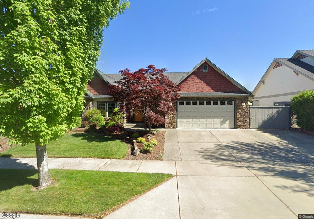
2137 Duncan Dr Medford, OR 97504
Estimated Value: $568,881 - $666,000
3
Beds
2
Baths
2,334
Sq Ft
$265/Sq Ft
Est. Value
About This Home
This home is located at 2137 Duncan Dr, Medford, OR 97504 and is currently estimated at $618,720, approximately $265 per square foot. 2137 Duncan Dr is a home located in Jackson County with nearby schools including Hoover Elementary School, Hedrick Middle School, and South Medford High School.
Ownership History
Date
Name
Owned For
Owner Type
Purchase Details
Closed on
Nov 14, 2024
Sold by
Adamson Gerald A and Adamson Linda M
Bought by
Gerald A Adamson And Linda Adamson Joint Revo and Adamson
Current Estimated Value
Purchase Details
Closed on
Jun 21, 2005
Sold by
Pactrend Inc
Bought by
Adamson Gerald A and Adamson Linda M
Create a Home Valuation Report for This Property
The Home Valuation Report is an in-depth analysis detailing your home's value as well as a comparison with similar homes in the area
Home Values in the Area
Average Home Value in this Area
Purchase History
| Date | Buyer | Sale Price | Title Company |
|---|---|---|---|
| Gerald A Adamson And Linda Adamson Joint Revo | -- | None Listed On Document | |
| Gerald A Adamson And Linda Adamson Joint Revo | -- | None Listed On Document | |
| Adamson Gerald A | $396,900 | Lawyers Title Ins |
Source: Public Records
Tax History Compared to Growth
Tax History
| Year | Tax Paid | Tax Assessment Tax Assessment Total Assessment is a certain percentage of the fair market value that is determined by local assessors to be the total taxable value of land and additions on the property. | Land | Improvement |
|---|---|---|---|---|
| 2025 | $5,249 | $361,930 | $120,960 | $240,970 |
| 2024 | $5,249 | $351,390 | $117,440 | $233,950 |
| 2023 | $5,088 | $341,160 | $114,020 | $227,140 |
| 2022 | $4,964 | $341,160 | $114,020 | $227,140 |
| 2021 | $4,836 | $331,230 | $110,700 | $220,530 |
| 2020 | $4,734 | $321,590 | $107,470 | $214,120 |
| 2019 | $4,622 | $303,140 | $101,300 | $201,840 |
| 2018 | $4,503 | $294,320 | $98,360 | $195,960 |
| 2017 | $4,422 | $294,320 | $98,360 | $195,960 |
| 2016 | $4,451 | $277,430 | $92,720 | $184,710 |
| 2015 | $4,278 | $277,430 | $92,720 | $184,710 |
| 2014 | $4,203 | $261,510 | $87,400 | $174,110 |
Source: Public Records
Map
Nearby Homes
- 1924 Crestbrook Rd
- 425 S Modoc Ave
- 341 Ardmore Ave
- 433 Highland Dr
- 305 S Groveland Ave
- 430 Highland Dr
- 2549 E Barnett Rd
- 2458 Republic Way
- 2406 Senate Way
- 2462 Senate Way
- 2556 Dellwood Ave
- 2233 Oakwood Dr
- 101 S Modoc Ave
- 2566 Heritage Way
- 317 Eastwood Dr
- 9 S Groveland Ave
- 1418 Appleton Cir
- 320 Eastwood Dr
- 908 Black Oak Dr
- 325 Sutter Ave
- 2143 Duncan Dr
- 2131 Duncan Dr
- 2125 Duncan Dr
- 2149 Duncan Dr
- 2138 Duncan Dr
- 2144 Duncan Dr
- 2119 Duncan Dr
- 732 Ellendale Dr
- 2150 Duncan Dr
- 2161 Duncan Dr
- 2175 Duncan Dr
- 738 Ellendale Dr
- 2113 Duncan Dr
- 2156 Duncan Dr
- 520 Windsor Ave
- 518 Windsor Ave
- 2125 Crestbrook Rd
- 735 Williams Ct
- 718 Williams Ct
- 1909 Greenwood St