Estimated Value: $260,000 - $322,000
3
Beds
3
Baths
2,019
Sq Ft
$148/Sq Ft
Est. Value
About This Home
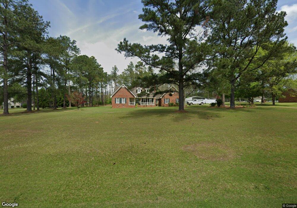
This home is located at 2137 Ga Highway 188 N, Cairo, GA 39827 and is currently estimated at $298,148, approximately $147 per square foot. 2137 Ga Highway 188 N is a home located in Grady County.
Ownership History
Date
Name
Owned For
Owner Type
Purchase Details
Closed on
Jun 23, 2021
Sold by
Karla B Phillips Family Trust
Bought by
Prince Karla B
Current Estimated Value
Purchase Details
Closed on
Apr 11, 2011
Sold by
Bass Farnsworth Janie B and Bass Phillips Karla
Bought by
Phillips Kevin E and Phillips Kailin E
Purchase Details
Closed on
Oct 9, 2010
Sold by
Farnsworth Janie B
Bought by
Bass Farnsworth Janie B and Bass Phillips Karla
Purchase Details
Closed on
Sep 7, 2010
Sold by
Lacy Amy Charlene
Bought by
Farnsworth Janie B
Purchase Details
Closed on
Feb 17, 2004
Sold by
Bishop Charles M
Bought by
Anderson Dusty R
Purchase Details
Closed on
Oct 9, 1986
Bought by
Bishop Charles M
Create a Home Valuation Report for This Property
The Home Valuation Report is an in-depth analysis detailing your home's value as well as a comparison with similar homes in the area
Home Values in the Area
Average Home Value in this Area
Purchase History
| Date | Buyer | Sale Price | Title Company |
|---|---|---|---|
| Prince Karla B | -- | -- | |
| Phillips Kevin E | -- | -- | |
| Bass Farnsworth Janie B | -- | -- | |
| Farnsworth Janie B | $160,000 | -- | |
| Anderson Dusty R | $175,000 | -- | |
| Bishop Charles M | $6,500 | -- |
Source: Public Records
Tax History Compared to Growth
Tax History
| Year | Tax Paid | Tax Assessment Tax Assessment Total Assessment is a certain percentage of the fair market value that is determined by local assessors to be the total taxable value of land and additions on the property. | Land | Improvement |
|---|---|---|---|---|
| 2024 | $2,924 | $97,049 | $5,333 | $91,716 |
| 2023 | $2,092 | $69,952 | $5,820 | $64,132 |
| 2022 | $2,092 | $69,952 | $5,820 | $64,132 |
| 2021 | $2,111 | $70,361 | $5,820 | $64,541 |
| 2020 | $2,118 | $70,361 | $5,820 | $64,541 |
| 2019 | $2,118 | $70,361 | $5,820 | $64,541 |
| 2018 | $1,989 | $70,361 | $5,820 | $64,541 |
| 2017 | $1,893 | $70,361 | $5,820 | $64,541 |
| 2016 | $1,650 | $61,243 | $5,820 | $55,423 |
| 2015 | $1,630 | $61,243 | $5,820 | $55,423 |
| 2014 | -- | $61,243 | $5,820 | $55,423 |
| 2013 | -- | $58,283 | $7,236 | $51,047 |
Source: Public Records
Map
Nearby Homes
- 3136 State Route 188
- 2427 Pierce Chapel Rd
- 1210 Elkins Rd
- 0 NE Airport Rd Unit 145784
- 3109 U S 84
- 3109 U S 84
- 414 Woodland Rd
- 144 Mount Nebo Ln
- 161 Evergreen Ln
- 00 State Route 188
- 0 State Route 188
- 78.6 Ac Strickland Rd
- 2600 U S 84
- 4164 U S 84 Unit Lot Q
- 66 22nd St NE
- 0 20th St NE
- 00 20th St NE
- 21 24th St NE
- 00 #10 Oak Bend Circle 4 38 Acres
- 00 NW 9th Ave
- 2872 Ga Highway 188 N
- 180 Aldredge Rd
- 357 West Rd
- 188 Royals Ln
- 405 West Rd
- 2742 Ga Highway 188 N
- 325 West Rd
- 287 Aldredge Rd
- 2763 Ga Highway 188 N
- 2763 State Route 188
- 404 West Rd
- 374 Aldredge Rd
- 243 West Rd
- 2994 Ga Highway 188 N
- 2634 State Route 188
- 2981 Ga Highway 188 N
- 495 West Rd
- 256 West Rd
- 2634 Ga Highway 188 N
- 363 Aldredge Rd