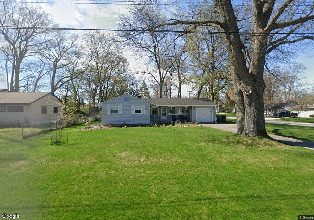
2137 Mayfair Ave Norton Shores, MI 49441
Estimated Value: $274,000 - $299,000
3
Beds
1
Bath
1,271
Sq Ft
$224/Sq Ft
Est. Value
About This Home
This home is located at 2137 Mayfair Ave, Norton Shores, MI 49441 and is currently estimated at $284,267, approximately $223 per square foot. 2137 Mayfair Ave is a home located in Muskegon County with nearby schools including Mona Shores High School, Muskegon Montessori Academy for Environmental Change, and St. Francis De Sales Elementary School.
Ownership History
Date
Name
Owned For
Owner Type
Purchase Details
Closed on
May 26, 2017
Sold by
Brooks Gerald M
Bought by
Goulet Anthony D
Current Estimated Value
Home Financials for this Owner
Home Financials are based on the most recent Mortgage that was taken out on this home.
Original Mortgage
$112,000
Outstanding Balance
$93,033
Interest Rate
3.97%
Mortgage Type
New Conventional
Estimated Equity
$191,234
Purchase Details
Closed on
Dec 3, 2010
Sold by
Brooks Gerald M
Bought by
Brooks Gerald M and Brooks Living Trust
Create a Home Valuation Report for This Property
The Home Valuation Report is an in-depth analysis detailing your home's value as well as a comparison with similar homes in the area
Home Values in the Area
Average Home Value in this Area
Purchase History
| Date | Buyer | Sale Price | Title Company |
|---|---|---|---|
| Goulet Anthony D | $130,000 | Premier Lakeshore Title | |
| Brooks Gerald M | -- | None Available |
Source: Public Records
Mortgage History
| Date | Status | Borrower | Loan Amount |
|---|---|---|---|
| Open | Goulet Anthony D | $112,000 |
Source: Public Records
Tax History Compared to Growth
Tax History
| Year | Tax Paid | Tax Assessment Tax Assessment Total Assessment is a certain percentage of the fair market value that is determined by local assessors to be the total taxable value of land and additions on the property. | Land | Improvement |
|---|---|---|---|---|
| 2025 | $2,857 | $127,600 | $0 | $0 |
| 2024 | $2,239 | $113,700 | $0 | $0 |
| 2023 | $2,139 | $100,400 | $0 | $0 |
| 2022 | $2,607 | $86,500 | $0 | $0 |
| 2021 | $2,268 | $69,000 | $0 | $0 |
| 2020 | $2,243 | $61,900 | $0 | $0 |
| 2019 | $2,202 | $56,400 | $0 | $0 |
| 2018 | $2,150 | $53,300 | $0 | $0 |
| 2017 | $1,740 | $50,200 | $0 | $0 |
| 2016 | $1,347 | $46,800 | $0 | $0 |
| 2015 | -- | $44,800 | $0 | $0 |
| 2014 | $1,617 | $44,700 | $0 | $0 |
| 2013 | -- | $41,900 | $0 | $0 |
Source: Public Records
Map
Nearby Homes
- 2278 Reneer Ave
- 2209 Hughes Ave
- 2270 Norman Ave
- 2690 Pinehurst Rd
- 2361 Norman Ave
- 3283 Mccracken St
- 2631 Liberty Rd
- 2625 Liberty Rd
- 2074 W Sherman Blvd
- 2165 Letart Ave
- 3507 Winnetaska Rd
- 1936 W Sherman Blvd
- 3454 Mccracken St
- 3463 Mccracken St
- 3494 Seneca Dr
- 1674 Columbus Ave
- 2559 Letart Ave
- 2238 Crozier Ave
- 1537 Garrison Rd
- 2385 Lincoln St
- 2137 Mayfair St
- 2123 Mayfair St
- 3006 Wellwood St
- 2991 Wellwood St
- 2111 Mayfair St
- 2111 Mayfair Ave
- 3018 Wellwood St
- 3015 Griesbach St
- 3005 Wellwood St
- 2136 Mayfair St
- 2124 Mayfair St
- 2152 Mayfair St
- 2160 Mayfair Ave
- 2175 Mayfair St
- 2160 Mayfair St
- 2110 Mayfair St
- 3017 Wellwood St
- 3030 Wellwood St
- 3010 Griesbach St
- 2187 Mayfair St