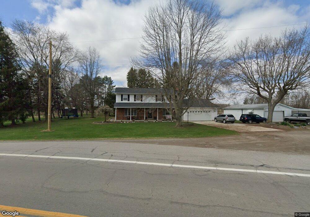
21370 State Route 190 Delphos, OH 45833
Estimated Value: $530,000 - $718,101
4
Beds
1
Bath
891
Sq Ft
$700/Sq Ft
Est. Value
About This Home
This home is located at 21370 State Route 190, Delphos, OH 45833 and is currently estimated at $624,051, approximately $700 per square foot. 21370 State Route 190 is a home located in Putnam County with nearby schools including Fort Jennings Elementary School, Fort Jennings High School, and Delphos St. John's High School.
Ownership History
Date
Name
Owned For
Owner Type
Purchase Details
Closed on
Mar 28, 2013
Sold by
Klima Jerome E and Klima Lorene V
Bought by
Memory Lane Klima Farm Llc
Current Estimated Value
Purchase Details
Closed on
Mar 18, 2010
Sold by
Klima Jerome E and Klima Melvin G
Bought by
Klima Jerome E
Create a Home Valuation Report for This Property
The Home Valuation Report is an in-depth analysis detailing your home's value as well as a comparison with similar homes in the area
Home Values in the Area
Average Home Value in this Area
Purchase History
| Date | Buyer | Sale Price | Title Company |
|---|---|---|---|
| Memory Lane Klima Farm Llc | -- | Attorney | |
| Klima Jerome E | $140,400 | None Available |
Source: Public Records
Tax History Compared to Growth
Tax History
| Year | Tax Paid | Tax Assessment Tax Assessment Total Assessment is a certain percentage of the fair market value that is determined by local assessors to be the total taxable value of land and additions on the property. | Land | Improvement |
|---|---|---|---|---|
| 2024 | $2,897 | $95,840 | $53,650 | $42,190 |
| 2023 | $3,007 | $61,770 | $28,830 | $32,940 |
| 2022 | $2,163 | $172,890 | $139,951 | $32,939 |
| 2021 | $2,198 | $61,680 | $28,830 | $32,850 |
| 2020 | $2,237 | $90,390 | $63,070 | $27,320 |
| 2019 | $2,587 | $75,560 | $45,490 | $30,070 |
| 2018 | $2,543 | $75,560 | $45,490 | $30,070 |
| 2017 | $3,064 | $75,560 | $45,490 | $30,070 |
| 2016 | $3,064 | $90,390 | $63,070 | $27,320 |
| 2015 | $3,364 | $90,390 | $63,070 | $27,320 |
| 2014 | $3,405 | $90,390 | $63,070 | $27,320 |
| 2013 | $2,290 | $59,550 | $32,230 | $27,320 |
Source: Public Records
Map
Nearby Homes
- 1303 Carolyn Dr
- 1220 Rose Anna Dr
- 810 N Franklin St
- 704 N Franklin St
- 628 N Pierce St
- 650 E 6th St
- 610 N Washington St
- 405 N Franklin St
- 914 E 3rd St
- 604 W 6th St
- 503 W 6th St
- 821 E 3rd St
- 903 E 3rd St
- 210 E 3rd St
- 616 W 5th St
- 409 N Bredeick St
- 633 E 2nd St
- 221 S Main St
- 7510 State Route 66
- 424 S Canal St
- 21374 State Route 190
- 21426 State Route 190
- 21484 State Route 190
- 21326 Road 24u
- 21485 Road 24u
- 21499 State Route 190
- 21654 State Route 190
- 21608 Road 24u
- 21077 State Route 190
- 21622 Road 24u
- 24551 Road U20
- 24533 Road U20
- 24535 Road U20
- 24486 Road U20
- 24822 Road U20
- 24444 Road U20
- 20799 Road 24t
- 20865 Road 24t
- 20850 Road 24t