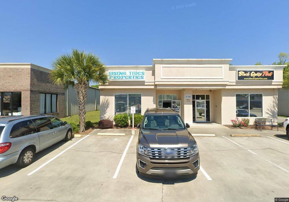
2138 S Highway 17 Murrells Inlet, SC 29576
Estimated Value: $2,793,878
--
Bed
--
Bath
4,086
Sq Ft
$684/Sq Ft
Est. Value
About This Home
This home is located at 2138 S Highway 17, Murrells Inlet, SC 29576 and is currently estimated at $2,793,878, approximately $683 per square foot. 2138 S Highway 17 is a home located in Horry County with nearby schools including Seaside Elementary, St. James Middle School, and St. James Intermediate.
Ownership History
Date
Name
Owned For
Owner Type
Purchase Details
Closed on
Dec 29, 2011
Sold by
Caspento Mario
Bought by
Santos Llc
Current Estimated Value
Purchase Details
Closed on
Nov 8, 2004
Sold by
Dingo Llc
Bought by
Caspento Mario and Caspento Maria A
Home Financials for this Owner
Home Financials are based on the most recent Mortgage that was taken out on this home.
Original Mortgage
$355,000
Interest Rate
5.77%
Mortgage Type
Commercial
Create a Home Valuation Report for This Property
The Home Valuation Report is an in-depth analysis detailing your home's value as well as a comparison with similar homes in the area
Home Values in the Area
Average Home Value in this Area
Purchase History
| Date | Buyer | Sale Price | Title Company |
|---|---|---|---|
| Santos Llc | -- | -- | |
| Caspento Mario | $1,075,000 | -- |
Source: Public Records
Mortgage History
| Date | Status | Borrower | Loan Amount |
|---|---|---|---|
| Previous Owner | Caspento Mario | $355,000 |
Source: Public Records
Tax History Compared to Growth
Tax History
| Year | Tax Paid | Tax Assessment Tax Assessment Total Assessment is a certain percentage of the fair market value that is determined by local assessors to be the total taxable value of land and additions on the property. | Land | Improvement |
|---|---|---|---|---|
| 2024 | -- | $114,007 | $56,924 | $57,083 |
| 2023 | $0 | $63,625 | $29,166 | $34,459 |
| 2021 | $13,576 | $79,320 | $31,626 | $47,694 |
| 2020 | $12,926 | $79,320 | $31,626 | $47,694 |
| 2019 | $12,926 | $79,320 | $31,626 | $47,694 |
| 2018 | $11,666 | $55,326 | $25,362 | $29,964 |
| 2017 | $11,566 | $55,326 | $25,362 | $29,964 |
| 2016 | -- | $55,326 | $25,362 | $29,964 |
| 2015 | $11,566 | $55,326 | $25,362 | $29,964 |
| 2014 | $10,946 | $55,326 | $25,362 | $29,964 |
Source: Public Records
Map
Nearby Homes
- 738 Oliver Dr
- 726 Oliver Dr
- 581 Vista Dr Unit 581 Vista Drive Lot
- 537 Woodland Dr
- 838 Marlin Ct
- 1101 Fox Sparrow Dr
- 539 Woodland Dr
- 654 Bluebird Ln Unit Woodlake Village
- 809 Marlin Ct
- 780 Finley Cir
- 919 Dock Place
- 818 Keel Ct
- 454 Sanddollar Dr
- 460 Fair Oaks Dr
- 462 Bay Dr
- 101 Georges Bay Rd
- 1001 Ray Costin Way Unit 1605
- 176 Lake Pointe Dr
- 1000 Ray Costin Way Unit 107
- 1000 Ray Costin Way Unit 114
- 2144 S Highway 17
- 2144 U S 17 Business
- 2132 U S 17 Business
- 2132 S Highway 17 Unit Slammer's Bar and Gr
- 2134 U S 17 Business Unit Lot 83 Misty Breeze
- 2134 S Highway 17
- 2152 U S 17 Business
- 2156 S Highway 17
- 2134 U S 17 Business
- 2138 U S 17 Business
- 2156 U S 17 Business
- 2156 U S 17 Business
- 2340 S Highway 17
- 2340 S Highway 17
- 2142 S Highway 17
- 2115 S Highway 17
- 736 Oliver Dr
- 613 Vista Dr
- Lot 18 Jasmine Ln
- 322 Misty Breeze Ln