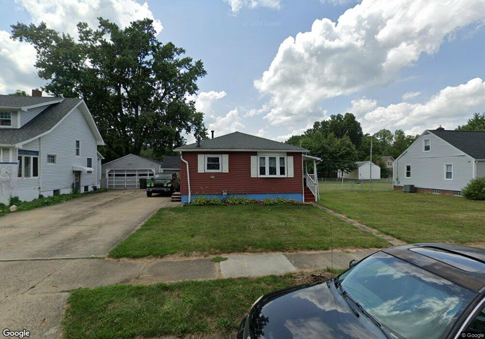
2139 Blenheim Ave Alliance, OH 44601
Estimated Value: $119,000 - $159,000
2
Beds
2
Baths
868
Sq Ft
$169/Sq Ft
Est. Value
About This Home
This home is located at 2139 Blenheim Ave, Alliance, OH 44601 and is currently estimated at $146,405, approximately $168 per square foot. 2139 Blenheim Ave is a home located in Stark County with nearby schools including Alliance Elementary School at Rockhill, Alliance Intermediate School at Northside, and Alliance Middle School.
Ownership History
Date
Name
Owned For
Owner Type
Purchase Details
Closed on
Aug 29, 2002
Sold by
Vincent Keith A and Vincent Lisa M
Bought by
Reed Dan and Reed Hannah
Current Estimated Value
Purchase Details
Closed on
Jun 2, 2000
Sold by
Mercer Wilfred M
Bought by
Vincent Keith A and Vincent Lisa M
Home Financials for this Owner
Home Financials are based on the most recent Mortgage that was taken out on this home.
Original Mortgage
$45,000
Interest Rate
8.18%
Mortgage Type
Purchase Money Mortgage
Create a Home Valuation Report for This Property
The Home Valuation Report is an in-depth analysis detailing your home's value as well as a comparison with similar homes in the area
Home Values in the Area
Average Home Value in this Area
Purchase History
| Date | Buyer | Sale Price | Title Company |
|---|---|---|---|
| Reed Dan | -- | Americas Choice Title Agency | |
| Vincent Keith A | $58,000 | -- |
Source: Public Records
Mortgage History
| Date | Status | Borrower | Loan Amount |
|---|---|---|---|
| Previous Owner | Vincent Keith A | $45,000 |
Source: Public Records
Tax History
| Year | Tax Paid | Tax Assessment Tax Assessment Total Assessment is a certain percentage of the fair market value that is determined by local assessors to be the total taxable value of land and additions on the property. | Land | Improvement |
|---|---|---|---|---|
| 2025 | -- | $42,530 | $10,150 | $32,380 |
| 2024 | -- | $42,530 | $10,150 | $32,380 |
| 2023 | $1,233 | $30,670 | $8,510 | $22,160 |
| 2022 | $1,181 | $30,670 | $8,510 | $22,160 |
| 2021 | $1,169 | $30,670 | $8,510 | $22,160 |
| 2020 | $785 | $26,180 | $7,420 | $18,760 |
| 2019 | $919 | $26,190 | $7,420 | $18,770 |
Source: Public Records
Map
Nearby Homes
- 0 Federal Ave
- 2630 Blenheim Ave
- 2635 Blenheim Ave
- 1870 Northview Ave
- 1016 Roseland Rd
- 1615 Fairview Place
- 2420 Beechwood Ave
- 1534 Fernwood Blvd
- 3018 Blenheim Ave
- 864 W College Rd
- 1601 Raywood Rd
- 1310 Overlook Dr
- 0 Winchester St
- 0 Winchester St Unit 5162877
- 1539 Parkway Blvd
- 856 Birchwood Dr
- 1176 Parkside Dr
- 2625 Belleflower Dr
- 720 Vincent Blvd
- 1114 Briarcliff Ave
- 2149 Blenheim Ave
- 2129 Blenheim Ave
- 2159 Blenheim Ave
- 2111 Blenheim Ave
- 2136 Federal Ave
- 2158 Federal Ave
- 2122 Federal Ave
- 2142 Blenheim Ave
- 2101 Blenheim Ave
- 2181 Blenheim Ave
- 2130 Blenheim Ave
- 2150 Blenheim Ave
- 2120 Blenheim Ave
- 2160 Blenheim Ave
- 2112 Blenheim Ave
- 2191 Blenheim Ave
- 2180 Federal Ave
- 2180 Federal Ave
- 2100 Federal Ave
- 2100 Blenheim Ave
Your Personal Tour Guide
Ask me questions while you tour the home.