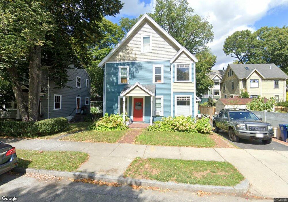
2139 Commonwealth Ave Unit 1 Auburndale, MA 02466
Auburndale NeighborhoodEstimated Value: $1,105,000 - $1,380,000
2
Beds
2
Baths
1,250
Sq Ft
$1,000/Sq Ft
Est. Value
About This Home
This home is located at 2139 Commonwealth Ave Unit 1, Auburndale, MA 02466 and is currently estimated at $1,250,335, approximately $1,000 per square foot. 2139 Commonwealth Ave Unit 1 is a home located in Middlesex County with nearby schools including C.C. Burr, F.A. Day Middle School, and Newton North High School.
Ownership History
Date
Name
Owned For
Owner Type
Purchase Details
Closed on
Mar 30, 2001
Sold by
Bank Rt and Bank Eugene M
Bought by
Hunt Denis and Wong-Hunt Louisa Y
Current Estimated Value
Purchase Details
Closed on
Dec 7, 1987
Sold by
Kendall Steven A
Bought by
Desormeaux Paul
Create a Home Valuation Report for This Property
The Home Valuation Report is an in-depth analysis detailing your home's value as well as a comparison with similar homes in the area
Home Values in the Area
Average Home Value in this Area
Purchase History
| Date | Buyer | Sale Price | Title Company |
|---|---|---|---|
| Hunt Denis | $469,000 | -- | |
| Desormeaux Paul | $295,000 | -- |
Source: Public Records
Mortgage History
| Date | Status | Borrower | Loan Amount |
|---|---|---|---|
| Open | Desormeaux Paul | $423,000 | |
| Closed | Desormeaux Paul | $351,900 |
Source: Public Records
Tax History
| Year | Tax Paid | Tax Assessment Tax Assessment Total Assessment is a certain percentage of the fair market value that is determined by local assessors to be the total taxable value of land and additions on the property. | Land | Improvement |
|---|---|---|---|---|
| 2025 | $8,620 | $879,600 | $748,400 | $131,200 |
| 2024 | $8,335 | $854,000 | $726,600 | $127,400 |
| 2023 | $8,064 | $792,100 | $577,900 | $214,200 |
| 2022 | $7,715 | $733,400 | $535,100 | $198,300 |
| 2021 | $7,239 | $672,800 | $490,900 | $181,900 |
| 2020 | $7,024 | $672,800 | $490,900 | $181,900 |
| 2019 | $6,571 | $628,800 | $458,800 | $170,000 |
| 2018 | $6,544 | $604,800 | $430,800 | $174,000 |
| 2017 | $6,170 | $554,900 | $395,200 | $159,700 |
| 2016 | $5,794 | $509,100 | $362,600 | $146,500 |
| 2015 | $5,524 | $475,800 | $338,900 | $136,900 |
Source: Public Records
Map
Nearby Homes
- 10 Higgins St
- 232 Melrose St Unit 2
- 283 Melrose St
- 187 Melrose St
- 2202 Commonwealth Ave Unit 1
- 69 Kaposia St
- 2259 Commonwealth Ave
- 194 Auburn St
- 49 Staniford St
- 305 Webster St Unit 2
- 160 Pine St Unit 12
- 1919 Commonwealth Ave Unit 1919
- 1917 Commonwealth Ave Unit 1917
- 12 Oakwood Rd
- 126 Charles St (Aub)
- 7 Sharon Ave Unit 7
- 88 Crescent St Unit 2
- 73 Auburn St Unit 75
- 1639 Washington St
- 101-103 Lexington St
- 2139 Commonwealth Ave
- 2139 Commonwealth Ave
- 2143 Commonwealth Ave
- 2133 Commonwealth Ave
- 235 Melrose St
- 235 Melrose St Unit 235
- 231 Melrose St
- 227 Melrose St
- 2149 Commonwealth Ave
- 9 Higgins St
- 9 Higgins St Unit 3
- 9 Higgins St Unit 4
- 18 Higgins St
- 223 Melrose St
- 2121 Commonwealth Ave Unit 1
- 2121 Commonwealth Ave
- 2134 Commonwealth Ave
- 2140 Commonwealth Ave Unit A
- 232 Melrose St
- 19 Higgins St
Your Personal Tour Guide
Ask me questions while you tour the home.