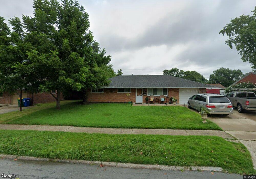
2139 Owendale Dr Dayton, OH 45439
Woodbourne-Hyde Park NeighborhoodEstimated Value: $166,489 - $194,000
3
Beds
1
Bath
1,080
Sq Ft
$168/Sq Ft
Est. Value
About This Home
This home is located at 2139 Owendale Dr, Dayton, OH 45439 and is currently estimated at $181,872, approximately $168 per square foot. 2139 Owendale Dr is a home located in Montgomery County with nearby schools including West Carrollton High School, Miami Valley Academies, and St. Albert the Great Catholic School.
Ownership History
Date
Name
Owned For
Owner Type
Purchase Details
Closed on
Nov 22, 2013
Sold by
Haper Stanley D and Haper Carole A
Bought by
Bmh Holding Company Llc
Current Estimated Value
Purchase Details
Closed on
Aug 11, 2010
Sold by
Estes Duane and Gayman Katy J
Bought by
Bovee Jeffery A and Bovee Marianne C
Purchase Details
Closed on
Sep 10, 1996
Sold by
Estes Beverly and Estes Estine
Bought by
Estes Beverly and Estes Estine
Create a Home Valuation Report for This Property
The Home Valuation Report is an in-depth analysis detailing your home's value as well as a comparison with similar homes in the area
Home Values in the Area
Average Home Value in this Area
Purchase History
| Date | Buyer | Sale Price | Title Company |
|---|---|---|---|
| Bmh Holding Company Llc | -- | None Available | |
| Bovee Jeffery A | $57,000 | M & M Title Co | |
| Estes Beverly | -- | -- |
Source: Public Records
Tax History Compared to Growth
Tax History
| Year | Tax Paid | Tax Assessment Tax Assessment Total Assessment is a certain percentage of the fair market value that is determined by local assessors to be the total taxable value of land and additions on the property. | Land | Improvement |
|---|---|---|---|---|
| 2024 | $3,018 | $42,150 | $7,820 | $34,330 |
| 2023 | $3,018 | $42,150 | $7,820 | $34,330 |
| 2022 | $2,636 | $28,290 | $5,250 | $23,040 |
| 2021 | $2,434 | $28,290 | $5,250 | $23,040 |
| 2020 | $2,439 | $28,290 | $5,250 | $23,040 |
| 2019 | $2,587 | $26,290 | $5,250 | $21,040 |
| 2018 | $2,424 | $26,290 | $5,250 | $21,040 |
| 2017 | $2,411 | $26,290 | $5,250 | $21,040 |
| 2016 | $2,437 | $25,700 | $5,250 | $20,450 |
| 2015 | $2,271 | $25,700 | $5,250 | $20,450 |
| 2014 | $2,271 | $25,700 | $5,250 | $20,450 |
| 2012 | -- | $26,970 | $7,000 | $19,970 |
Source: Public Records
Map
Nearby Homes
- 2090 Mattis Dr
- 1692 Hillwood Dr
- 1673 W Stroop Rd
- 4051 Ellery Ave
- 4207 S Dixie Dr
- 4301 Tait Rd
- 1952 Tait Circle Rd
- 1905 Tait Circle Rd
- 4629 Richwood Dr
- 4661 Richwood Dr
- 2050 William Ln
- 2639 Blanchard Ave
- 2571 Cluster Ave
- 4792 Loxley Dr
- 3720 Ridgeleigh Rd Unit D
- 1955 Kresswood Cir
- 5084 Mays Ave
- 1349 Tamerlane Rd
- 2399 Polo Park Dr
- 4400 Royal Ridge Way
- 2125 Owendale Dr
- 2153 Owendale Dr
- 2128 Mattis Dr
- 2114 Mattis Dr
- 2142 Mattis Dr
- 2113 Owendale Dr
- 2167 Owendale Dr
- 2142 Owendale Dr
- 2128 Owendale Dr
- 2154 Mattis Dr
- 2156 Owendale Dr
- 2116 Owendale Dr
- 2181 Owendale Dr
- 2099 Owendale Dr
- 2170 Owendale Dr
- 2104 Owendale Dr
- 2168 Mattis Dr
- 2127 Mattis Dr
- 2141 Mattis Dr
- 2159 Lynpark Ave