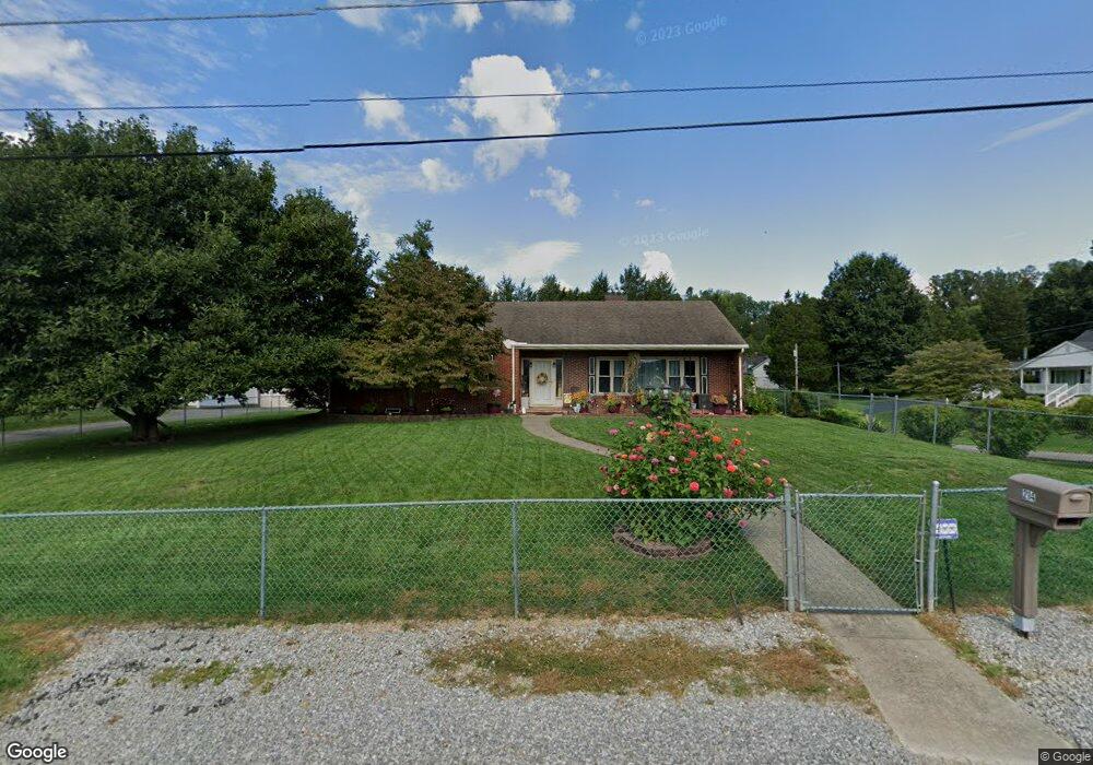
214 5th St Bridgeport, WV 26330
Estimated Value: $316,000 - $372,000
3
Beds
3
Baths
1,810
Sq Ft
$196/Sq Ft
Est. Value
About This Home
This home is located at 214 5th St, Bridgeport, WV 26330 and is currently estimated at $354,051, approximately $195 per square foot. 214 5th St is a home located in Harrison County with nearby schools including Heritage Christian School and Dollie Hilll Christian Academy.
Ownership History
Date
Name
Owned For
Owner Type
Purchase Details
Closed on
Oct 29, 2013
Sold by
Roby Ronald H and Roby Sandra G
Bought by
Storage Susan L and Warren Nancy E
Current Estimated Value
Home Financials for this Owner
Home Financials are based on the most recent Mortgage that was taken out on this home.
Original Mortgage
$176,000
Outstanding Balance
$130,132
Interest Rate
4.17%
Mortgage Type
New Conventional
Estimated Equity
$223,919
Purchase Details
Closed on
Mar 1, 2005
Sold by
Fannie Mae
Bought by
Roby Sandra G
Create a Home Valuation Report for This Property
The Home Valuation Report is an in-depth analysis detailing your home's value as well as a comparison with similar homes in the area
Home Values in the Area
Average Home Value in this Area
Purchase History
| Date | Buyer | Sale Price | Title Company |
|---|---|---|---|
| Storage Susan L | $220,000 | None Available | |
| Roby Sandra G | -- | None Available |
Source: Public Records
Mortgage History
| Date | Status | Borrower | Loan Amount |
|---|---|---|---|
| Open | Storage Susan L | $176,000 |
Source: Public Records
Tax History Compared to Growth
Tax History
| Year | Tax Paid | Tax Assessment Tax Assessment Total Assessment is a certain percentage of the fair market value that is determined by local assessors to be the total taxable value of land and additions on the property. | Land | Improvement |
|---|---|---|---|---|
| 2025 | $2,093 | $157,380 | $23,340 | $134,040 |
| 2024 | $2,093 | $147,180 | $23,340 | $123,840 |
| 2023 | $1,915 | $136,980 | $23,340 | $113,640 |
| 2022 | $1,782 | $135,960 | $23,340 | $112,620 |
| 2021 | $1,743 | $134,460 | $23,340 | $111,120 |
| 2020 | $1,984 | $131,280 | $22,380 | $108,900 |
| 2019 | $1,977 | $130,740 | $22,380 | $108,360 |
| 2018 | $1,947 | $129,240 | $22,380 | $106,860 |
| 2017 | $1,910 | $127,200 | $22,380 | $104,820 |
| 2016 | $1,863 | $125,220 | $22,380 | $102,840 |
| 2015 | $1,571 | $124,020 | $22,380 | $101,640 |
| 2014 | $1,502 | $119,520 | $19,440 | $100,080 |
Source: Public Records
Map
Nearby Homes
- 221 Broadway Ave
- 406 Willis Ave
- 230 Grand Ave
- 443 Lawman Ave
- 120 Center Ct
- Lot 6 HC Industrial Park
- 632 Lawman Ave
- 103 Willow Oak Dr
- 142 Willow Oak Dr
- 109 Willow Oak Dr
- 144 Willow Oak Dr
- 141 Willow Oak Dr
- 140 Willow Oak Dr
- 101 Willow Oak Dr
- Lot 1 the Vale Rd
- 102 W Philadelphia Ave
- 422 Worthington Dr
- TBD Johnson Ave
- 640 Pennsylvania Ave
- 119 Hill St