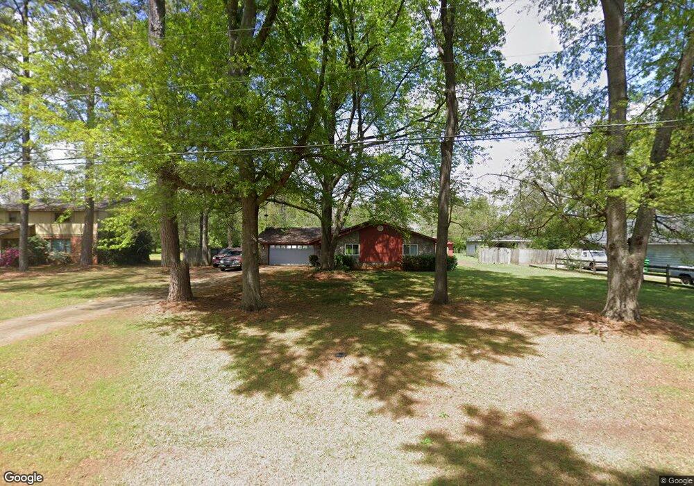
214 Air Park Dr Warner Robins, GA 31088
Estimated Value: $212,211 - $251,000
3
Beds
2
Baths
1,554
Sq Ft
$150/Sq Ft
Est. Value
About This Home
This home is located at 214 Air Park Dr, Warner Robins, GA 31088 and is currently estimated at $233,803, approximately $150 per square foot. 214 Air Park Dr is a home located in Houston County with nearby schools including David A. Perdue Primary School, David A. Perdue Elementary School, and Feagin Mill Middle School.
Ownership History
Date
Name
Owned For
Owner Type
Purchase Details
Closed on
Apr 11, 2008
Sold by
Grant Janet W and Williams Nellie Snider
Bought by
Gries David M
Current Estimated Value
Home Financials for this Owner
Home Financials are based on the most recent Mortgage that was taken out on this home.
Original Mortgage
$89,000
Outstanding Balance
$56,554
Interest Rate
6.03%
Mortgage Type
Purchase Money Mortgage
Estimated Equity
$177,249
Purchase Details
Closed on
May 31, 1980
Sold by
Starkey William A and Starkey Jennifer J
Bought by
Williams Charles E and Nellie S*
Purchase Details
Closed on
Apr 29, 1977
Sold by
Warner Robins Air Park Estates
Bought by
Starkey William A and Starkey Jennifer J
Purchase Details
Closed on
Feb 22, 1974
Sold by
Gottschalk & Gottschalk Inc
Bought by
Warner Robins Air Park Estates
Create a Home Valuation Report for This Property
The Home Valuation Report is an in-depth analysis detailing your home's value as well as a comparison with similar homes in the area
Home Values in the Area
Average Home Value in this Area
Purchase History
| Date | Buyer | Sale Price | Title Company |
|---|---|---|---|
| Gries David M | $119,000 | None Available | |
| Williams Charles E | -- | -- | |
| Starkey William A | -- | -- | |
| Warner Robins Air Park Estates | -- | -- |
Source: Public Records
Mortgage History
| Date | Status | Borrower | Loan Amount |
|---|---|---|---|
| Open | Gries David M | $89,000 |
Source: Public Records
Tax History Compared to Growth
Tax History
| Year | Tax Paid | Tax Assessment Tax Assessment Total Assessment is a certain percentage of the fair market value that is determined by local assessors to be the total taxable value of land and additions on the property. | Land | Improvement |
|---|---|---|---|---|
| 2024 | $1,475 | $61,680 | $9,360 | $52,320 |
| 2023 | $1,243 | $51,440 | $9,360 | $42,080 |
| 2022 | $1,134 | $46,920 | $9,360 | $37,560 |
| 2021 | $993 | $40,880 | $8,400 | $32,480 |
| 2020 | $994 | $40,720 | $8,400 | $32,320 |
| 2019 | $994 | $40,720 | $8,400 | $32,320 |
| 2018 | $948 | $38,840 | $8,400 | $30,440 |
| 2017 | $949 | $38,840 | $8,400 | $30,440 |
| 2016 | $950 | $38,840 | $8,400 | $30,440 |
| 2015 | $952 | $38,840 | $8,400 | $30,440 |
| 2014 | -- | $38,840 | $8,400 | $30,440 |
| 2013 | -- | $38,840 | $8,400 | $30,440 |
Source: Public Records
Map
Nearby Homes
- 110 Mayberry Ln
- 1148 Thornblade Dr
- 108 Mayberry Ln
- 104 Mayberry Ln
- 207 Courthouse Ln
- 414 Bella Notte Cir
- 414 Bella Notte Cir Unit 23A
- 102 Mayberry Ln
- 102 Mayberry Ln Unit LOT 1 MB
- 401 Bella Notte Cir Unit 5D
- 401 Bella Notte Cir
- 416 Bella Notte Cir
- 416 Bella Notte Cir Unit 22A
- 418 Bella Notte Cir Unit 21A
- 409 Bella Notte Cir Unit 1D
- 409 Bella Notte Cir
- 404 Minter Dr
- 500 Bella Notte Cir Unit 16A
- 500 Bella Notte Cir
- 502 Bella Notte Cir
- 212 Air Park Dr
- 216 Air Park Dr
- 210 Air Park Dr
- 208 Air Park Dr
- 213 Air Park Dr
- 209 Air Park Dr
- 211 Air Park Dr
- 207 Air Park Dr
- 206 Air Park Dr
- 205 Air Park Dr
- 204 Air Park Dr
- 103 Marcelline Ct
- 101 Marcelline Ct
- 807 Haverhill Cir
- 809 Haverhill Cir
- 105 Marcelline Ct
- 805 Haverhill Cir
- 107 Marcelline Ct
- 203 Air Park Dr
- 803 Haverhill Cir