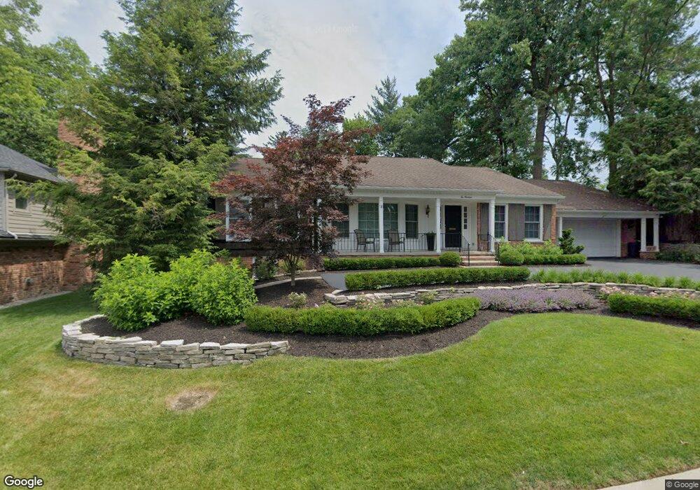
214 Dean Ln Grosse Pointe Farms, MI 48236
Estimated Value: $572,354 - $763,000
--
Bed
1
Bath
2,963
Sq Ft
$226/Sq Ft
Est. Value
About This Home
This home is located at 214 Dean Ln, Grosse Pointe Farms, MI 48236 and is currently estimated at $668,839, approximately $225 per square foot. 214 Dean Ln is a home located in Wayne County with nearby schools including Richard Elementary School, Brownell Middle School, and Grosse Pointe South High School.
Ownership History
Date
Name
Owned For
Owner Type
Purchase Details
Closed on
Nov 6, 2020
Sold by
Montgomery Robert J and Montgomery Pamela J
Bought by
Montgomery Robert J and Montgomery Pamela J
Current Estimated Value
Purchase Details
Closed on
Oct 11, 2019
Sold by
Montgomery Pamela J
Bought by
Montgomery Pamela J and Montgomery Robert J
Purchase Details
Closed on
Dec 7, 2018
Sold by
Courtney Joanne M and Montgomery Pamela J
Bought by
Courtney Joanne M and Montgomerty Pamela J
Purchase Details
Closed on
Oct 15, 2013
Sold by
Courtney Joanne M and Courtney Richard M
Bought by
Courtney Joanne M
Create a Home Valuation Report for This Property
The Home Valuation Report is an in-depth analysis detailing your home's value as well as a comparison with similar homes in the area
Home Values in the Area
Average Home Value in this Area
Purchase History
| Date | Buyer | Sale Price | Title Company |
|---|---|---|---|
| Montgomery Robert J | -- | None Available | |
| Montgomery Pamela J | -- | None Available | |
| Montgomery Pamela J | -- | None Available | |
| Courtney Joanne M | -- | None Available | |
| Courtney Joanne M | -- | None Available |
Source: Public Records
Tax History Compared to Growth
Tax History
| Year | Tax Paid | Tax Assessment Tax Assessment Total Assessment is a certain percentage of the fair market value that is determined by local assessors to be the total taxable value of land and additions on the property. | Land | Improvement |
|---|---|---|---|---|
| 2025 | $5,813 | $270,600 | $0 | $0 |
| 2024 | $5,813 | $253,600 | $0 | $0 |
| 2023 | $5,326 | $243,300 | $0 | $0 |
| 2022 | $5,326 | $220,100 | $0 | $0 |
| 2021 | $9,773 | $214,100 | $0 | $0 |
| 2019 | $9,610 | $205,200 | $0 | $0 |
| 2018 | $5,709 | $212,500 | $0 | $0 |
| 2017 | $11,261 | $292,000 | $0 | $0 |
| 2016 | $11,804 | $271,300 | $0 | $0 |
| 2015 | $23,381 | $254,300 | $0 | $0 |
| 2013 | $22,650 | $226,500 | $0 | $0 |
| 2012 | $5,906 | $222,100 | $53,600 | $168,500 |
Source: Public Records
Map
Nearby Homes
- 213 Muir Rd
- 233 Mcmillan Rd
- 240 Mckinley Ave
- 201 Mcmillan Rd
- 276 Lewiston Rd
- 194 Charlevoix Ave
- 166 Lewiston Rd
- 180 Fisher Rd
- 745 Lincoln Rd
- 218 Merriweather Rd
- 259 Mount Vernon Ave
- 341 Mcmillan Rd
- 216 Ridge Rd
- 352 Mckinley Ave
- 827 Fisher Rd
- 130 Merriweather Rd
- 302 Mount Vernon Ave
- 317 Mount Vernon Ave
- 314 Mount Vernon Ave
- 93 Merriweather Rd