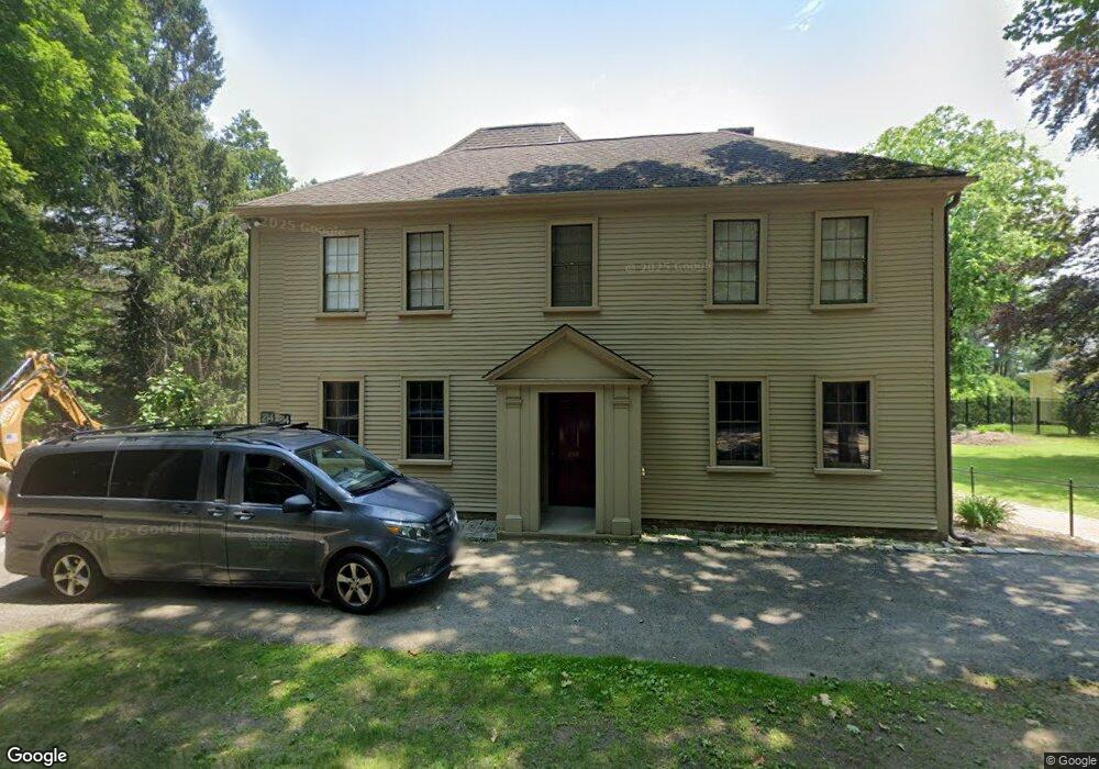
214 Fox Hill St Westwood, MA 02090
Estimated Value: $1,794,000 - $2,146,000
6
Beds
5
Baths
5,604
Sq Ft
$354/Sq Ft
Est. Value
About This Home
This home is located at 214 Fox Hill St, Westwood, MA 02090 and is currently estimated at $1,982,431, approximately $353 per square foot. 214 Fox Hill St is a home located in Norfolk County with nearby schools including Westwood High School, St. Sebastian's School, and Xaverian Brothers High School.
Ownership History
Date
Name
Owned For
Owner Type
Purchase Details
Closed on
May 13, 2019
Sold by
Caperton Hugh J Est
Bought by
214 Fox Hill Llc
Current Estimated Value
Purchase Details
Closed on
Sep 24, 1999
Sold by
Mason Andrew G and Mason Jennifer D
Bought by
Caperton Hugh J and Caperton Elizabeth W
Home Financials for this Owner
Home Financials are based on the most recent Mortgage that was taken out on this home.
Original Mortgage
$500,000
Interest Rate
8.1%
Mortgage Type
Purchase Money Mortgage
Purchase Details
Closed on
May 26, 1992
Sold by
Imbrie John Z
Bought by
Mason Andrew G and Mason Jennifer D
Create a Home Valuation Report for This Property
The Home Valuation Report is an in-depth analysis detailing your home's value as well as a comparison with similar homes in the area
Home Values in the Area
Average Home Value in this Area
Purchase History
| Date | Buyer | Sale Price | Title Company |
|---|---|---|---|
| 214 Fox Hill Llc | $1,220,000 | -- | |
| Caperton Hugh J | $480,000 | -- | |
| Mason Andrew G | $370,000 | -- |
Source: Public Records
Mortgage History
| Date | Status | Borrower | Loan Amount |
|---|---|---|---|
| Previous Owner | Mason Andrew G | $500,000 | |
| Previous Owner | Mason Andrew G | $20,000 | |
| Previous Owner | Mason Andrew G | $21,000 | |
| Previous Owner | Mason Andrew G | $295,000 |
Source: Public Records
Tax History Compared to Growth
Tax History
| Year | Tax Paid | Tax Assessment Tax Assessment Total Assessment is a certain percentage of the fair market value that is determined by local assessors to be the total taxable value of land and additions on the property. | Land | Improvement |
|---|---|---|---|---|
| 2025 | $20,210 | $1,578,900 | $602,300 | $976,600 |
| 2024 | $18,648 | $1,455,700 | $574,100 | $881,600 |
| 2023 | $18,031 | $1,260,900 | $478,500 | $782,400 |
| 2022 | $17,052 | $1,149,800 | $404,550 | $745,250 |
| 2021 | $17,625 | $1,192,500 | $385,300 | $807,200 |
| 2020 | $18,770 | $1,293,600 | $385,300 | $908,300 |
| 2019 | $18,046 | $1,231,800 | $366,700 | $865,100 |
| 2018 | $17,887 | $1,185,350 | $366,700 | $818,650 |
| 2017 | $17,431 | $1,196,350 | $366,700 | $829,650 |
| 2016 | $16,182 | $1,103,800 | $366,700 | $737,100 |
| 2015 | $15,412 | $1,011,300 | $366,700 | $644,600 |
Source: Public Records
Map
Nearby Homes
- 401 Sandy Valley Rd
- 18 Longmeadow Dr
- 1 Laura Ln
- 20 Longmeadow Dr
- 314 Grove St
- 223 Robert Rd
- 130 Cobleigh St
- 39 Westbrook Ln
- 24 Pond Farm Rd
- 49 Fisher St
- 886 Gay St
- 8 Karen Pines St
- 131 Bay Colony Dr
- 26 Longmeadow Dr
- 262 Meadowbrook Rd
- 250 Meadowbrook Rd
- 298 Washington St Unit 208
- 298 Washington St Unit 302
- 298 Washington St Unit 210
- 4 Shoestring Ln