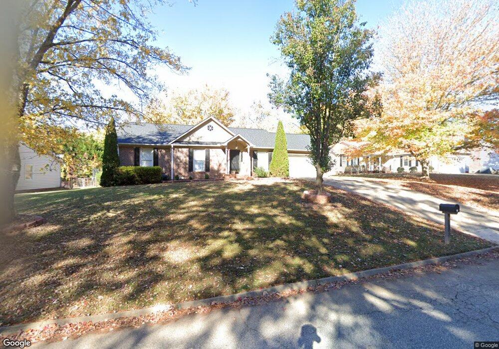
214 Foxhound Rd Simpsonville, SC 29680
Estimated Value: $283,000 - $386,000
3
Beds
2
Baths
1,640
Sq Ft
$189/Sq Ft
Est. Value
About This Home
This home is located at 214 Foxhound Rd, Simpsonville, SC 29680 and is currently estimated at $310,328, approximately $189 per square foot. 214 Foxhound Rd is a home located in Greenville County with nearby schools including Plain Elementary, Bryson Middle School, and Hillcrest High School.
Ownership History
Date
Name
Owned For
Owner Type
Purchase Details
Closed on
Feb 1, 2010
Sold by
Montrose Fred W
Bought by
Randolph Steven Allen
Current Estimated Value
Home Financials for this Owner
Home Financials are based on the most recent Mortgage that was taken out on this home.
Original Mortgage
$127,645
Outstanding Balance
$86,442
Interest Rate
5.5%
Mortgage Type
FHA
Estimated Equity
$223,886
Purchase Details
Closed on
Feb 16, 2007
Sold by
Montrose Fred W
Bought by
Montrose Fred W
Purchase Details
Closed on
Jun 11, 1999
Sold by
Shirlen Eugene
Bought by
Montrose Fred W
Create a Home Valuation Report for This Property
The Home Valuation Report is an in-depth analysis detailing your home's value as well as a comparison with similar homes in the area
Home Values in the Area
Average Home Value in this Area
Purchase History
| Date | Buyer | Sale Price | Title Company |
|---|---|---|---|
| Randolph Steven Allen | $130,000 | -- | |
| Montrose Fred W | -- | None Available | |
| Montrose Fred W | $129,000 | -- |
Source: Public Records
Mortgage History
| Date | Status | Borrower | Loan Amount |
|---|---|---|---|
| Open | Randolph Steven Allen | $127,645 |
Source: Public Records
Tax History Compared to Growth
Tax History
| Year | Tax Paid | Tax Assessment Tax Assessment Total Assessment is a certain percentage of the fair market value that is determined by local assessors to be the total taxable value of land and additions on the property. | Land | Improvement |
|---|---|---|---|---|
| 2024 | $1,306 | $6,220 | $1,150 | $5,070 |
| 2023 | $1,321 | $6,220 | $1,150 | $5,070 |
| 2022 | $1,277 | $6,220 | $1,150 | $5,070 |
| 2021 | $1,278 | $6,220 | $1,150 | $5,070 |
| 2020 | $1,200 | $5,410 | $1,000 | $4,410 |
| 2019 | $1,200 | $5,410 | $1,000 | $4,410 |
| 2018 | $1,065 | $5,410 | $1,000 | $4,410 |
| 2017 | $1,065 | $5,410 | $1,000 | $4,410 |
| 2016 | $1,015 | $135,150 | $25,000 | $110,150 |
| 2015 | $1,015 | $135,150 | $25,000 | $110,150 |
| 2014 | $1,029 | $139,440 | $27,000 | $112,440 |
Source: Public Records
Map
Nearby Homes
- 58 Fair Village Ln
- 56 Fair Village Ln
- 54 Fair Village Ln
- 52 Fair Village Ln
- 501 Foxhound Rd
- 61 Fair Village Ln
- 59 Fair Village Ln
- 57 Fair Village Ln
- 51 Fair Village Ln
- 49 Fair Village Ln
- 39 Fair Village Ln
- 19 Fair Village Ln
- Durham Plan at Fairview Village - Townhomes
- Cary Plan at Fairview Village - Townhomes
- Bristol Plan at Fairview Village - Townhomes
- 511 Foxhound Rd
- 102 Spring Meadow Rd
- 6 W Fairgate Ct
- 13 Arbordale Ln
- 167 Border Ave
- 216 Foxhound Rd
- 212 Foxhound Rd
- 106 Fox Hollow Ct
- 218 Foxhound Rd
- 210 Foxhound Rd
- 108 Fox Hollow Ct
- 217 Foxhound Rd
- 104 Fox Hollow Ct
- 219 Foxhound Rd
- 215 Foxhound Rd
- 110 Fox Hollow Ct
- 213 Foxhound Rd
- 208 Foxhound Rd
- 102 Fox Hollow Ct
- 220 Foxhound Rd
- 211 Foxhound Rd
- 112 Fox Hollow Ct
- 206 Foxhound Rd
- 221 Foxhound Rd
- 100 Fox Hollow Ct