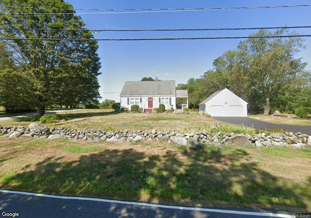
214 Goodwin Rd Eliot, ME 03903
East Eliot NeighborhoodEstimated Value: $515,744 - $571,000
3
Beds
3
Baths
1,547
Sq Ft
$356/Sq Ft
Est. Value
About This Home
This home is located at 214 Goodwin Rd, Eliot, ME 03903 and is currently estimated at $550,436, approximately $355 per square foot. 214 Goodwin Rd is a home located in York County with nearby schools including Marshwood High School and Seacoast Waldorf School.
Ownership History
Date
Name
Owned For
Owner Type
Purchase Details
Closed on
Mar 1, 2022
Sold by
Brooker Steven R and Brooker Lily A
Bought by
West Heidi L
Current Estimated Value
Purchase Details
Closed on
Jul 30, 2010
Sold by
Bradbard Debra H
Bought by
Brooker Lily A and Brooker Steven R
Home Financials for this Owner
Home Financials are based on the most recent Mortgage that was taken out on this home.
Original Mortgage
$40,000
Interest Rate
4.78%
Mortgage Type
Purchase Money Mortgage
Create a Home Valuation Report for This Property
The Home Valuation Report is an in-depth analysis detailing your home's value as well as a comparison with similar homes in the area
Home Values in the Area
Average Home Value in this Area
Purchase History
| Date | Buyer | Sale Price | Title Company |
|---|---|---|---|
| West Heidi L | -- | None Available | |
| Brooker Lily A | -- | -- |
Source: Public Records
Mortgage History
| Date | Status | Borrower | Loan Amount |
|---|---|---|---|
| Previous Owner | Brooker Lily A | $40,000 | |
| Previous Owner | Brooker Lily A | $100,000 | |
| Previous Owner | Brooker Lily A | $75,000 | |
| Previous Owner | Brooker Lily A | $25,000 |
Source: Public Records
Tax History
| Year | Tax Paid | Tax Assessment Tax Assessment Total Assessment is a certain percentage of the fair market value that is determined by local assessors to be the total taxable value of land and additions on the property. | Land | Improvement |
|---|---|---|---|---|
| 2024 | $3,720 | $313,900 | $126,000 | $187,900 |
| 2023 | $3,586 | $292,700 | $119,700 | $173,000 |
| 2022 | $3,449 | $285,000 | $119,700 | $165,300 |
| 2021 | $3,652 | $270,500 | $109,300 | $161,200 |
| 2020 | $3,746 | $254,800 | $104,100 | $150,700 |
| 2019 | $3,746 | $254,800 | $104,100 | $150,700 |
| 2018 | $3,746 | $254,800 | $104,100 | $150,700 |
| 2017 | $3,644 | $254,800 | $104,100 | $150,700 |
| 2016 | $3,580 | $254,800 | $104,100 | $150,700 |
| 2015 | $3,494 | $249,600 | $104,100 | $145,500 |
| 2014 | $3,444 | $249,600 | $104,100 | $145,500 |
| 2013 | $3,287 | $249,600 | $104,100 | $145,500 |
Source: Public Records
Map
Nearby Homes
- 42 Caslyn Dr
- 19 Seward Farm Ln
- 8 Caslyn Dr
- 65 Wildbrook Ln
- Lot 4 Stonecrop Farm Ln
- Lot 1 Brixham (Stonecrop Farm Lot 1) Rd
- 45 Scotland Bridge Rd
- TBD Pasture Hill Dr
- 10 Pasture Hill Dr
- 1128 State Rd
- Lot 2 Cedar Tbd
- 49 Sandalwood Cir
- 20 Colony Way
- 14 Colony Way
- 59 Sandalwood Cir
- 19 Aspen Cir
- 4 Bhoireann Ln
- 22 Summer Ln
- 3 Bhoireann Ln
- 161 Bolt Hill Rd
Your Personal Tour Guide
Ask me questions while you tour the home.