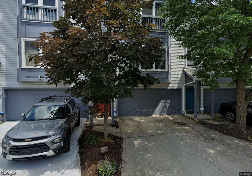
214 Hastings St Unit 214 Cincinnati, OH 45219
Clifton NeighborhoodEstimated Value: $283,000 - $330,000
2
Beds
3
Baths
1,328
Sq Ft
$228/Sq Ft
Est. Value
About This Home
This home is located at 214 Hastings St Unit 214, Cincinnati, OH 45219 and is currently estimated at $303,312, approximately $228 per square foot. 214 Hastings St Unit 214 is a home located in Hamilton County with nearby schools including Clifton Area Neighborhood School, Robert A. Taft Information Technology High School, and Gilbert A. Dater High School.
Ownership History
Date
Name
Owned For
Owner Type
Purchase Details
Closed on
Mar 4, 2005
Sold by
Beasley Alfred J and Fisher Beasley Diane
Bought by
Glacid Group Inc
Current Estimated Value
Purchase Details
Closed on
Dec 29, 2004
Sold by
Glacid Group Inc
Bought by
Hairston Russell E and Hairston Julia A
Home Financials for this Owner
Home Financials are based on the most recent Mortgage that was taken out on this home.
Original Mortgage
$152,900
Interest Rate
7.62%
Mortgage Type
Fannie Mae Freddie Mac
Create a Home Valuation Report for This Property
The Home Valuation Report is an in-depth analysis detailing your home's value as well as a comparison with similar homes in the area
Home Values in the Area
Average Home Value in this Area
Purchase History
| Date | Buyer | Sale Price | Title Company |
|---|---|---|---|
| Glacid Group Inc | -- | None Available | |
| Hairston Russell E | $169,900 | -- |
Source: Public Records
Mortgage History
| Date | Status | Borrower | Loan Amount |
|---|---|---|---|
| Previous Owner | Hairston Russell E | $152,900 |
Source: Public Records
Tax History Compared to Growth
Tax History
| Year | Tax Paid | Tax Assessment Tax Assessment Total Assessment is a certain percentage of the fair market value that is determined by local assessors to be the total taxable value of land and additions on the property. | Land | Improvement |
|---|---|---|---|---|
| 2024 | $4,675 | $78,306 | $14,700 | $63,606 |
| 2023 | $4,778 | $78,306 | $14,700 | $63,606 |
| 2022 | $4,891 | $71,908 | $11,760 | $60,148 |
| 2021 | $4,709 | $71,908 | $11,760 | $60,148 |
| 2020 | $4,847 | $71,908 | $11,760 | $60,148 |
| 2019 | $4,417 | $59,924 | $9,800 | $50,124 |
| 2018 | $4,423 | $59,924 | $9,800 | $50,124 |
| 2017 | $4,202 | $59,924 | $9,800 | $50,124 |
| 2016 | $3,943 | $55,441 | $7,816 | $47,625 |
| 2015 | $3,555 | $55,441 | $7,816 | $47,625 |
| 2014 | $3,580 | $55,441 | $7,816 | $47,625 |
| 2013 | $3,834 | $58,356 | $8,225 | $50,131 |
Source: Public Records
Map
Nearby Homes
- 2143 W Clifton Ave
- 237 Renner St
- 251 Renner St
- 261 Renner St
- 227 Renner St
- 265 Renner St
- 221 Renner St
- 305 Klotter Ave
- 276 Emming St
- 269 W McMicken Ave
- 265 W McMicken Ave
- 316 Klotter Ave
- 2175 Sohn St
- 280 Stark St
- 306 W McMicken Ave
- 125 Parker St
- 255 Warner St
- 2101 Ohio Ave
- 115 Parker St
- 124 Parker St
- 216 Hastings St Unit 216
- 218 Hastings St
- 220 Hastings St Unit 220
- 222 Hastings St
- 210 Hastings St
- 215 Hastings St
- 219 Hastings St
- 211 Hastings St
- 221 Klotter Ave
- 208 Hastings St
- 209 Hastings St
- 225 Klotter Ave
- 219 Klotter Ave
- 229 Klotter Ave
- 217 Klotter Ave
- 206 Hastings St
- 231 Klotter Ave
- 230 Hastings St
- 215 Klotter Ave
- 227 Hastings St Unit 227