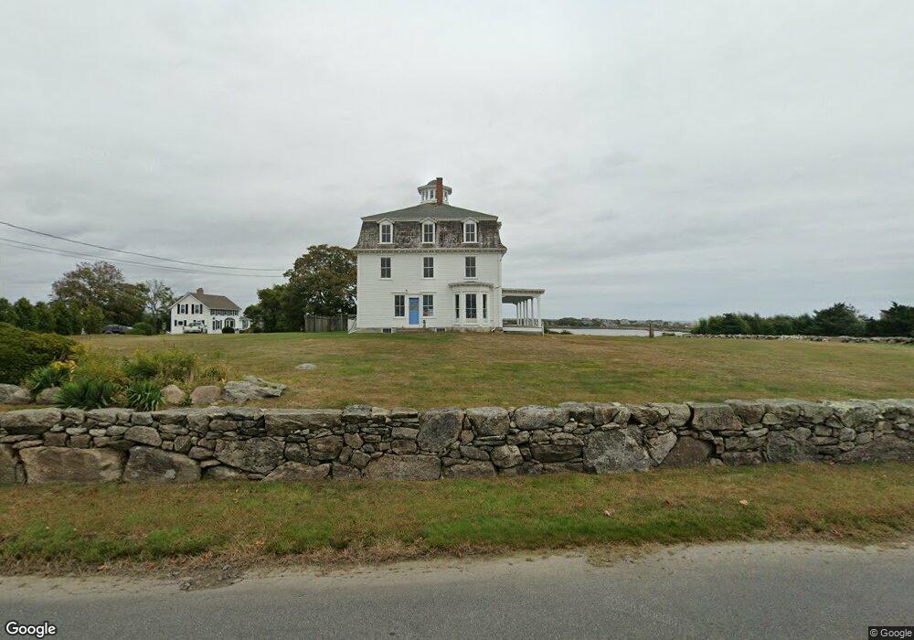
214 Howland Rd Westport, MA 02790
Acoaxet NeighborhoodEstimated Value: $2,247,310 - $3,695,000
16
Beds
--
Bath
7,221
Sq Ft
$436/Sq Ft
Est. Value
About This Home
This home is located at 214 Howland Rd, Westport, MA 02790 and is currently estimated at $3,151,437, approximately $436 per square foot. 214 Howland Rd is a home located in Bristol County with nearby schools including Alice A. Macomber Primary School, Westport Elementary School, and Westport Middle-High School.
Ownership History
Date
Name
Owned For
Owner Type
Purchase Details
Closed on
Jan 30, 2023
Sold by
Children T
Bought by
Elefante Nicholas T and Elefante Phoebe H
Current Estimated Value
Purchase Details
Closed on
Jan 24, 2023
Sold by
Elefante Phoebe H
Bought by
Elefante Jeffrey P and Satterlee Catherine T
Purchase Details
Closed on
Dec 27, 2007
Sold by
Howland Prop Llc
Bought by
Satterlee Catherine T and Satterlee Catherine T
Create a Home Valuation Report for This Property
The Home Valuation Report is an in-depth analysis detailing your home's value as well as a comparison with similar homes in the area
Home Values in the Area
Average Home Value in this Area
Purchase History
| Date | Buyer | Sale Price | Title Company |
|---|---|---|---|
| Elefante Nicholas T | -- | None Available | |
| Children T | -- | None Available | |
| Elefante Jeffrey P | -- | None Available | |
| Satterlee Catherine T | -- | -- | |
| Howland Prop Llc | -- | -- |
Source: Public Records
Tax History Compared to Growth
Tax History
| Year | Tax Paid | Tax Assessment Tax Assessment Total Assessment is a certain percentage of the fair market value that is determined by local assessors to be the total taxable value of land and additions on the property. | Land | Improvement |
|---|---|---|---|---|
| 2025 | $12,169 | $1,633,400 | $1,258,300 | $375,100 |
| 2024 | $11,892 | $1,538,400 | $1,166,700 | $371,700 |
| 2023 | $11,799 | $1,446,000 | $1,111,700 | $334,300 |
| 2022 | $12,123 | $1,429,600 | $1,111,700 | $317,900 |
| 2021 | $11,461 | $1,329,600 | $1,011,700 | $317,900 |
| 2020 | $10,871 | $1,289,600 | $971,700 | $317,900 |
| 2019 | $10,770 | $1,302,300 | $971,700 | $330,600 |
| 2018 | $9,320 | $1,140,700 | $898,200 | $242,500 |
| 2017 | $8,929 | $1,120,300 | $885,600 | $234,700 |
| 2016 | $8,790 | $1,111,200 | $885,600 | $225,600 |
| 2015 | $8,451 | $1,065,700 | $885,600 | $180,100 |
Source: Public Records
Map
Nearby Homes
- 189 Brayton Point Rd
- 304 Brayton Point Rd
- 19 Seabury Ln
- 255 John Dyer Rd
- 18 Old Barn Rd
- 1881 Main Rd
- 1749 Main Rd
- 128 Maple Ave
- 0 Reed Rd (Ss)
- 245 John Dyer Rd
- 1580 Main Rd
- 505 Long Hwy
- 1702J Drift Rd
- 1702 Drift Rd
- 141 S Of Commons Rd
- 1346 Main Rd Unit B
- 0 Willow Ave
- 17 Quail Trail
- 116 Amy Hart Path
- 83 Long Hwy