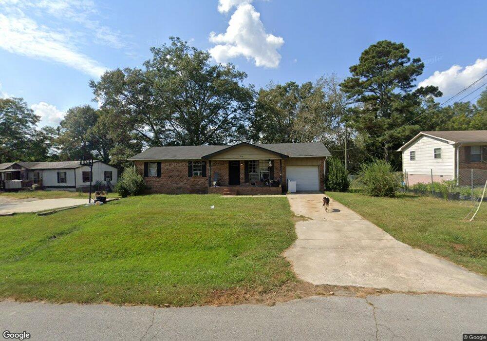
214 Lipham St Bowdon, GA 30108
Estimated Value: $201,368 - $290,000
4
Beds
2
Baths
1,288
Sq Ft
$177/Sq Ft
Est. Value
About This Home
This home is located at 214 Lipham St, Bowdon, GA 30108 and is currently estimated at $228,342, approximately $177 per square foot. 214 Lipham St is a home located in Carroll County with nearby schools including Bowdon Elementary School, Bowdon Middle School, and Bowdon High School.
Ownership History
Date
Name
Owned For
Owner Type
Purchase Details
Closed on
Mar 15, 2010
Sold by
Parham Curtis J
Bought by
Parham Mary T
Current Estimated Value
Purchase Details
Closed on
Dec 28, 1998
Sold by
Parham Curtis J and Parham Ma
Bought by
Parham Curtis J and Parham Mary
Purchase Details
Closed on
Oct 15, 1997
Sold by
Secretary Of Hud
Bought by
Parham Curtis J and Parham Ma
Purchase Details
Closed on
Apr 1, 1997
Sold by
Ga Housing & Fin Au
Bought by
Secretary Of Hud
Purchase Details
Closed on
Feb 5, 1992
Bought by
Pilot Patricia
Create a Home Valuation Report for This Property
The Home Valuation Report is an in-depth analysis detailing your home's value as well as a comparison with similar homes in the area
Home Values in the Area
Average Home Value in this Area
Purchase History
| Date | Buyer | Sale Price | Title Company |
|---|---|---|---|
| Parham Mary T | -- | -- | |
| Parham Curtis J | -- | -- | |
| Parham Curtis J | -- | -- | |
| Secretary Of Hud | $36,600 | -- | |
| Ga Housing & Fin Au | $36,600 | -- | |
| Pilot Patricia | $31,100 | -- |
Source: Public Records
Tax History
| Year | Tax Paid | Tax Assessment Tax Assessment Total Assessment is a certain percentage of the fair market value that is determined by local assessors to be the total taxable value of land and additions on the property. | Land | Improvement |
|---|---|---|---|---|
| 2025 | $1,317 | $45,910 | $4,565 | $41,345 |
| 2024 | $1,335 | $45,910 | $4,565 | $41,345 |
| 2023 | $1,335 | $51,299 | $4,565 | $46,734 |
| 2022 | $1,074 | $33,156 | $3,056 | $30,100 |
| 2021 | $943 | $28,280 | $2,264 | $26,016 |
| 2020 | $866 | $25,754 | $2,264 | $23,490 |
| 2019 | $827 | $24,279 | $2,264 | $22,015 |
| 2018 | $796 | $22,845 | $2,264 | $20,581 |
| 2017 | $798 | $22,845 | $2,264 | $20,581 |
| 2016 | $737 | $24,839 | $2,264 | $22,575 |
| 2015 | $488 | $13,351 | $4,000 | $9,351 |
| 2014 | $491 | $13,351 | $4,000 | $9,351 |
Source: Public Records
Map
Nearby Homes
- 714 Yates Rd
- 110 Bartlett Cir
- 0 Bartlett Cir Unit 10666514
- 301 Angela Ave Unit 8
- 301 Angela Ave
- 309 Angela Ave
- 309 Angela Ave Unit 6
- 255 Eason St Unit 10
- 255 Eason St
- 263 Eason St Unit 12
- 263 Eason St
- 267 Eason St
- 267 Eason St Unit 13
- 101 Winding Road - Lot 1a & 1b & Lot 2
- 0 W Highway 166 Unit 10700336
- 0 W Highway 166 Unit 150705
- 0 W Highway 166 Unit 148352
- 313 Ellenwood Dr
- 310 W College St
- 110 Bevis Cir
- 212 Lipham St
- 220 Lipham St
- 222 Lipham St
- 210 Lipham St
- 224 Lipham St
- 217 Lipham St
- 731 Yates Rd
- 206 Lipham St
- 228 Lipham St
- 204 Lipham St
- 227 Lipham St
- 213 Lipham St
- 230 Lipham St
- 232 Lipham St
- 750 Brickyard Rd
- 0 Sandy Flat Rd Unit 7634218
- 0 Sandy Flat Rd Unit Tract 3 8662864
- 639 Mitchell Ave
- 750 Yates Rd
- 702 Mitchell Ave
Your Personal Tour Guide
Ask me questions while you tour the home.