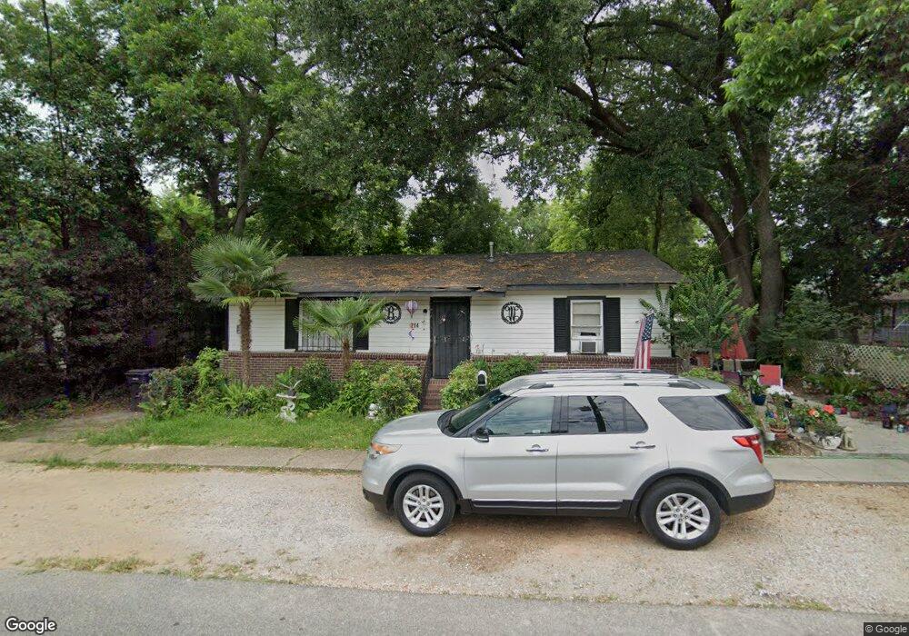
214 Max St Mobile, AL 36610
East Prichard NeighborhoodEstimated Value: $34,000 - $257,000
Studio
1
Bath
1,000
Sq Ft
$104/Sq Ft
Est. Value
About This Home
This home is located at 214 Max St, Mobile, AL 36610 and is currently estimated at $103,680, approximately $103 per square foot. 214 Max St is a home located in Mobile County with nearby schools including Grant Elementary School, Mobile Co Training Middle School, and Vigor High School.
Ownership History
Date
Name
Owned For
Owner Type
Purchase Details
Closed on
Apr 11, 2003
Sold by
Dickinson Carl
Bought by
Dickinson Ledresta
Current Estimated Value
Purchase Details
Closed on
Apr 10, 2003
Sold by
Weston Claudia
Bought by
Dickinson Ledresta
Purchase Details
Closed on
Apr 7, 2003
Sold by
Bettis John W
Bought by
Watts Brenda
Purchase Details
Closed on
Apr 2, 2003
Sold by
Bettis Don S
Bought by
Watts Brenda
Create a Home Valuation Report for This Property
The Home Valuation Report is an in-depth analysis detailing your home's value as well as a comparison with similar homes in the area
Home Values in the Area
Average Home Value in this Area
Purchase History
| Date | Buyer | Sale Price | Title Company |
|---|---|---|---|
| Dickinson Ledresta | -- | -- | |
| Dickinson Ledresta | -- | -- | |
| Dickinson Ledresta | -- | -- | |
| Watts Brenda | -- | -- | |
| Watts Brenda | $12,000 | -- | |
| Dickinson Ledresta | -- | -- | |
| Dickinson Ledresta | -- | -- | |
| Watts Brenda | -- | -- | |
| Watts Brenda | -- | -- | |
| Watts Brenda | -- | -- | |
| Watts Brenda | -- | -- |
Source: Public Records
Tax History
| Year | Tax Paid | Tax Assessment Tax Assessment Total Assessment is a certain percentage of the fair market value that is determined by local assessors to be the total taxable value of land and additions on the property. | Land | Improvement |
|---|---|---|---|---|
| 2025 | -- | $1,550 | $300 | $1,250 |
| 2024 | -- | $1,540 | $220 | $1,320 |
| 2023 | $162 | $1,470 | $220 | $1,250 |
| 2022 | $162 | $1,320 | $200 | $1,120 |
| 2021 | $181 | $1,470 | $220 | $1,250 |
| 2020 | $181 | $1,470 | $220 | $1,250 |
| 2019 | $173 | $2,820 | $0 | $0 |
| 2018 | $173 | $2,820 | $0 | $0 |
| 2017 | $173 | $2,820 | $0 | $0 |
| 2016 | $178 | $2,900 | $0 | $0 |
| 2013 | $196 | $3,040 | $0 | $0 |
Source: Public Records
Map
Nearby Homes
- 407 Garrison Ave
- 317 W Main St
- 103 W Love Joy Loop
- 116 Grant Cir
- 721 Gilbert St
- 0 W Prichard Ave Unit 7677800
- 0 W Prichard Ave Unit 7678472
- 626 Percy Ave
- 328 Glendale St
- 227 E Elm St
- 302 S Price Ave
- 807 Reynolds Ave
- 814 Beck Ave
- 941 Avenue H
- 101 Diaz St
- 0 N Wilson Ave Unit 7685671
- 0 N Wilson Ave Unit 388456
- 0 N Thomas Ave Unit 7730384
- 510 Iowa Ave
- 719 Saxon St
Your Personal Tour Guide
Ask me questions while you tour the home.