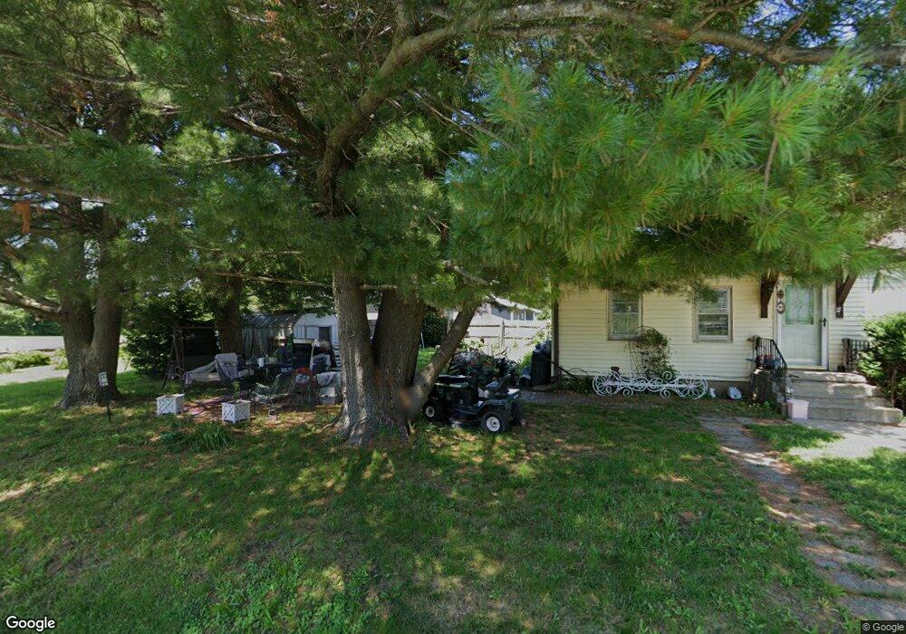
214 Mcmurtry Dr Henderson, IL 61439
Estimated Value: $114,000 - $139,000
2
Beds
1
Bath
1,344
Sq Ft
$94/Sq Ft
Est. Value
About This Home
This home is located at 214 Mcmurtry Dr, Henderson, IL 61439 and is currently estimated at $126,937, approximately $94 per square foot. 214 Mcmurtry Dr is a home located in Knox County with nearby schools including Silas Willard Elementary School, Gale School, and Lombard Middle School.
Ownership History
Date
Name
Owned For
Owner Type
Purchase Details
Closed on
Sep 13, 2023
Sold by
Ryan-Lawson Tina A
Bought by
Sebben Joshua J
Current Estimated Value
Home Financials for this Owner
Home Financials are based on the most recent Mortgage that was taken out on this home.
Original Mortgage
$86,284
Outstanding Balance
$84,551
Interest Rate
7.25%
Mortgage Type
Construction
Estimated Equity
$42,386
Purchase Details
Closed on
Jun 9, 2005
Bought by
Lawson Ryan and Lawson Tina A
Create a Home Valuation Report for This Property
The Home Valuation Report is an in-depth analysis detailing your home's value as well as a comparison with similar homes in the area
Home Values in the Area
Average Home Value in this Area
Purchase History
| Date | Buyer | Sale Price | Title Company |
|---|---|---|---|
| Sebben Joshua J | $106,000 | Attorney Only | |
| Lawson Ryan | -- | -- |
Source: Public Records
Mortgage History
| Date | Status | Borrower | Loan Amount |
|---|---|---|---|
| Open | Sebben Joshua J | $86,284 |
Source: Public Records
Tax History Compared to Growth
Tax History
| Year | Tax Paid | Tax Assessment Tax Assessment Total Assessment is a certain percentage of the fair market value that is determined by local assessors to be the total taxable value of land and additions on the property. | Land | Improvement |
|---|---|---|---|---|
| 2024 | $2,306 | $35,530 | $3,360 | $32,170 |
| 2023 | $2,306 | $33,290 | $3,150 | $30,140 |
| 2022 | $1,599 | $19,940 | $2,840 | $17,100 |
| 2021 | $1,504 | $18,460 | $2,630 | $15,830 |
| 2020 | $1,454 | $17,250 | $2,460 | $14,790 |
| 2019 | $1,468 | $17,250 | $2,460 | $14,790 |
| 2018 | $1,473 | $17,420 | $2,480 | $14,940 |
| 2017 | $1,489 | $17,420 | $2,480 | $14,940 |
| 2015 | -- | $17,080 | $2,430 | $14,650 |
| 2013 | $1,404 | $18,350 | $2,610 | $15,740 |
Source: Public Records
Map
Nearby Homes
- 218 Mcmurtry Dr
- 207 S State St
- 2260 Knox Road 600 E
- 593 Knox Road 2000 N
- 2390 U S 150
- Lot 11 Marmac Dr
- Lot 4 Marmac Dr
- 2819 Montague Dr
- Lot 3 & 4 Lincoln Park Dr
- 2851 Parkway Ct
- Lot 8 Shepherd Dr
- Lot 7 Shepherd Dr
- 3175 Buckingham Rd
- 126 N Depot St
- Lot 9 Shepherd Dr
- Lot 10 Shepherd Dr
- Lot 6 Shepherd Dr
- Lot 11 Shepherd Dr
- Lot 5 Shepherd Dr
- Lot 12 Shepherd Dr
- 216 Mcmurtry Dr
- 212 Mcmurtry Dr
- 210 Mcmurtry Dr
- 207 Mcmurtry Dr
- 205 Mcmurtry Dr
- 209 Mcmurtry Dr
- 211 Mcmurtry Dr
- 208 Mcmurtry Dr
- 206 Mcmurtry Dr
- 204 Mcmurtry Dr
- 203 N 3rd St
- 201 Mcmurtry
- 201 Mc Murtry Dr
- 207 N 3rd St
- 205 N 3rd St
- 212 E Franklin St
- 200 Mcmurtry
- 103 N 3rd St
- 204 E Franklin St
- 210 N 3rd St