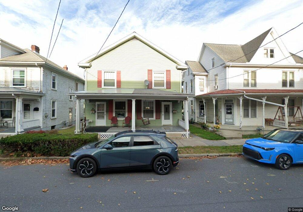
214 N Chestnut St Palmyra, PA 17078
Estimated Value: $185,000 - $202,000
2
Beds
2
Baths
1,106
Sq Ft
$176/Sq Ft
Est. Value
About This Home
This home is located at 214 N Chestnut St, Palmyra, PA 17078 and is currently estimated at $194,576, approximately $175 per square foot. 214 N Chestnut St is a home located in Lebanon County with nearby schools including Palmyra Area Senior High School and St. Joan of Arc Elementary School.
Ownership History
Date
Name
Owned For
Owner Type
Purchase Details
Closed on
Aug 27, 2010
Sold by
Craig Matthew C and Craig Jennifer L
Bought by
Kocuba Christopher
Current Estimated Value
Purchase Details
Closed on
Jan 4, 2008
Sold by
Trostle Rebecca C
Bought by
Craig Matthew C and Tillett Jennifer L
Home Financials for this Owner
Home Financials are based on the most recent Mortgage that was taken out on this home.
Original Mortgage
$104,176
Interest Rate
6.27%
Mortgage Type
FHA
Create a Home Valuation Report for This Property
The Home Valuation Report is an in-depth analysis detailing your home's value as well as a comparison with similar homes in the area
Home Values in the Area
Average Home Value in this Area
Purchase History
| Date | Buyer | Sale Price | Title Company |
|---|---|---|---|
| Kocuba Christopher | $112,500 | None Available | |
| Craig Matthew C | $105,000 | None Available |
Source: Public Records
Mortgage History
| Date | Status | Borrower | Loan Amount |
|---|---|---|---|
| Previous Owner | Craig Matthew C | $104,176 |
Source: Public Records
Tax History Compared to Growth
Tax History
| Year | Tax Paid | Tax Assessment Tax Assessment Total Assessment is a certain percentage of the fair market value that is determined by local assessors to be the total taxable value of land and additions on the property. | Land | Improvement |
|---|---|---|---|---|
| 2025 | $3,160 | $110,600 | $20,200 | $90,400 |
| 2024 | $2,792 | $110,600 | $20,200 | $90,400 |
| 2023 | $2,792 | $110,600 | $20,200 | $90,400 |
| 2022 | $2,663 | $110,600 | $20,200 | $90,400 |
| 2021 | $2,476 | $110,600 | $20,200 | $90,400 |
| 2020 | $2,445 | $110,600 | $20,200 | $90,400 |
| 2019 | $2,392 | $110,600 | $20,200 | $90,400 |
| 2018 | $2,316 | $110,600 | $20,200 | $90,400 |
| 2017 | $686 | $110,600 | $20,200 | $90,400 |
| 2016 | $2,175 | $110,600 | $20,200 | $90,400 |
| 2015 | -- | $110,600 | $20,200 | $90,400 |
| 2014 | -- | $110,600 | $20,200 | $90,400 |
Source: Public Records
Map
Nearby Homes
- 1 E Broad St
- 26 N Railroad St
- 40 N Grant St
- 128 E Main St
- 30 Willow St
- 22 Willow St
- 14 Willow St
- 104 N Locust St
- 421 N Railroad St
- 4 Evergreen Alley
- 44 Evergreen Alley
- 28 Evergreen Alley
- 13 Evergreen Alley
- 414 E Main St
- 133 W Spruce St
- 322 E Cherry St
- 197 W Spruce St
- 0 N Railroad St
- 24 N Green St
- 136 N Penn St
- 216 N Chestnut St
- 212 N Chestnut St
- 218 N Chestnut St
- 210 N Chestnut St
- 220 N Chestnut St
- 224 N Chestnut St
- 204 N Chestnut St
- 226 N Chestnut St
- 202 N Chestnut St
- 115 E Broad St
- 230 N Chestnut St
- 234 N Chestnut St
- 108 E Broad St
- 108 E Broad St
- 116 E Broad St
- 207 N Lincoln St
- 201 N Lincoln St
- 236 N Chestnut St
- 150 N Chestnut St
- 231 N Lincoln St